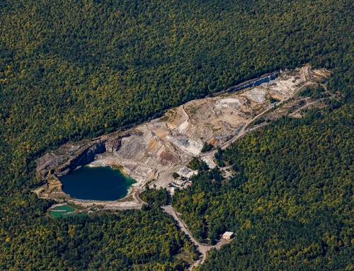
PROTECT has released a series of satellite photographs that show heavy tree cutting on state-held conservation easement lands in the northern Adirondack Park. These images show many clearcuts of just under 25 acres designed to avoid permit review by the Adirondack Park Agency (APA), extensive use of strip clearcuts hundreds of feet long, and small patch checkerboard clearcuts. Currently, the State of New York owns over 780,000 acres of conservation easements that are supposed to ensure sustainable forestry to help the local economy and protect the open space landscape of the Adirondack Park. The state invested over $130 million to purchase the conservation easements.
These pictures provide a backdrop to the current controversy around the Adirondack Park Agency’s (APA) deliberation over finalizing a new General Permit for clearcutting projects on private and state conservation easement lands in the Adirondack Park. Current APA rules require that any landowner who clearcuts 25 acres or more must obtain an APA permit as this is a jurisdictional activity. The APA is working to create a new General Permit that would allow any landowner that has obtained Forest Stewardship Council (FSC) or Sustainable Forestry Initiative (SFI) certifications, and various other certification programs, to automatically qualify for a General Permit to clearcut. The General Permit streamlines the process for which an applicant can gain approval for a clearcut. The last major application for a clearcut was by Rayonier, owner of over 130,000 acres of managed forestlands across the Adirondack Park, and over 100,000 acres in St. Lawrence County. The APA has not shown why the current application process is inadequate and requires a streamlined General Permit.
The heavy cutting of forests on lands where the State of New York owns conservation easements raises many questions about the long-term sustainable management and forest health in the Adirondacks. It appears that the main justification in support of the APA relaxing its clearcutting policies is that the forest managers on conservation easement lands believe current rules require them to leave too many trees standing. They want to be able the clearcut larger areas and not have to leave wide buffers between clearcuts.
The pictures below show how forest managers have skirted current APA rules and heavily cut conservation easement lands. Once cleared lands have established seedlings, the standing trees are taken upon repeat harvests. Or, a series of small 24 acre or less clearcuts are cut. These are plain to see from these pictures. Another technique is small patch cuts of 8-10 acres in a checkerboard pattern. The large industrial timber landowners have found these techniques unsatisfactory and are now pushing the APA to allow them to undertake clearcuts of potentially hundreds of acres.
In essence, new relaxed clearcutting regulations will allow land managers to clearcut areas of hundreds of acres. In this respect small patch cuts, 24-acre clearcuts and strip clearcuts are likely to be replaced by full-scale clearcuts.
The APA is now poised to move ahead with its new General Permit that will relax clearcutting rules. PROTECT is at a loss to see how the APA’s decision to relax clearcutting rules benefits the forests on conservation easement lands. As the pictures below show, these lands are already being heavily cut and large-scale clearcutting will only intensify this trend.

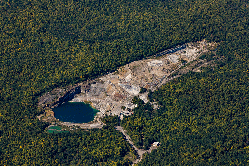
Rayonier conservation easement lands on the west shore of Carry Falls Reservoir in the Town of Colton. Formerly the Niagara Mohawk easement. Note extensive use of strip clearcuts and larger 24-acre clearcuts designed to avoid APA review.
The picture above shows the various techniques commonly used by forest managers on conservation easement lands. The map below shows the locations of over 780,000 acres of state owned conservation easement lands.

Map of state conservation easements in the Adirondack Park. NYS owns over 780,000 acres of conservation easements to provide long-term sustainable forest products and protect open space, among other purposes.
More pictures follow that show heavy cutting on state held conservation easement lands in the Adirondack Park. Note the heavy use of strip clear cuts, shelterwood cuts, patch clearcuts and 24-acre clear cuts. Conservation easements are supposed to provide the benefit of long-term sustainable forestry. Current management actions and efforts by the APA to relax clearcutting rules undermine sustainable forestry in the Adirondack Park.

Rayonier conservation easement lands, originally the Yorkshire easement, in the Town of Colton south of Route 3 and west of Massawepie Mire. Note extensive use of strip clearcuts and larger clear cuts.

Long Pond conservation easement in the Town of Colton, St. Lawrence County. Note use of strip clear cuts and larger patch clearcuts. Note also the differences with private lands and Forest Preserve on the east side of this tract (picture right).

Conservation easement owned by the Forestland Group, south of the South Branch of the Grasse River, Town of Clare in St. Lawrence County. Note the use of silvicultural treatments of strip cuts, clearcuts and patch clearcuts. Note too the Forest Preserve buffer maintained along the river.

Conservation easement owned by the Forestland Group, north of the South Branch of the Grasse River and Tooley Pond Road, Town of Clare in St. Lawrence County. Note the extensive use of silvicultural treatments of strip clearcuts. Note too the Forest Preserve buffer maintained along the river.

Conservation easement lands north of the Raquette River in the Town of Piercefield. This easement was made as a gift to NYS of the development rights in the 1990s. The recreation and forest management rights have remained with the landowner. This picture shows extensive use of checkerboard "patch" clear cuts, strip cuts and larger clearcuts as silvicultural forest management tools.

Another section of the Conservation Fund conservation easement lands north of the Raquette River in the Town of Piercefield. This picture shows extensive use of checkerboard "patch" clear cuts.

Lyme Timber Company conservation easement lands, Town of Piercefield, St. Lawrence County, between Route 3 and the Raquette River. Note the heavy clearcuts and strip clear cuts.

Lyme Timber Company conservation easement just south of Route 3, west of Gull Pond, Town of Piercefield, St. Lawrence County. Note the strip clearcuts and clearcuts.

Lyme Timber Company conservation easement just south of the Raquette River, Town of Piercefield, St. Lawrence County. Note the strip clearcuts and clearcuts.

Lyme Timber Company conservation easement just south of Route 3, west of Gull Pond, Town of Piercefield, St. Lawrence County. Note the extensive use of strip clearcuts.

Forestland Group conservation easement in the Town of Clifton, St. Lawrence County. Note the extensive strip clearcuts and clear cuts.

Forestland Group conservation easement, Town of Santa Clara, Franklin County, west of Route 30. Note the patch clear cuts.

Lassiter Properties conservation easement, Town of Hopkinton, St. Lawrence County, east of Carry Falls Reservoir. Note strip clearcuts and large clearcuts.

Lassiter Properties conservation easement, Town of Hopkinton, St. Lawrence County, east of Carry Falls Reservoir. Note strip clearcuts.
The differences between heavily cut conservation easement forest lands and the Forest Preserve are stark. The picture below shows a Lyme Timber Company tract in Piercefield in St. Lawrence County that borders a large tract of “forever wild” Forest Preserve. The Forest Preserve has a robust canopy whereas the conservation easement lands have been heavily logged.

Comparison of Lyme Timber Company conservation easement tract and Forest Preserve lands in the Town of Piercefield, St. Lawrence County. Note the vast differences between the heavily cut managed timber lands and the Forest Preserve.

