Update: This article was originally posted on October 23rd based on a field visit to the site on October 18, 2012. On November 12th the site was visited again to view new work. New pictures and comments are posted at the end of this article.
Original Post: The Department of Environmental Conservation (DEC) and Adirondack Park Agency (APA) are in the process of building a major new “community connector” snowmobile trail through the interior of the Forest Preserve in the heart of the Moose River Plains Wild Forest area. This is the first such “community connector” snowmobile trail to be built as part of a new policy and program implementation to significantly expand snowmobiling through the Forest Preserve by linking communities in a Park-wide snowmobile trail network. PROTECT believes these so-called “trails” are nothing like hiking trails, but are in effect new roads through the Forest Preserve. PROTECT believes that this new snowmobile trail construction program violates the State Land Master Plan and very likely the NYS Constitution.
The APA and DEC approved this new program, despite widespread opposition from the environmental community, in the Unit Management Plan (UMP) for the Moose River Plains Wild Forest Area. The APA and DEC promulgated and approved a new “Guidance” document that authorized this type of de facto road construction through the Forest Preserve. PROTECT heartily objected to this new policy and program when it was enacted in 2009. The new “community connector snowmobile trail” through the heart of the Moose River Plains Wild Forest Area is the first major such trail to be built. These “community connector” snowmobile trails will eventually criss-cross the Forest Preserve. PROTECT sees these as de facto new roads and inappropriate for the Forest Preserve.
Field Inspection of this new work on October 18, 2012 revealed the reality of “community connector” snowmobile “trail” construction to be even more objectionable than we feared. The pictures below show construction more like an engineered road than the required “character of a foot trail,” profoundly altering the natural terrain in order both to facilitate grooming by heavy, tracked machines permitted only on designated roads, and in turn to enable high-speed travel by snowmobiles.

Map above is of a new 5-mile “community connector” snowmobile trail. Such trails are supposed to be located on the periphery of Wild Forest areas and along roads. This trail was cut through the heart of the Moose River Plains Wild Forest Area. The objective of this trail is to connect the hamlet of Raquette Lake with the major snowmobile thoroughfare of the Moose River Plains Road that links Indian Lake and Inlet. DEC and APA claim there was no other option to meet their objectives of linking these communities other than by cutting a new 5-mile trail through the interior of the Forest Preserve. The new trail comes out at the 8th Lake Campground.
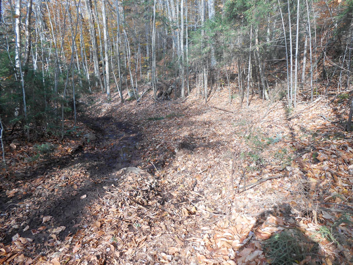
Trail construction (above) created a gully. The snowmobile trail in this spot was widened to over 20 feet in width. “Community Connector” snowmobile trails are supposed to be 9 feet wide in straight areas and 12 feet wide on slopes and curves. This turn is excessively wide. This part of the trail followed an old tote road, which apparently now is too chewed up from construction activities to use for the snowmobile trail, so the trail had to be widened. PROTECT does not support snowmobile trails of this width.
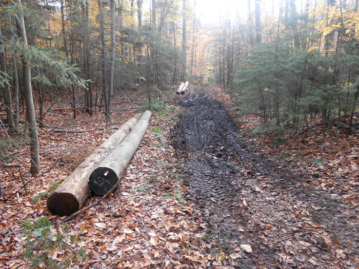
This new “community connector” snowmobile trail requires a number of major bridges. This shows 25-foot-long poles partly transported to where they will be used for a bridge. Moving these poles to locations results in gouging the trail and creating deep ruts. DEC and APA should be made to rehabilitate areas damaged during trail construction.
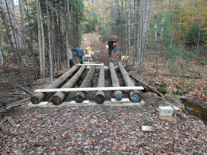
Snowmobile bridges are no small things. They are 12 feet wide and have to be able to support a large tracked groomer weighing several tons. The entire new trail has over 20 bridges. The section from the Moose River Plains Road to the 8th Lake Campground has 9 such bridges. This bridge under construction is about .5 miles from Route 28, just south of the 7th Lake Boat Launch.
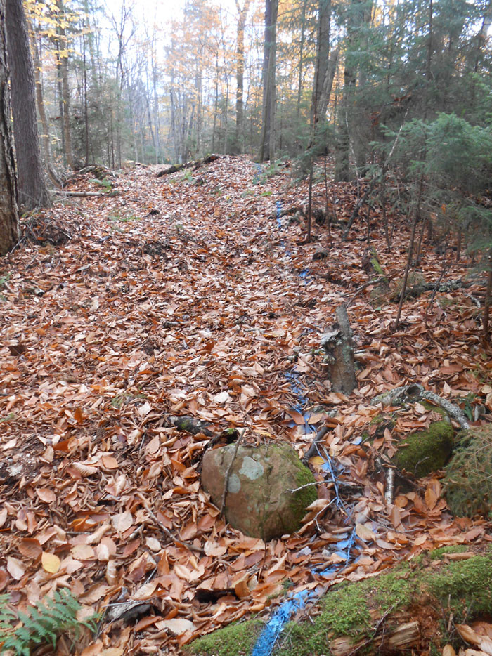
This trail was laid out by DEC and APA staff. The blue paint in this picture shows the outer edge of the snowmobile trail. This trail is supposed to be 9 feet wide with slopes and curves allowed to be 12 feet in width. This part of the trail has not yet been graded. The area on the right side will be dug out to make the trail level. The right side of the trail will have a “bench cut” dug into the slope. All of these modifications are for the purpose of enabling safety at high rates of speed by snowmobiles.
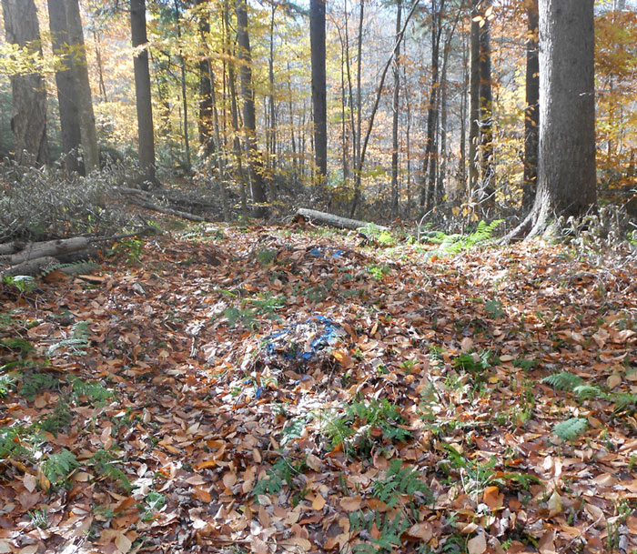
This picture (above) shows blue paint on a rock and a stump. This means that the rock and stump will be removed because they’re too high and protrude into the trail, which causes problems for groomers and snowmobiles. A great deal of work has been done on this trail to grade and flatten it. A graded and flattened trail is a de facto road and not a trail. The State Land Master Plan (SLMP) specifically defines snowmobile trails having “essentially the same character as a foot trail” (p. 19).
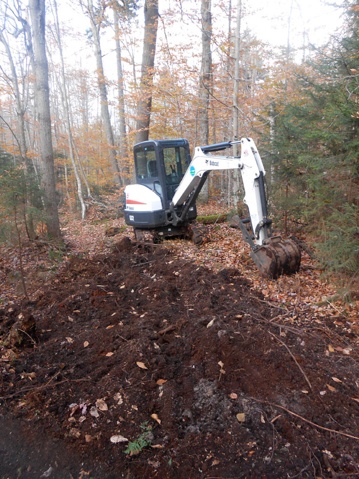
In this section of DEC and APA “community connector” snowmobile trail heavy machinery is used to “grade” the snowmobile trail. This picture shows areas freshly graded and an area of the old tote road that has not yet been graded. The backhoe removes large rocks, stumps, digs out slopes for bench cuts, and digs up the entire trail surface area to smooth and make uniform the overall trail surface. The level of terrain alteration for this “community connector snowmobile trail” is consistent with road construction, not trail construction.
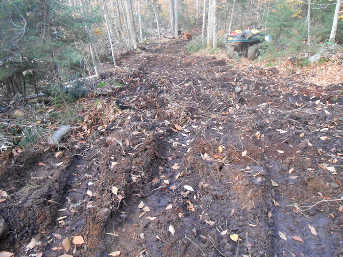
This picture shows a section of a “community connector” snowmobile trail under construction. This section is being graded to make sure that it’s level and smooth. Parts of this stretch seemed excessively wide. Construction of a major snowmobile trail like this one through the Moose River Plains Wild Forest area is not a simple or delicate operation, but requires heavy machinery and significant alteration of the terrain. This is yet another way that this snowmobile trail is much more like a road than a hiking trail.
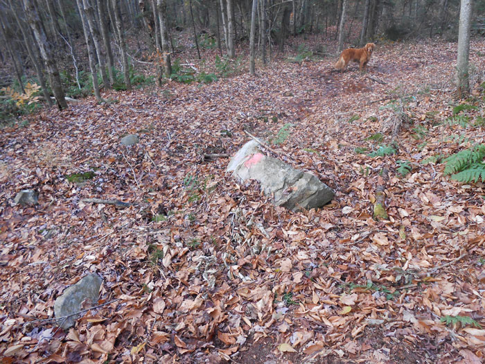
A protruding rock (above) that is scheduled to be removed. The DEC and APA found this rock to be objectionable and not consistent with a “community connector” snowmobile trail. The rock, deposited by a glacier 12,000 years ago, and protected by the NYS Constitution as part of “forever wild” lands 118 years ago, will be moved by the APA and DEC so that snowmobiles can operate safely at high rates of speed. Removal of rocks and stumps are more consistent with road construction than trail construction.
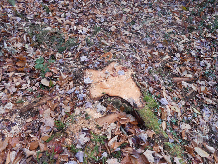
Picture (above) of a typical stump in the new trail. PROTECT counted over 1100 stumps in the 5 miles from the Moose River Plains Road to the 7th Lake Boat Launch. A tree is not recognized in state law or protected by the NYS Constitution (as interpreted by various case law) until it reaches 3 inches in diameter at breast height (DBH). The DEC and APA work plans called for hundreds on trees to be removed and many more saplings and seedlings of something less than 3 inches DBH to be brushed out. This is another way in which the community connector trail more resembles a road, where trees are routinely removed, rather than a hiking trail, where the trail is routinely routed around or in between the trees.
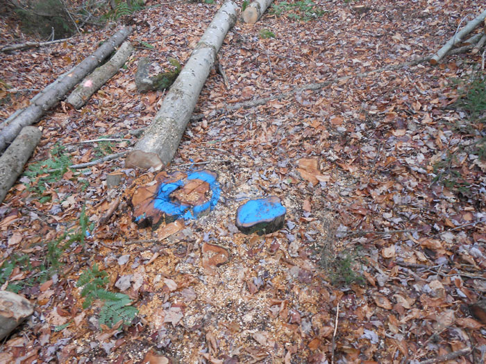
More stumps marked for removal. The SLMP specifies that foot trails must be designed “in a manner causing the least effect on the surrounding environment” (p. 17).
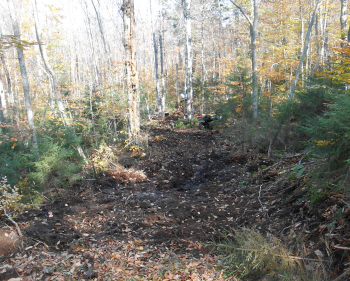
This picture (above) is a good example of a “bench cut” where the side slope has been cut into by the heavy machinery in order to create a smooth and level surface. This “community connector” snowmobile trail has many bench cuts. Bench cuts are actions associated with road construction, not trail construction.
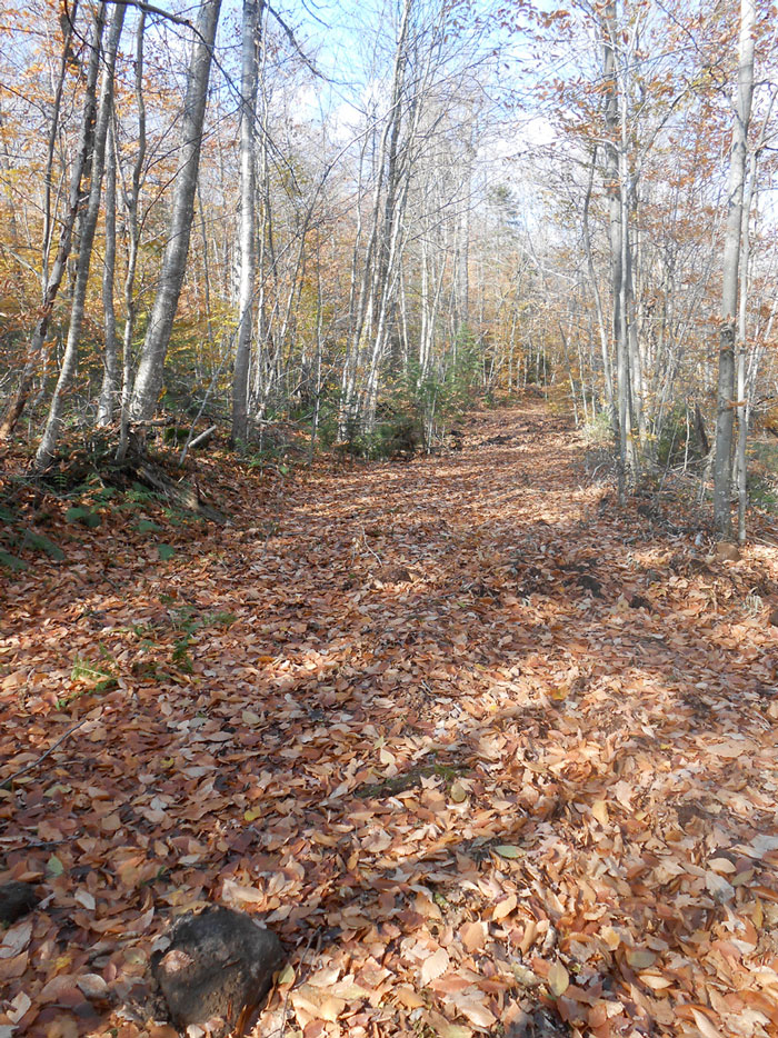
This is a completed part of the new “community connector” snowmobile trail. It’s graded, widened, flattened, leveled, and has bench cuts. PROTECT sees this as a de facto new road through the heart of the Moose River Plains Wild Forest Area.

Pictured above is another completed section of the new “community connector” snowmobile trail. Note the bench cut on the right and the bank build up on the left. This trail will facilitate high volumes of snowmobiles at high rates of speed.
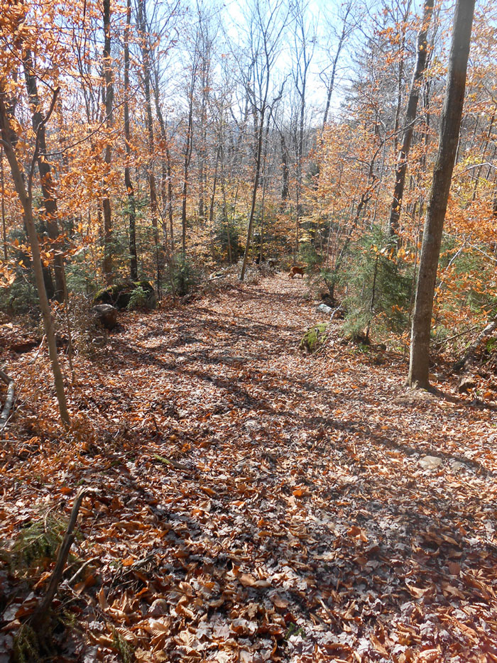
Another completed section of the new “community connector” snowmobile trail through the heart of the Moose River Plains Wild Forest area. It looks like a road, was designed like a road, was built like a road, and will be travelled by motor vehicles at high rates of speed like a road, so it must be a road.
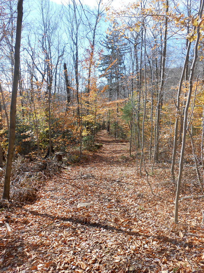
Another completed section of the new “community connector” snowmobile trail through the heart of the Moose River Plains Wild Forest area. It looks like a road, was designed like a road, was built like a road, and will be travelled by motor vehicles at high rates of speed like a road, so it must be a road.
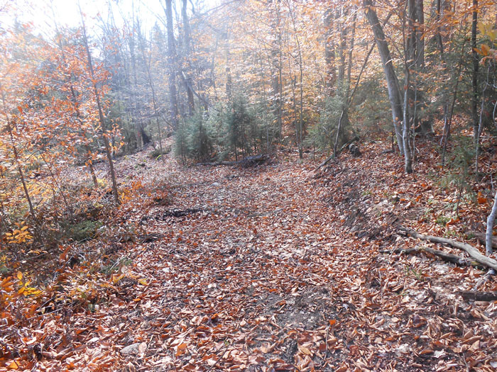
Another completed section of the new “community connector” snowmobile trail. Note the extensive grading and bench cuts.
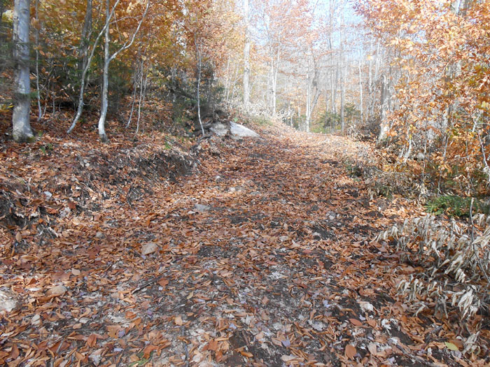
Another completed section of the new “community connector” snowmobile trail. Note the extensive grading and bench cuts. This snowmobile trail has the character of a road, not the character of a footpath.
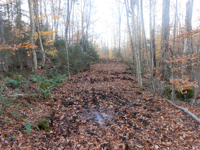
Another picture (above) of a completed section of the “community connector” snowmobile trail. Note the bench cuts, grading, rock removal, stump removal, and water bar systems for drainage.
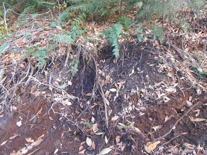
A close up of a bench cut. The SLMP specifies that foot trails must be designed “in a manner causing the least effect on the surrounding environment” (p. 17).
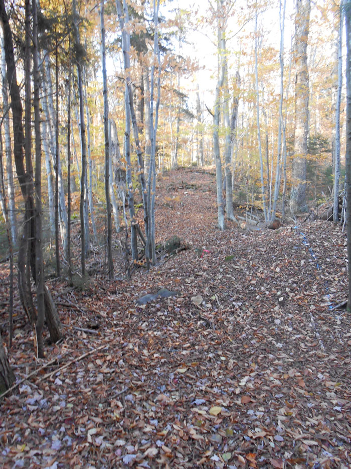
A cut and cleared new section of the “community connector” trail that departs the old tote road. This section has not yet been graded and flattened or undergone rock and stump removal. That is scheduled to happen soon.
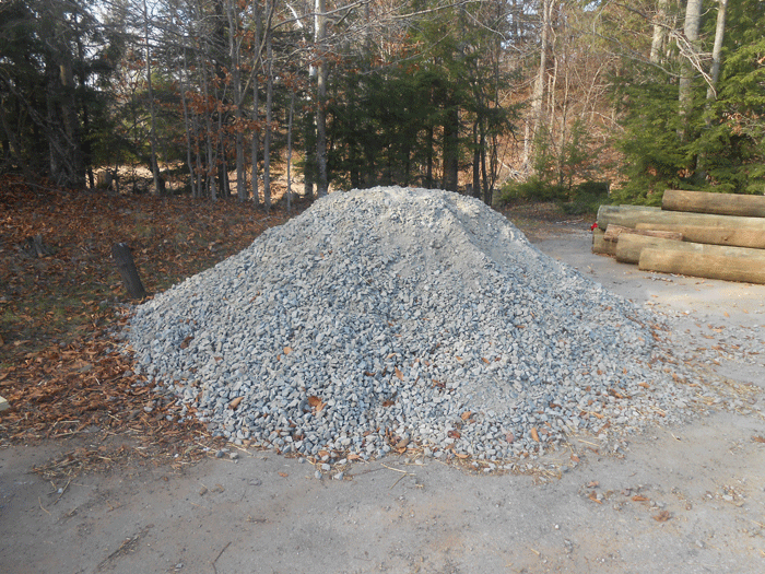
New: A gravel load waiting for use to stabilize the trail. The use of gravel to hardpack or stabilize is yet another indicator that this “community connector” class II snowmobile trail more resembles a road that a foot trail.
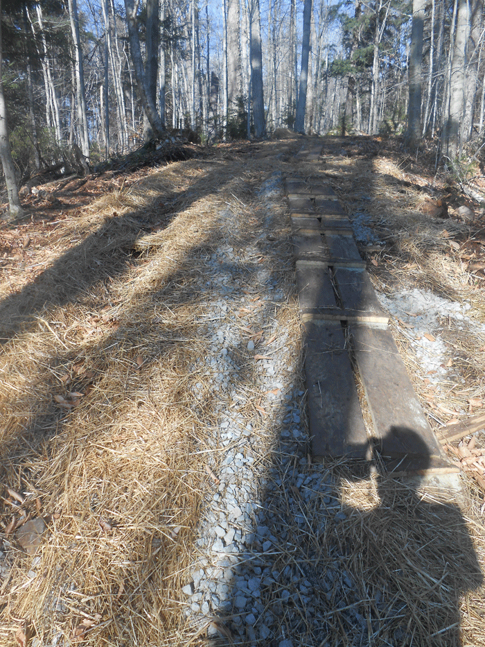
New: This picture shows a steep part of the trail where gravel was used to stabilize the trail as well as straw to cover damaged surface during excavation. This steep area is likely to be difficult for groomers to operate.
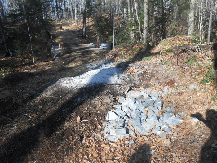
New: This picture shows a ledge cut. This type of severe terrain alteration does not occur on a foot trail, but does occur on a road.

New: Extensive use of straw was used to stabilize long sections of trail where excavation work, tree removal, grading and rock removal caused extensive damage. This type of restoration work is unusual for a foot trail, but common for a road way where construction requires extensive terrain alteration.
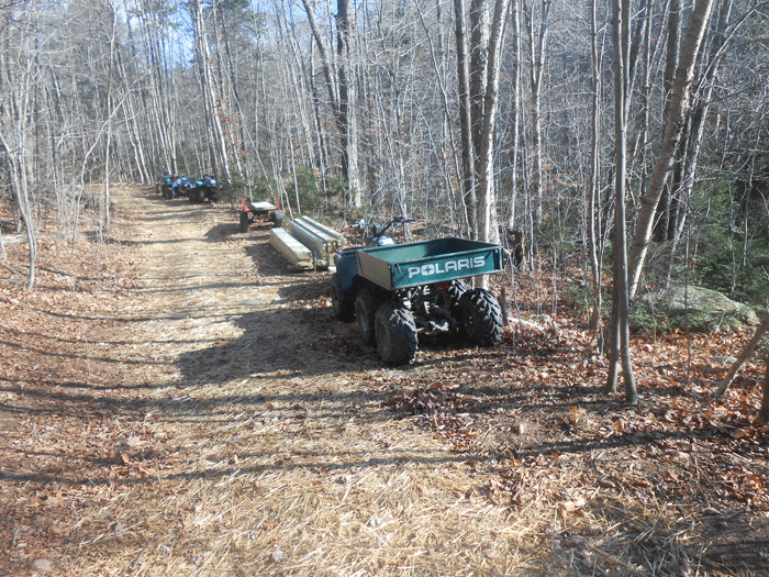
New: Extensive use of motor vehicles have been a part of this “community connector” snowmobile trail construction. All terrain vehicles have driven the length of this snowmobile trail corridor to ferry supplies and personnel. This type of motor vehicle use is common on snowmobile trails, but not part of a foot trail construction.
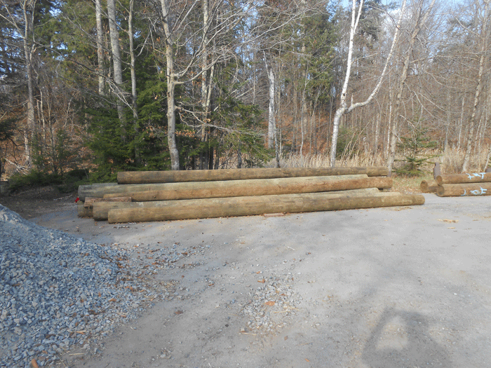
New: More than two dozen bridges will be built on this trail, which necessitates the use of large telephone pole type of materials.

