It seems pretty clear at this point that the state agencies that manage the High Peaks Wilderness Area, and adjacent Wilderness areas, are not interested in limiting public use. The state is investing in new parking areas, new hiking trails, and a new hiker transportation system that are all designed to facilitate ever-higher levels of public use in the High Peaks, not limit it.
Consider the change underway at Cascade Mountain. The new and improved hiking trails that are under construction to the summits of Cascade and Porter mountains and to Mt. Van Hoevenberg will begin at a new trailhead in the Mt. Van Hoevenberg Winter Sports Complex managed by the Olympic Regional Development Authority (ORDA). Most of this facility is being rebuilt, and a significant part of this upgrade is the construction of nine acres of new parking lots that will hold around 1,500 vehicles.
In summer months, in the hiking season, these parking lots will be readily available to provide easy trailhead parking for hikes to Cascade, Porter and Mt. Van Hoevenberg. The new ORDA parking lots will more than triple the number of parking spaces that currently exist during peak use times at the current Cascade Mountain trailhead, when the small parking lots on Route 73 are full and intensive roadside parking lines both sides of the highway, creating a real public safety hazard. The new hiking trails under construction are explicitly designed to withstand the heavy public use that will be funneled through the new ORDA trailhead.
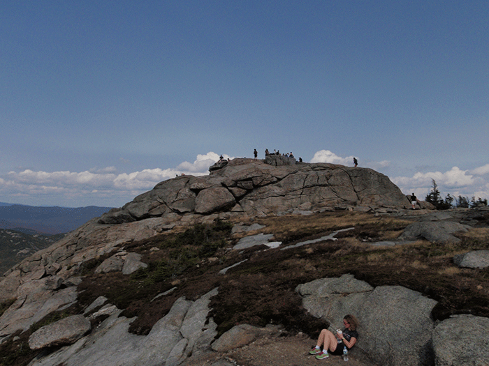
The summit of Cascade Mountain.
When the new trailhead opens for Cascade Mountain, and the old hiking trail off Route 73 and the associated parking areas are closed in 2021 or 2022, the state will have designed a system to facilitate nearly unlimited access to Cascade, Porter, and Mt. Van Hoevenberg mountains. According to the Department of Environmental Conservation (DEC) trailhead registration data, Cascade Mountain saw around 13,000 people sign-in at the register in 1994, which grew to over 34,000 and 35,000 people in 2016 and 2017, before modest efforts to reduce use were implemented.
Through the last 25 years, according to DEC trailhead register data, Mt. Van Hoevenberg saw over 4,000 people sign-in to hike the mountain at the trailhead at South Meadows. The new ORDA trailhead, and splendid new trail to the summit of Mt. Van Hoevenberg, will be half the length to the summit as the South Meadows trail, so it’s highly likely that hiker numbers on this mountain will explode. 1,500 cars could easily bring more than 2,000 hikers a day to Cascade/Porter and Mt. Van Hoevenberg.
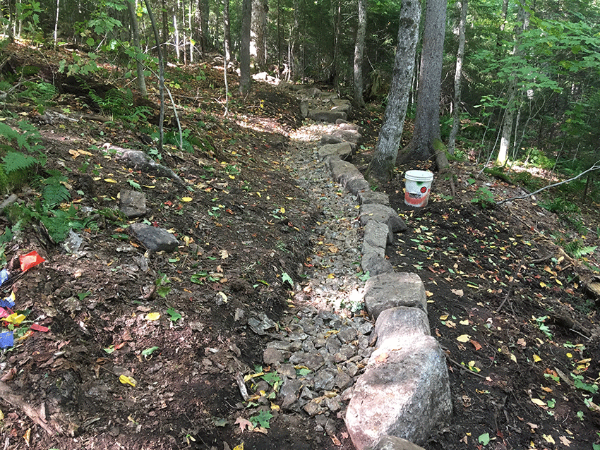
Picture of a section of a new trail under construction to the summit of Mt. Van Hoevenberg.
Through these new facilities, the state is building a system to facilitate unlimited use at Cascade Mountain, the single most heavily hiked mountain in the High Peaks. The new trailhead will be equipped with restrooms, a shop with food, and a public information center of some kind. While these efforts may better educate and prepare hikers, they will likely also serve as further attractions to draw ever higher numbers. Once this new system is operational, will Cascade Mountain see its highest number of hikers ever? I’d take that bet.
Let’s look at public access to the High Peaks from the Adirondack Loj Road. There too, it appears, facilitating unlimited public use is the principal management objective. The current system includes parking for a fee at Adirondak Loj, which is run by the Adirondack Mountain Club. There is also ad hoc parking up and down the South Meadows Road and nearly unlimited roadside parking on the east side of Adirondak Loj Road, starting a few feet outside of the Loj property and running for miles along the roadside.
The trailhead register data showed about 41,000 people signed in at the Loj in 1994 and rose to a high of over 59,000 people signing-in at the register in 2017. Nearby, a steady number of over 6,000 people signed-in at the register to hike into Indian Pass. The Marcy Dam Truck Trail at the end of the South Meadow Road has seen fluctuating sign-in levels over the years, from a high of over 8,000 to a low of around 4,000, likely driven by irregular restrictions on roadside parking on the Loj Road.
The Loj Road is the principal access to Mount Marcy, Phelps, Colden, the Algonquin Range, Tabletop, among other High Peaks. This level of use of around 70,000 people each year entering the hiking trail complex accessed from various points along the Adirondak Loj Road does not seem poised to change. The 1999 High Peaks Unit Management Plan (UMP) called for the construction of a new parking lot near the South Meadows Road, but it was never built. The Town of North Elba at one time policed parking on the Loj Road but has abandoned these efforts in recent years.
Let’s look at the trailheads accessed in the Town of Keene, such as The Garden, and those along Route 73, from Rooster Comb to Round Pond (Dix Mountain). The DEC and Town of Keene have clamped down on roadside parking that used to spill out of the trailhead parking lots and line Route 73 for miles at Chapel Pond and Roaring Brook. If the lots were full in 2019 at Rooster Comb, Adirondack Mountain Reserve (AMR), Roaring Brook, Chapel Pond, and Round Pond, hikers were basically out of luck (de facto permits through first-come-first-served parking spaces). “No Parking” signs and parking tickets were issued to curb spillover roadside parking, and it mostly worked.
AMR operates a public parking lot on the south side of Route 73 across from the DEC Roaring Brook parking lot and trailhead to Giant Mountain. AMR provides access, through a state-owned conservation easement, to the mountains of The Great Range, Dial, Nippletop, Colvin and Blake, the trails around the Au Sable Lakes, among other destinations. The data for the AMR trailhead is good. Use there has more than doubled, jumping from 10,000 or so people signing-in in the mid-1990s, to over 25,000 people in recent years. AMR staff police their parking lot and inform the public when the lot is full, which on most summer days happens early.
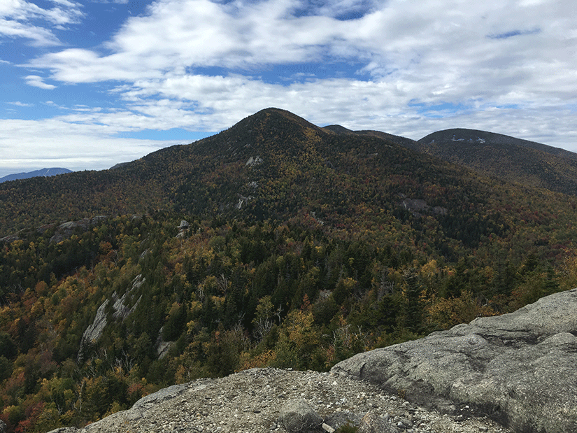
A view of the approach from the New Russia Trailhead to Rocky Peak and Giant Mountain.
Unfortunately, data for the Giant Mountain/Rocky Peak trail system, which includes four trailheads, is unreliable for historic purposes. In recent years, the combined trailhead sign-ins topped 24,000 people in 2016 and dropped to around 19,000 in 2018. About half of the access to Giant Mountain is through the Zander Scott Trailhead at Chapel Pond. Trailhead registration data for the Round Pond (Dix Mountain) and Rooster Comb is also incomplete with major gaps. The best guess is that Rooster Comb trail sees perhaps 4,000 to 6,000 hikers annually, and Round Pond sees 2,000 to 3,000 sign-ins.
For the last three years, the Town of Keene has operated a hiker shuttle to ferry hikers from Marcy Field to The Garden trailhead. This shuttle has been successful in its principal goal of alleviating problems caused by spillover roadside parking on local roads when The Garden parking lot was full. Trailhead registration data for The Garden is incomplete and has major gaps. Data from the 1990s seems intact, with use ranging from 14,000 to 18,000 registrations in those years. Recent data is unreliable but appears to show over 21,000 people signing-in in 2016 and dropping to the 16,000-17,000 level in the last few years. The unreliable status of The Garden data makes it difficult to assess the situation.
The Town of Keene counts shuttle riders. In 2017 and 2018 the Town of Keene ran a part-time shuttle, operating on weekends and holidays during the summer months. In 2017, the part-time shuttle ferried over 2,000 riders and in 2018 they counted over 1,600, but town officials say that number is low. In 2019, the shuttle expanded to seven days a week due to road construction that prevented public access to The Garden, and the shuttle ferried over 6,000 riders.
This year, Governor Cuomo has proposed $1.2 million in the new state budget for free shuttles that will operate 16 hours a day for seven days a week through the summer hiking season. These shuttles will complement the Town of Keene shuttle to The Garden and will ferry hikers from Marcy Field in Keene Valley, which has nearly unlimited parking, to trailheads all along Route 73. The idea of the shuttles is that they will run for long hours to facilitate the high demand to hike in the High Peaks in Keene when all of the trailhead parking lots are full. Every hour, all summer long, a shuttle will drop hikers at trailheads, from Rooster Comb to Round Pond. Other shuttles may ferry hikers to Cascade/Porter.
Hikers who find the Route 73 parking lots full will experience some shuttle interruptus in their hiking plans but nevertheless will be shuttled-in to their desired trailhead after a delay of an hour or so. In this way, state plans will facilitate a higher level of public use on these hiking trails than was available last year. The morning hiker rush will likely see the Route 73 parking lots filled, followed by hourly drops of additional hikers. The expanded shuttle system that is set to start this summer has the potential to boost hiker numbers at Rooster Comb, Giant Mountain, and AMR beyond anything recorded previously.
Nearby at Hurricane Mountain, historic data for trailhead registration is unreliable and has major gaps. The last few years appear more complete. Hurricane Mountain saw its main trail from Route 9N rebuilt in recent years. Spillover parking from the tiny parking lot on Route 9N appears to be tolerated by state and local officials as there are no “No Parking” signs near the trailhead. Recent years have seen 5,000 to 6,000 people signing-in at the trailhead, which appears to be a doubling of historic levels, but long-term trend data is suspect.
Like Hurricane Mountain, access points to other parts of the High Peaks Wilderness is facilitated by small parking lots and spillover roadside parking. This regularly happens at the trailheads to Ampersand Mountain, the Seward Range, and at Upper Works at Tahawus. Historic trailhead registration data for these trailheads are woeful. Data for Ampersand Mountain doesn’t really exist. The limited data from recent years shows 8,800 hikers signed-in in 2014, 9,900 in 2015, and 8,800 in 2018. Data for the Seward Range (Blueberry Trailhead parking area) is pretty poor too but shows 3,100 hikers signed-in in 2017 and 2,200 in 2018, but these numbers are questionable. Data for Upper Works are pretty good for the last 15 years, though 2017 is incomplete. Upper Works has seen registrations in the 5,000 to 6,000 range over the last several years. For all practical purposes, there are no limits to public access at any of these trailheads.
Only Elk Lake has real, hard limits to public access. The state conservation easement with the Elk Lake Reserve specifies public parking at three locations. Two parking lots facilitate access to the Dix Range, and one to Panther Gorge and Colvin and Blake mountains. When these parking areas are full, there is no other parking option. The dataset for the trailhead registrations at Elk Lake is poor, buts shows 3,700 sign-ins in 2015, 3,900 in 2016 and a drop to 2,700 in 2018. The Elk Lake parking lots are the only actual facilities that functionally place limits on public access currently in operation in the High Peaks Wilderness.
The DEC is in the process of managing a new public advisory committee for the High Peaks. Not since the High Peaks Advisory Committee of the 1980s and 1990s has there been a serious focus on High Peaks management. The 1999 UMP saw major reforms like banning campfires, bringing campsites into compliance with state rules, dog leash laws, and group size limits, which made additional measures for things like mandatory bear canisters possible. This new advisory body is Keene-centric, stocked mainly with Keene residents, as that community is on the front lines of management and public use conflicts for the High Peaks. The committee includes the most vocal opponents of any form of a permit system, so it’s a good bet that any meaningful effort to manage public use through permits is effectively off the table.
Ironically, this committee was not involved in planning for the new shuttle system set to go into operation this summer. Nor has this committee looked at the potential impacts from the new parking facilities that will provide unlimited access to Cascade Mountain and Mt. Van Hoevenberg. The committee has not yet looked at any public access issues along the Adirondak Loj Road.
We certainly support an intensive focus on improving the management of the High Peaks Wilderness and associated Forest Preserve units. Yet, the profound disconnect between the committee’s work and major state construction projects and new programs designed to enhance public access that are already underway, should ring alarm bells. These new projects, some publicly vetted, some not, will shape long-term planning options for the High Peaks Wilderness for years to come.


