
The new High Peaks Visitor Use Management Plan is deeply flawed, but marks an advance in overall Forest Preserve management in the Adirondack Park
The long-awaited “High Peaks Project Area Visitor Use Management Pilot Project Final Recommendations Report and Monitoring Plan” (Plan) was released by the Department of Environmental Conservation (DEC) and its consultant DJ&A. After its release, this report was subject to a virtual public meeting and public comment period that ended on June 1st.Protect the Adirondacks filed comments.
PROTECT welcomes DEC’s first major effort to utilize the Visitor Use Management Framework (VUMF) in the central High Peaks Wilderness region. PROTECT has long advocated importing the use of Visitor Use Management (VUM) to DEC’s care and custody of the Forest Preserve in the Adirondack and Catskill Parks. We centered our comments to the High Peaks Advisory Group (HPAG) in early 2020 on the use of VUM in the High Peaks.
After the release of the HPAG report, PROTECT advocated with others for VUM funding in the NYS Environmental Protection Fund. When DEC’s VUM efforts were launched with DJ&A, PROTECT served on the stakeholder group for the development of the High Peaks Wilderness VUM Plan. Our review of the final report finds many strengths and many weaknesses. It’s worth noting that the plan’s weaknesses were raised and discussed during the stakeholder process, where PROTECT’s concerns were echoed by other members, though these flaws persisted and remain part of the final draft published plan.
The chief failure of the VUM Plan is the absence of data on the natural resource impacts of both current and increasing recreational use. The Adirondack Park State Land Master Plan (Master Plan) makes clear that its “unifying theme … is that the protection and preservation of the natural resources of the state lands within the Park must be paramount.” Master Plan at 1. The VUM Plan’s recommendations to implement significant, long-term management changes in the absence of any analysis of natural resource impacts is inconsistent with this Master Plan mandate and could lead to unintended adverse impacts to natural resources. Dramatic changes in policy—such as instituting a permit system or parking management—cannot and should not be considered in the absence of comprehensive, combined data on natural resource impacts, social impacts, recreational experience, and public safety.
At more than 275,000 acres in size, the High Peaks Wilderness is New York’s premier Wilderness area and the third largest Wilderness area east of the Mississippi River. The High Peaks is by far the largest Wilderness in the eleven Northeast states in the U.S., home to some 57 million people. The High Peaks Wilderness and other adjacent Wilderness areas in the Adirondack Park are located within a day’s drive 80 million people from New York City, Toronto, Canada, to Washington, D.C. and northern Virginia, and attracts hundreds of thousands of visitors each year. The incredible beauty and rugged landscape of the High Peaks have made this area the most popular part of the Forest Preserve for decades. Public use in the High Peaks has steadily increased over the last two decades, spiked during Covid years in 2020 and 2021, and only recently ebbed with a sharp downturn in Canadian tourism starting in 2025. For decades, Canadians made up around 30% of all hikers in the High Peaks.
Problems from recreational use from hiking and camping in the High Peaks in certain areas have been seen in erosion and damage to heavily used, trampled, and poorly maintained trails and parking shortages, leading to long lines of dangerous roadside parking. Higher public use has led to higher incidents for Forest Rangers responding to the need for hiker rescues and calls for assistance. These chronic problems have revealed the shortcomings of DEC’s strained management in the High Peaks, plagued by limited resources. PROTECT has long argued that the trails and management of the High Peaks Wilderness specifically, and the Forest Preserve generally, suffer from a lack of investment by the State of New York.
Visitor Use Management Planning
DEC and the Adirondack Park Agency (APA) in 2021 unveiled a draft policy “Visitor-Use Management And Wildlands Monitoring Of Forest Preserve Lands In The Adirondack Park.” This draft guidance policy document was aimed at shaping how APA-DEC will utilize VUM planning in its Forest Preserve management. This guidance was developed on the heels of the HPAG report that centered its recommendations on VUM planning. The APA-DEC draft VUM guidance talks about the “two critical sets of characteristics” in the Forest Preserve management being “the natural resource conditions of our State lands and the visitor experiences that are desired and considered appropriately suited to each area’s land classifications.” (p. 1)
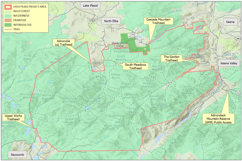
The map of the Visitor Use Management planning area in the central High Peaks Wilderness.
Our assessment of the new DEC-DJ&A VUM Plan is that it does not meet the standards articulated in the draft guidance, nor does it meet the standards articulated in various VUM planning documents published by the National Park Service/National Forest Service.
From our review of various federal VUM planning documents it’s our understanding that at its core VUM planning stresses the importance of gathering information and data on the specific natural resources of a management area. Gathering information and data on an area’s natural resources is essential in VUM planning because it is the only way to:
- Define and protect desired resource conditions (e.g., intact vegetation, soils, erosion, wildlife habitat, water quality, etc.).
- Understand how visitor use actually affects those resources over space and time, that identify the public goals for outdoor recreational uses.
- Make defensible, data‑driven decisions about where, when, and how to manage visitor access and activities.
- Understand the effectiveness of new management strategies and actions based on changes to natural resources or the public experience.
Without good resource data, managers are essentially guessing where thresholds are and when impacts become unacceptable. By analyzing current data, managers can tailor use levels and management actions to keep conditions within agreed‑upon limits. Once data has been gathered an analyzed, it’s used to determine “baseline conditions.” A baseline must be understood in order to determine whether management changes need to be made to move towards the “desired conditions.”
This process in VUM planning allows managers to understand current impacts from visitor use, establish baselines for visitor impacts, assess changes over time, and proactively implement new measures to attain future desired conditions. Data and analysis are crucial, foundational parts of this process. VUM planning simply will not work without an underlying foundation of accurate data and understanding about both the natural resource conditions and the public experiences in an area. This analysis informs any new management strategies and actions. There are a range of management actions that can be employed to regulate and manage public use of a wild natural resource area, but these actions should be tailored to mediating negative impacts. Once new management actions are implemented, then there should be long-term monitoring to understand its effectiveness.
In our review of the DEC-DJ&A VUM Plan we do not find the holistic VUM planning outlined in various federal VUM planning documents and outlined above. For instance, in the DEC-DJ&A Plan it would have been useful to have ecological data gathered at the same time and place as the crowding analysis was undertaken. The Plan relied heavily on visitor crowding/people-per-viewscape analysis of specific trails and specific mountaintop destinations as its primary research and relied on ecological studies largely undertaken on a range of other Forest Preserve points of interest outside of the High Peaks.
The Foundation of VUM Planning is Natural Resource Impacts Data
During the stakeholder process, PROTECT and others pressed for a wider scope of research, but DEC cited budgetary constraints as compelling a more limited focus on social impacts. Although DEC acknowledged that SUNY-ESF Adirondack Ecological Center in Newcomb is gathering ecological data with their “ecological scorecard” assessments that started in 2019 through a DEC contract and are ongoing on the Forest Preserve. PROTECT supports this vital work and urged that it be aligned with VUM planning. The VUM Plan’s proposal to implement significant policy changes in the absence of the comprehensive analysis envisioned by the VUMF is premature and lacks an adequate scientific basis.
The lack of any natural resource analysis is inexplicable, given that DEC has partnered with SUNY ESF on a multi-year project to collect natural resource data in the High Peaks Wilderness and other Forest Preserve units in the Adirondack Park. PROTECT strongly supports this work and urges DEC to continue and increase its collaboration with state universities. However, we are perplexed as to why these important data were not integrated into the VUM Plan.
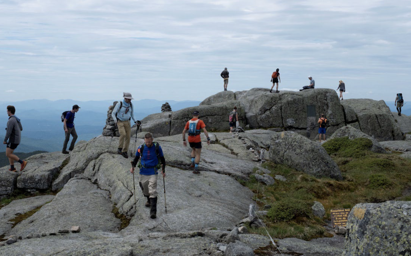
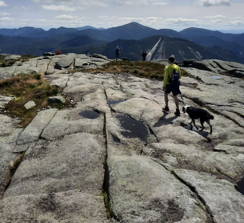
Hikers on the summit of Mount Marcy.
The VUMF assumes that social and natural resource impacts will be evaluated together, in a single report, with recommendations grounded in a comprehensive understanding of both. Consequently, the VUM Plan’s omission of natural resource data limits fails to fully implement the VUMF and thus seriously limits the Report’s usefulness for decision-making. This omission does not undermine the VUM Plan’s social-impact data or conclusions, but it fails to provide an adequate basis for some of the Plan’s proposed management actions.
The natural resource data collected by SUNY ESF could influence—either positively or negatively—DEC’s consideration of those actions. Accordingly, PROTECT urges DEC to integrate and social and natural resource impact analyses to fully align with and implement the VUMF. To that end, we urge DEC to change the Plan’s title to “Draft High Peaks Project Area Social Impacts Analysis and Monitoring Plan” to more accurately reflect the Report’s limited scope. We also urge DEC to prepare a draft final report that integrates the social and natural resources impact analyses for the High Peaks Wilderness Area and release that for public comment.
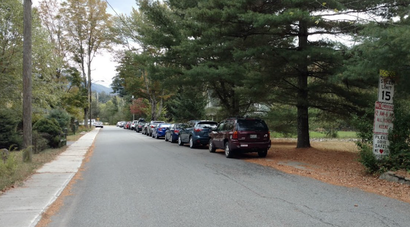
Roadside parking in downtown Keene.
Consequently, it is premature—absent natural resource impact data—to consider parking limitations or restricting visitor use through a permit system, which are aggressive management approaches that, in PROTECT’s view, would be justified only by a robust data set addressing physical, biological, and social impacts together. Moreover, actions taken in response to identified natural resource impacts could reduce—or eliminate—the need for a permit system. For example, if the natural resource analysis recommends temporarily closing the heavily used Phelps and Van Hoevenberg trails to Mount Marcy, that step could allow seriously degraded and eroded trails to recover while simultaneously reducing hiker numbers, potentially achieving use-reduction goals without permits. Although institution of a permit system for the busiest days may ultimately be necessary, PROTECT believes such a significant policy change should be made only after considering a complete data set on physical, biological, and social impacts.
PROTECT nevertheless commend DEC’s collection of scientific data on social impacts to better inform its management decisions addressing the impacts of increasing recreational use pressures in the High Peaks. The VUM Report provides a science-based analysis of social impacts and outlines an achievable long-term monitoring program to support future impact analyses and to evaluate the effectiveness of adaptive management strategies.
Hiker on the summit of Algonquin Mountain.
Recommendations
- PROTECT encourages DEC to implement the general strategies and actions identified in the VUM Report throughout the High Peaks Project Area. These include working with municipal and nongovernmental partners to provide the public with more information about trip planning, sustainable visitor-use practices (Leave No Trace), and alternative hiking destinations. However, this information should be provided in environmentally sensitive ways compatible with the Adirondack Park and the Forest Preserve (such as through online resources or staff at trailheads), rather than through placement of intrusive, large electronic signs along major travel corridors bordering Forest Preserve lands, as has occurred in the past.
- We also urge DEC to continue the long-term data gathering and monitoring proposed in the VUM Plan. We strongly support the Plan’s recommendation to complete an assessment of the impacts of recreational use on natural resources and urge DEC to inform the public how it intends to integrate the findings, conclusions and recommendations in the VUM Plan with the ecological scorecard data for the High Peaks being collected by SUNY ESF.
- DEC should consider reorganizing an ongoing High Peaks Wilderness Stakeholder Advisory Group to facilitate information sharing, collaboration, and problem-solving for management of the High Peaks Wilderness Area. The group should include local government, relevant agencies and institutions, stakeholder organizations, and members of the general public, among others, and should meet on a regular basis. PROTECT would welcome the opportunity to serve on such an advisory group.
- PROTECT strongly supports the Plan’s recommendation that DEC use the VUMF in other Forest Preserve units, with the important caveat that future use of the VUMF should ensure that natural resource, social and recreational impacts and analysis are integrated in a single report.
- PROTECT urges DEC-APA to complete the VUM Guidance policy document and to begin applying it to other highly visited Forest Preserve units.


