It’s slow work for the forest to take back a road. But once the forest gets started, its work is relentless. The State of New York has owned the Burn Road on the north side of Little Tupper Lake, part of the William C. Whitney Wilderness area, since 1997 when it bought the 14,700-acre north end of the larger Whitney tract. It was classified as Wilderness soon thereafter, though the road remained open for several years to honor access agreements with neighboring landowners to haul out logs.
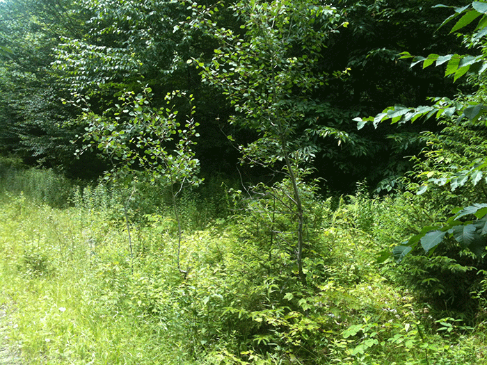
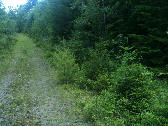
15 years later, young maples, white pines, alders, white birch, and striped maples, among other trees, work daily to break apart the long-packed gravel road bed. Leaf litter and the detritus of perennial ferns, grasses, and sedges bury the road in many places. The thick forest edge grows inward to narrow the road corridor as trees unpruned and unfettered grow laterally as they grow higher.
The Burn Road is a designated foot trail today and maintained by the Department of Environmental Conservation (DEC). The road extends a half dozen miles and connects with a trail network to a half dozen remote ponds. Blowdown is removed and there is a clear foot trail track from moderate use down the middle of this abandoned road. The forest reclamation process would be quicker if fallen trees were allowed to rot in the road corridor.
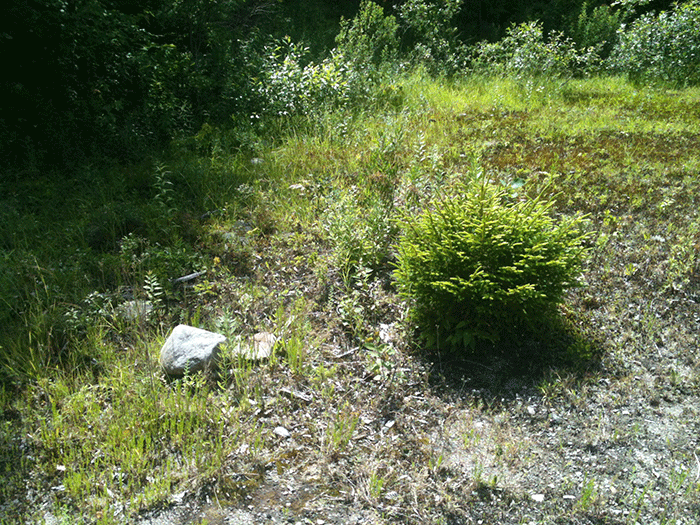
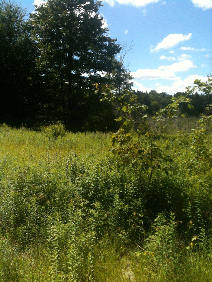
In many places only a narrow pathway is evident through thick stems of young trees. In other places the gravel road bed is bared. There are places where half-acre former log landings or road maintenance sand and gravel pits have not seen much change and stand as grassy fields dotted with a few brave trees. Stumps are visible in the surrounding forest from its logging past. Most trees in the forest beyond the roadside are young, though the canopy is largely closed.
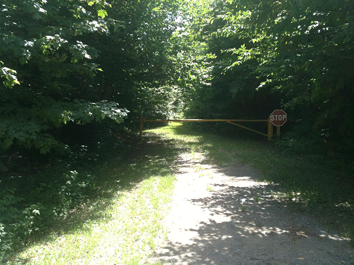
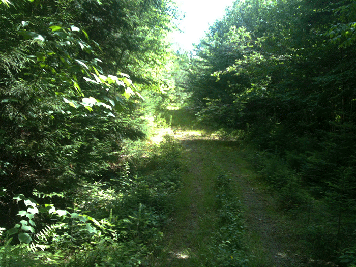
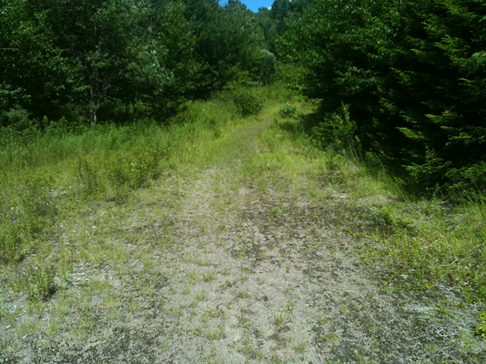
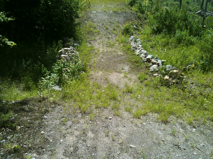
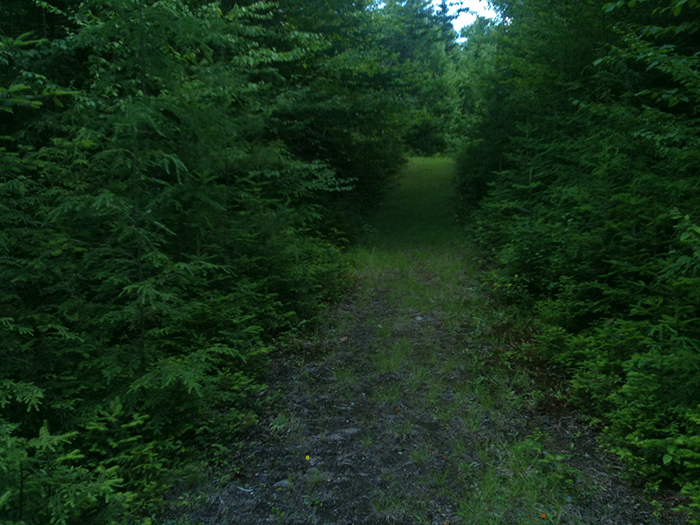
The entrance to the Burn Road, now a foot trail through the William C. Whitney Wilderness Area.
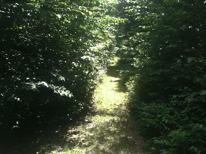
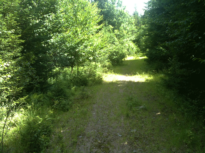
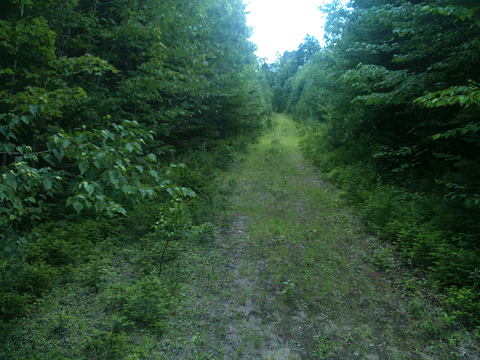
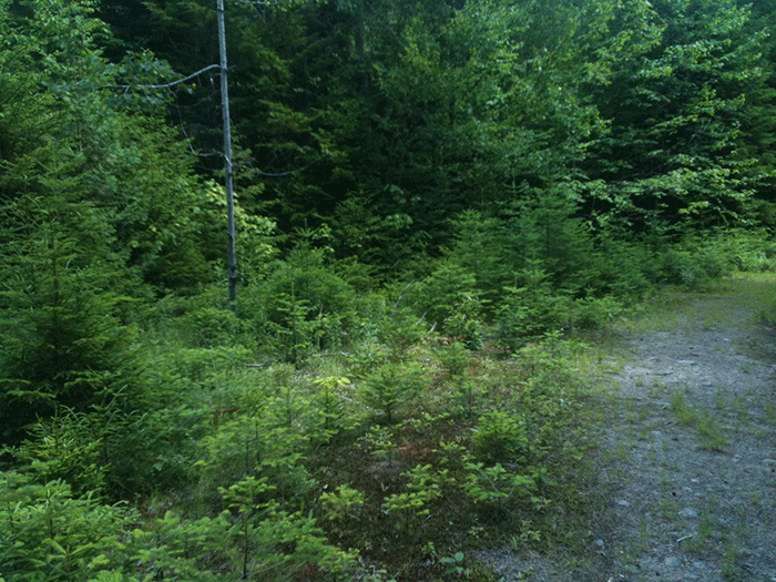
A part of the Burn Road where trees have grown in laterally, considerably narrowing the former road.
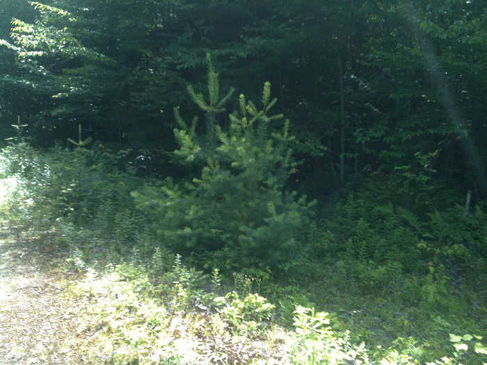
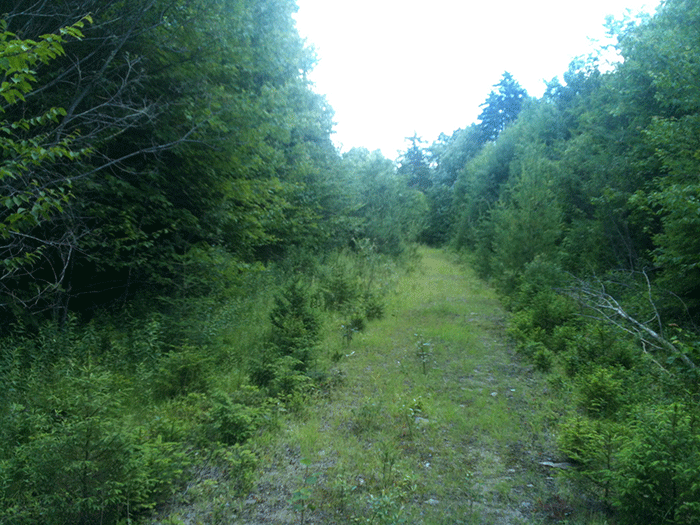
White pines struggle to break through the old roadbed and get a foothold. The roadbed is still heavy in places with a legacy of crushed stone and gravel.
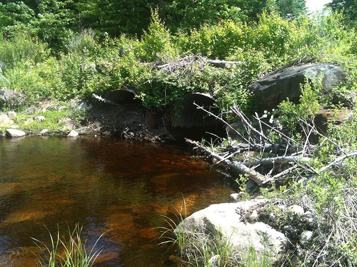
Other remnants of the Whitney land’s industrial forest management past remain. A large double culvert is plainly evident at one point. That one side is clear while the other is clogged by beavers shows it’s being maintained. The DEC has stabilized and repaired the trail above the culverts after wash-outs. The reclamation work of the forest would be quicker if the beavers were let alone to do their jobs. That the large culverts remain in a Wilderness area is a sign that after 15 years, the DEC has failed to draft a Unit Management Plan (UMP) for this area and address a variety of issues, such as natural resource rehabilitation.
The remains of roads can persist in the Forest Preserve for a long time. In the Blue Ridge Wilderness Area, stretches of the old Buntline Road can still be seen today. Legend has it that this road was cut from Indian Lake to Eagle Lake to haul out manuscripts for fans of Ned Buntline’s pulp fiction. This road was cleared as snowmobile trail in the 1960s and some old snowmobile bridges are rotting away today. Part of this road is used today as a hiking trail, while other parts of the road have been reclaimed by the forest. On the parts of the road maintained as a hiking trail remnant tread lines, from tires or wagon wheels, are visible today.
Each acquisition of new Forest Preserve is accompanied by calls that logging roads should be kept open. This is an irresistible siren song for many state officials. Closing old roads on new Forest Preserve lands is always difficult. It’s even difficult to close roads once the state says they should be closed as we’ve seen with the Crane Pond Road in the Pharaoh Lake Wilderness and the White House or West Roads in the Silver Lake Wilderness. Both remain open despite UMP dictates to close them.
One of the main reasons for opposition to Wilderness is the desire to access forest lands by road and automobiles. Wilderness takes us out from behind the wheel of our automobiles, a very comfortable place for many. Another reason is that Wilderness is a place where people have to walk or use a boat without a motor. It’s a place where each footstep or paddle stroke takes one farther away from the human-dominated world.
When former tote roads or haul roads are gated and let to revert back to forest, Wilderness supporters are accused of “manufacturing” Wilderness. Here, the argument is that we’re forcibly and artificially transforming lands used for logging or hunting camps to another purpose. In fact, we’re just making a decision as a civil society for a new use of the land. Generally, we’re swapping tree cutting, intensive mechanized forest management, and motorized recreational uses for letting the land alone, hopefully forever, as a place where natural ecological processes can proceed unbothered by human activity, save for some foot trails, campsites, pit privies, trail signs and lean-tos.
The framers of the National Wilderness Act searched for the perfect words to evoke the principle of how Wilderness lands would be managed. Were these lands to be unbothered by humans – or untrampled, unfettered, unbound, unhampered, unconfined, uncontrolled, or unmanipulated? “Undisturbed” was written into early drafts of the Wilderness Act. Of course, Howard Zahniser, principal author of the Wilderness Act, famously determined to use the word “untrammeled.” The Wilderness Act defines Wilderness as “an area where the earth and its community of life are untrammeled by man, where man himself is a visitor who does not remain.” A trammel is a “net for catching fish” or a “hobble for confining horses.”
Wilderness is a forward-looking management policy. Wilderness management is all about what happens on the land in the years and decades ahead. Wilderness management deliberately ignores the past and pushes ahead. In Wilderness areas we proudly try to bury the past beneath the cover of tall trees, beaver ponds, leaf litter, accumulated duff, witch-hobble, and much more. Stubborn remnants of the past dot the landscape, but they grow fainter each season.
Many people use Wilderness areas recreationally; some bushwhack, but most stick to trails. Some of the most popular hiking trails and mountain summits in the Adirondacks are in Wilderness areas. Some of the most heavily used campsites and lean-tos are in Wilderness. Yet, these are secondary purposes to long-term natural resource protection provided by Wilderness management. The main purpose is to let natural ecological processes shape the future of these lands.
I’ve always seen Wilderness management as fitting with national historic lore about America as a land of redemption, new beginnings and self-invention. In Wilderness areas we give nature an opportunity to obliterate the past and start fresh. It’s the great second chance. It’s a hopeful management policy. We sever the chains of history and we don’t let the past hold back the present or shackle the future.
The abandoned Burn Road in the Whitney Wilderness area tells this story. The business of taking back a road is slow work for the forest, but the last 15 years have seen the forest get a foothold that now secured won’t be given back. In the years ahead, the grassy meadows will give way, the gravel patches will be buried over, and a new forest will possess the land.
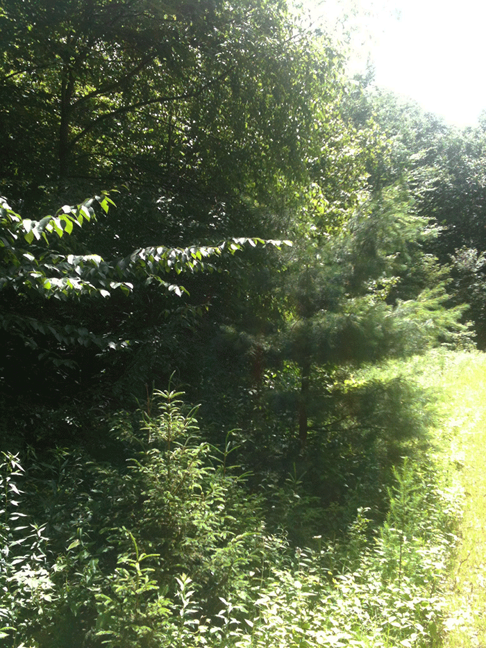
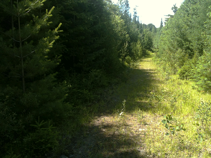
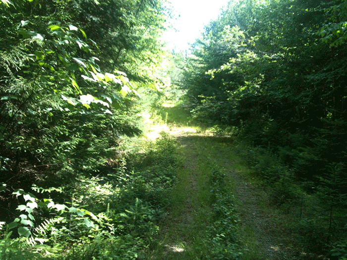
More pictures of the Burn Road from the summer of 2014 are below that show the slow, yet inexorable growth of the forest to repossess this road.
This article was also published on the Adirondack Almanack.
