The West River Road in the central part of the Silver Lake Wilderness area winds along the north side of the West Branch of the Sacandaga River. In many places the road is close to the river. It’s a local road for most of its length and is managed and maintained by the Towns of Wells. It cuts through Forest Preserve lands on its east end and provides access for various private land inholdings. The West River Road has long been classified as the Sacandaga Primitive Area, which includes just the road corridor that accessed the inholdings. While private landowners used the road, the public did too and road side camping sites with easy motor vehicle access are commonplace along the road.
The state purchased the westernmost private inholding, which means that the last .7 mile of road has remained as an open road and Primitive Corridor in violation of the Adirondack Park State Land Master Plan because Primitive Corridors must have a purpose for managing a non-conforming use, such as private access through the Forest Preserve to an inholding, and cannot be maintained solely to provide public motor vehicle access. This issue was spelled out in the Silver Lake Wilderness Area Unit Management Plan (UMP).
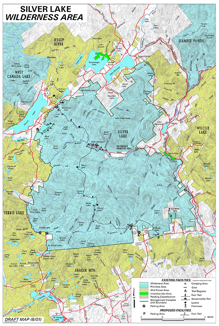
The 106,770-acre Silver Lake Wilderness is one of the largest Wilderness areas in the Adirondack Park, along with the Siamese Ponds Wilderness (112,524 acres) area, Five Ponds Wilderness (117,978 acres), and High Peaks Wilderness (192,685 acres). The Northville-Placid trail runs north-south through this area. The area includes Silver Lake and a long stretch of the West Branch of the Sacandaga River. See map of this Wilderness area below:
The Silver Lake Wilderness UMP was approved in 2006. The Adirondack Park Agency (APA) recognized that this motor vehicle road in a Wilderness area was a non-conforming use because the last .7 miles of the West River Road served no purpose as a Primitive Area, other than allowing motor vehicle access within a Wilderness area. The justification for maintaining this Primitive Area was for private landowners to access their inholdings. With the sale of the westernmost inholding, the last .7 miles of the West River Road openly violated the Adirondack Park State Land Master Plan (SLMP). Here is how SLMP describes and provides guidance for the Sacandaga Primitive Area (the West River Road): “Should the private lands west of this section be acquired by the state, this road should be terminated … and the right-of-way, as well as the acquisition, should become part of the Silver Lake Wilderness.”
The last .7 miles of the West River Road remains a road and not Wilderness.
The APA enumerated a process to bring this road into conformance within the 5-year period of the approved Silver Lake Wilderness UMP. Pertinent parts of the resolution to approve the Silver Lake Wilderness UMP are below:
“WHEREAS, the entire length of the West River Road, also known as Whitehouse Road, is a public road currently maintained by the Town of Wells which passes through State land and three separate private in-holdings within the Silver Lake Wilderness; and
WHEREAS, the Sacandaga Primitive Area designation is recognized by the State Land Master Plan as having highway use and associated legal interests “whose removal, though a long- term objective, cannot be provided for by a fixed deadline”; and
WHEREAS, the Town has gone on record stating that the West River Road provides motor vehicle access to several private parcels, provides important access to the Sacandaga River corridor and serves as an important entrance to the Silver Lake Wilderness Area; and
WHEREAS, the Department does not have sole legal authority to close the full extent of the road because Highway Law §212 does not authorize closure of a road which does not pass over or through lands wholly controlled by the State; and
WHEREAS, the Plan commits to efforts to work cooperatively with the Town of Wells to bring that portion of the West River Road that extends beyond the last private in-holding into compliance with the State Land Master Plan by the end of the five-year period covered by this Plan; and
WHEREAS, the Department has committed to completion of a campsite impact assessment for primitive tent sites in the areas, as well as to continued consultation with the Agency regarding design criteria for primitive tent sites to ensure they will conform to the guidelines and criteria of the Master Plan;”
The most important part of this resolution is the statement that the Department of Environmental Conservation (DEC) will “bring that portion of the West River Road that extends beyond the last private in-holding into compliance with the State Land Master Plan by the end of the five-year period covered by this Plan.” In 2014, some eight years after the UMP was approved, the DEC has not done this work yet. The APA and DEC are three years late in making a decision on the closure of this road. The absence of action has resulted in motor vehicle incursions into the Silver Lake Wilderness area.
The Silver Lake Wilderness Area UMP identifies the .7 miles at the west end of West River Road as a non-conforming use. The DEC was tasked with conducting a campsite inventory and making recommendations to the APA about the best way to close this road. Page 79 of the UMP states:
The Master Plan contains several specific provisions on the use of motor vehicles in areas classified as wilderness. The Master Plan, June 2001, states in guideline 2 under the heading “Structures and improvements” on pages 21 and 22, that in wilderness areas “roads and state truck trails” are considered non-conforming structures. Guideline 1 under the heading “Motor vehicles, motorized equipment and aircraft” on page 23 of the Master Plan, provides “public use of motor vehicles, motorized equipment and aircraft will be prohibited.” Thus, the Master Plan does not allow for any use of public motor vehicles on wilderness units within the Adirondack Park. Under the Master Plan, that portion of the road which is not included in the Sacandaga Primitive Area must therefore be closed to the public use of motor vehicles. If, however, the Primitive Corridor does include only 0.7 mile of this road, DEC is without legal authority to effectuate a closure of that portion of the road which reaches to the last parcel of private property situated on the road, because Highway Law §212 does not authorize the Department to close a road which does not pass over or through lands “wholly controlled” by the State.
Further discussions will be held with the Town of Wells to address the future status of the last 0.7 miles of the West River Road. Within the 5-year period covered by this UMP, said discussions will result in action which bring the status of this section of road into compliance with Master Plan requirements. Possible options for effectuating such compliance might include, among other things, an order of abandonment by the Town pursuant to Highway Law § 205(1) or a Commissioner closure order pursuant to Highway Law § 212.
The last .7 miles of the West River Road includes a handful of roadside car camping sites. There are also trails that lead off the road. While some of the trails are gated there are signs of All Terrain Vehicle (ATV) routes around the gates. The west end of the West River Road is close to the Northville Placid Trail. The failure to close the West River Road has allowed motor vehicles to access wild parts of the Silver Lake Wilderness and ATVs to ride on hiking trails.
Below are pictures of what the West River Road looks like today for the sections located within the Silver Lake Wilderness area.
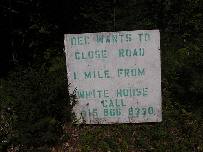
Sign on the Town of Wells section of the West River Road, advocating against close of the western .7 miles of road in the Silver Lake Wilderness Area.
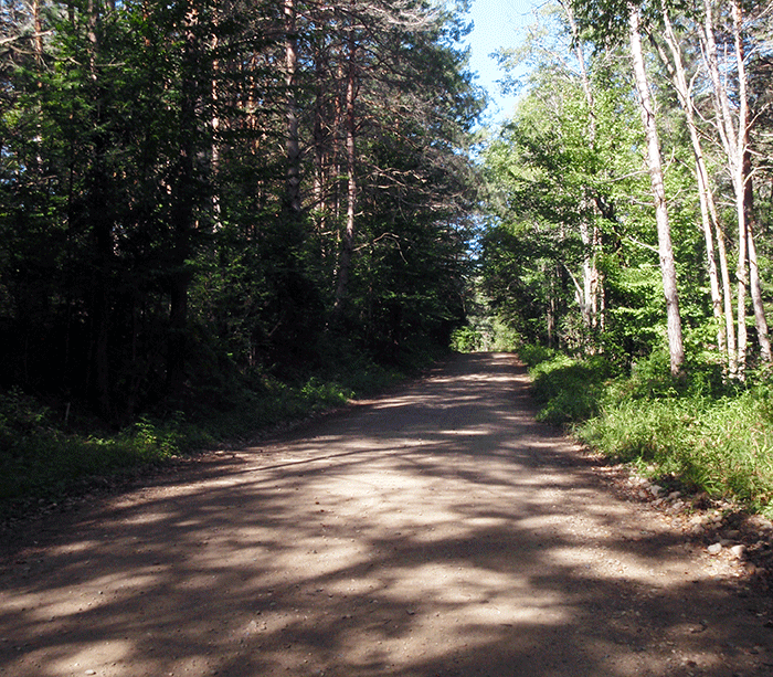
A section of the West River Road within the Silver Lake Wilderness Area.
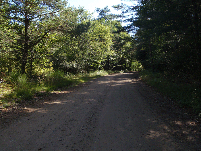
Another section of the West River Road within the Silver Lake Wilderness Area.
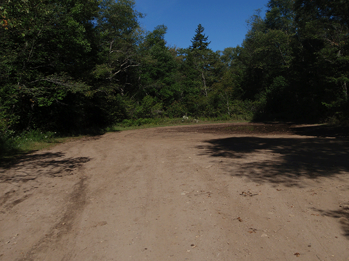
A large baseball field-size dead end turnabout at the end of the West River Road within the Silver Lake Wilderness Area.
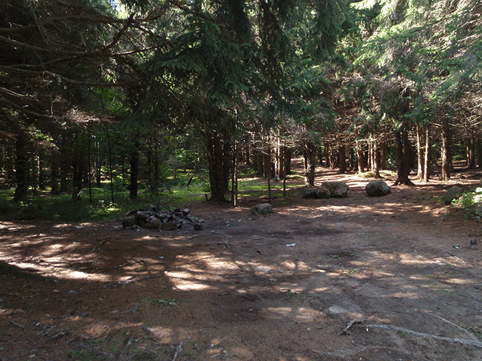
Roadside campsite on a section of West River Road located within the Silver Lake Wilderness Area.
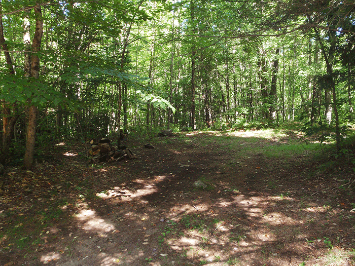
Another roadside campsite on a section of West River Road located within the Silver Lake Wilderness Area.
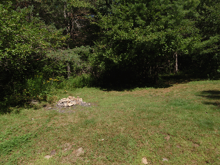
Roadside campsite on a section of West River Road located within the Silver Lake Wilderness Area.
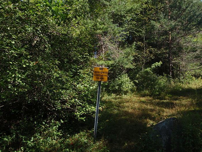
A sign along the western section of the West River Road, within the boundary of the Silver Lake Wilderness Area, informing the public not to use motor vehicles on trails. Use of motor vehicles is evident on Wilderness lands.
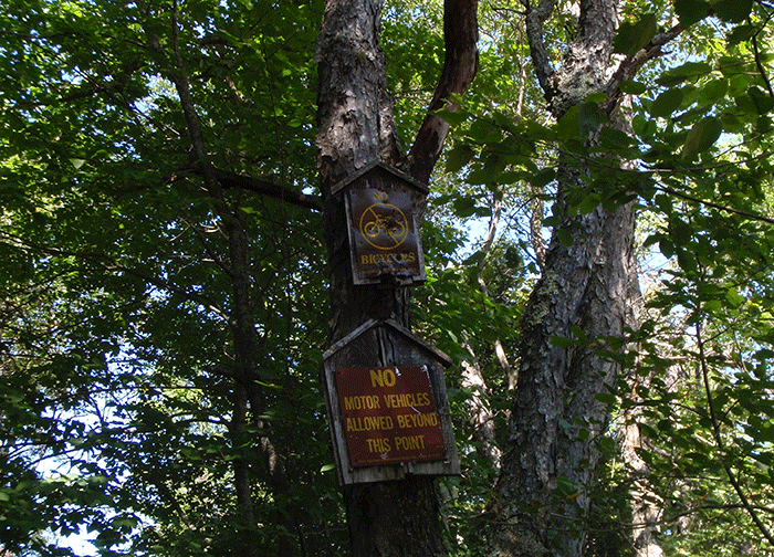
More signs along the western section of the West River Road, within the boundary of the Silver Lake Wilderness Area, informing the public not to use motor vehicles on trails. Use of motor vehicles is evident on Wilderness lands.
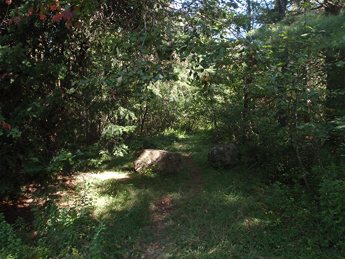
A foot trail in the Silver Lake Wilderness, accessed by the West River Road, where motor vehicle use is evident.
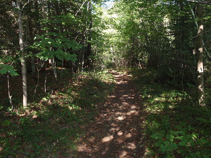
Another foot trail in the Silver Lake Wilderness, accessed by the West River Road, where motor vehicle use is evident.
Protect the Adirondacks will continue to advocate that the APA and DEC make a decision on road closure and uphold state law that bans roads in Wilderness areas.


