There have been steady reports through the summer of 2014 of cars and trucks getting stuck in the mud on the Crane Pond Road in the Pharaoh Lake Wilderness area. A recent visit to the road found it to be a mess. Management appears contradictory and inconsistent. With the road now in a state of disrepair it’s become a safety hazard for the public.
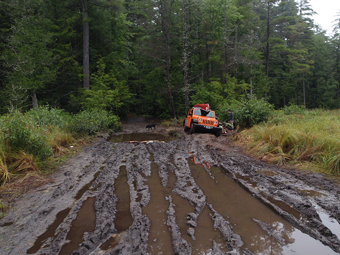
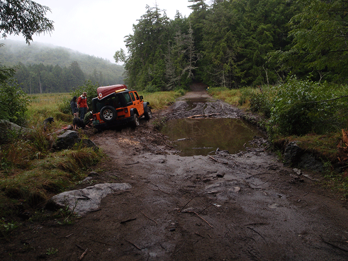
A jeep stuck in the mud in late August 2014 on the Crane Pond Road in the Pharaoh Lake Wilderness area.
This road has been controversial for decades. It has a long legal history. In 1979, part of the road was a Primitive Corridor where the road would remain usable based on maintenance and use. Crane Pond Road was officially classified as part of the Pharaoh Lake Wilderness area in November 1987 as part of a classification package signed by then Governor Mario Cuomo after official recommendations by the Adirondack Park Agency (APA).
See letter from PROTECT to state agencies.
In 1989, the Commissioner of the Department of Environmental Conservation (DEC) Thomas Jorling ordered the road be closed. DEC used its authority under a revised State Highway law passed in 1988. The Supervisor of the Town of Schroon, John Kelly, sued the DEC and the State Supreme Court ruled in favor of the DEC. Kelly appealed to the Appellate Division, which upheld the Supreme Court decision in favor of the DEC’s authority to close the road. The Court of Appeals, New York’s highest court, turned down a motion seeking leave to appeal the Appellate Division decision.
The Pharaoh Lake Wilderness Area Unit Management Plan (UMP) was approved in 1992 and recounts this legal history. The UMP affirmed that this road should be closed.
The state attempted to barricade the road with large boulders but these were removed in 1991. Outcries from motor vehicle access activists and local government have carried the day since then to keep the road open. A scuffle on the road saw Adirondack leaders glorified for standing up to Wilderness advocates who wanted the road closed. This has been the case through the last five New York Governors and various administrations of the DEC and APA over the past 20 years.
Crane Pond Road runs for approximately two miles to Crane Pond. There are several trailheads along the road and two informal parking areas before a parking area, boat launch, and cluster of campsites and the end of the road on the west end of Crane Pond. The road runs through wetlands and along steep ridge sides.
Our visit on August 22, 2014 found management to be haphazard and unlike any other part of the Forest Preserve. We did not drive the road, but parked at the end of the Town of Schroon section of Crane Pond Road, where the DEC maintains a parking area, and before the Crane Pond Road turns sharply south into the Pharaoh Lake Wilderness area. There was no trailhead register.
There was not a single Forest Preserve, State Land or Wilderness Area sign all along the Crane Pond Road. If these have been put up over the years, they have been removed. Trailhead signs still remain, though often 10 feet high and one has to squint to read them. Thankfully various “No Fire” or “No Camping” signs remain because there are many undesignated roadside camping spots. On the day of our visit no Forest Ranger was seen, though more than a dozen cars were encountered along the road.
On our field visit, there were cars parked at the main parking area outside the Wilderness area. Perhaps these were people who knew that the Crane Pond Road is an illegal use in the Wilderness area and chose not to drive on the road. Or, these were people who found the road in disrepair and did not want to risk damage to their vehicle. Or, perhaps, these were people who just wanted to hike.
The approach on Crane Pond Road brings one to pass under a large 8 or 10-foot American flag that is draped over the road. This is clearly a statement about the “rights” of motor vehicle advocates to use the Crane Pond Road and marks the symbolic nature of what this road has come to represent.
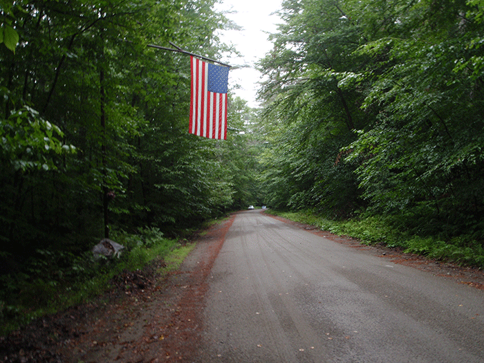
A large flag hangs over the end of the Crane Pond Road, where it transitions from a Town of Schroon Road to part of the Forest Preserve Road. Located in a Wilderness Area, a Unit Management Plan stated in 1992 that Crane Pond Road should be closed, but it remains open.
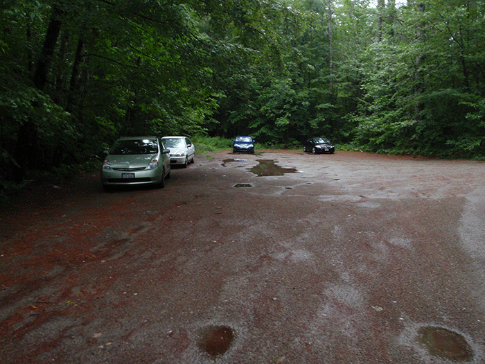
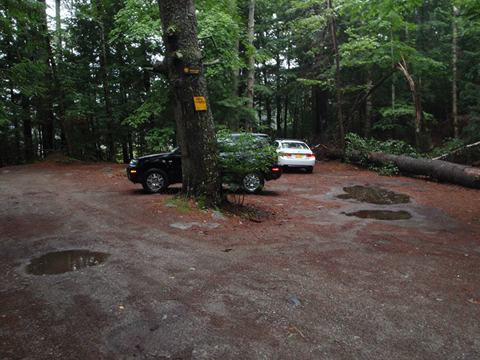
The parking area at the beginning of the Crane Pond Road, used by some members of the public.
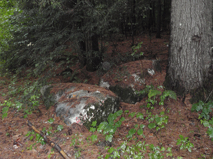
Boulders pushed aside at the entrance to the Crane Pond Road on the Forest Preserve stand as reminders of the time when the DEC tried to close the road and placed boulders to block the entrance. Smaller boulders were hauled around on a pickup truck in Albany as the “stones of shame.” These larger boulders have faded, unreadable spray-painted messages.
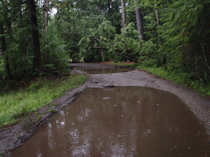
The Crane Pond Road seems to exist in a state of suspended non-managed management. Someone has worked to maintain the road in many places where water bars are evident for stormwater management to promote better drainage and prevent washout. In other places trees that have fallen into or across the road have clearly been sawed and cleared. Yet, in other places culverts have deteriorated and part of the road has collapsed. In other areas the road is pockmarked by enormous puddles a foot deep. Enormous rocks jut into the road surface in other places.
This part of the Crane Pond Road has an actively maintained water bar to manage drainage and prevent wash-outs.
This part of the Crane Pond Road had a downed tree cut and moved to clear the road. Parts of the fallen and cleared tree can be seen on both side of the road.
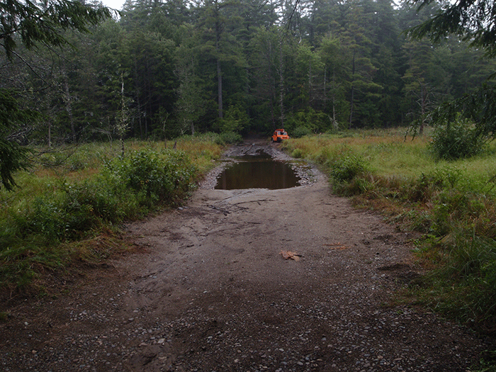
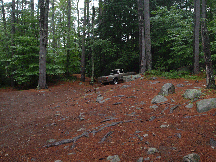
A parking area half way along Crane Pond Road at the Goose trailhead.
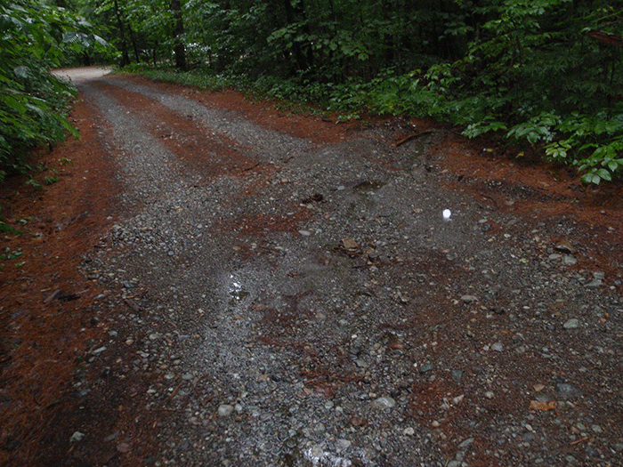
Large wetland 1 miles from parking area at beginning of Crane Pond Road on the Forest Preserve. This stretch of road is badly chewed up. A number of vehicles, such as this jeep, have been stuck in the mud here.
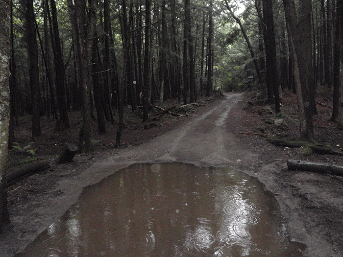
Another view of an damaged part of the Crane Pond Road.
Another part of the Crane Pond Road in disrepair where soils have been damaged and compacted. Downed trees can also be seen leaning over the road.
Truck parked near the canoe launch at Crane Pond. A nearby sign reads “No Motorboats.”
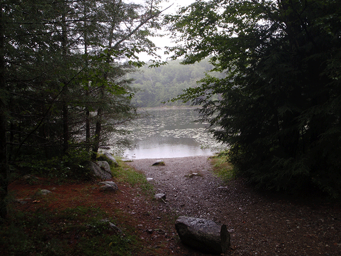
The canoe launch to Crane Pond.
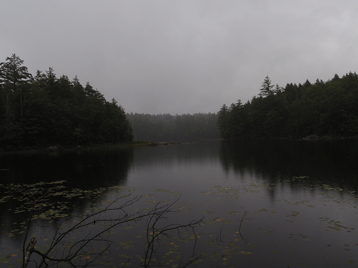
Beautiful Crane Pond. With many small bays and points, this pond is a great place to paddle and camp. The management of this area needs to be improved.
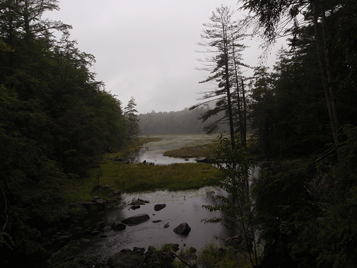
The outlet from Crane Pond flows to nearby wetlands and ponds.
The Crane Pond Road should have been closed years ago. Official state regulatory programs for Forest Preserve classification and for Forest Preserve management have required that this road be closed. The state’s highest courts have upheld the state’s authority to close this road. Yet Crane Pond Road remains open.
State laws should be upheld and the Crane Pond Road should be closed.


