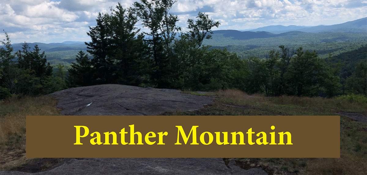
Panther Mountain is a short hike to an open rocky summit with sweeping views outside of Tupper Lake
Panther Mountain
0.6 miles (1.2 miles round trip)
Saranac Lake Wild Forest Area
Tupper Lake, Franklin County
Hiking, Snowshoeing
Level of Difficulty: Easy
Hike Panther Mountain
The 0.6-mile Panther Mountain Trail is a short hike to an open rocky summit outside of Tupper Lake in Franklin County. The trail is on public Forest Preserve lands in the Saranac Lake Wild Forest Area. The trail is steep, gaining 780 feet in elevation in 0.6 miles, is well-worn and easy to follow. The short distance and the beautiful summit view make it an ideal stop for anyone seeking to spend an hour or two among and above the trees.
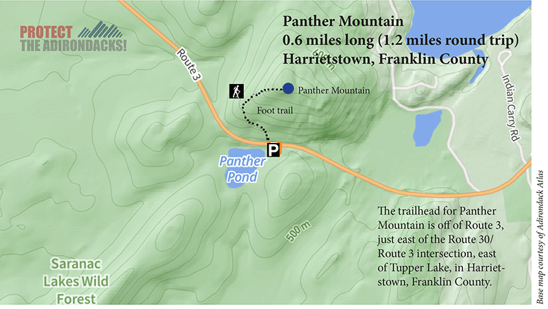
The roadside parking area is located on the south side of Route 3 between Tupper Lake and Saranac Lake, about 1.5 miles east of the intersection with Route 30. There is no signage for the lot, but the DEC trailhead sign is visible across the road.
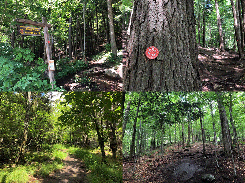
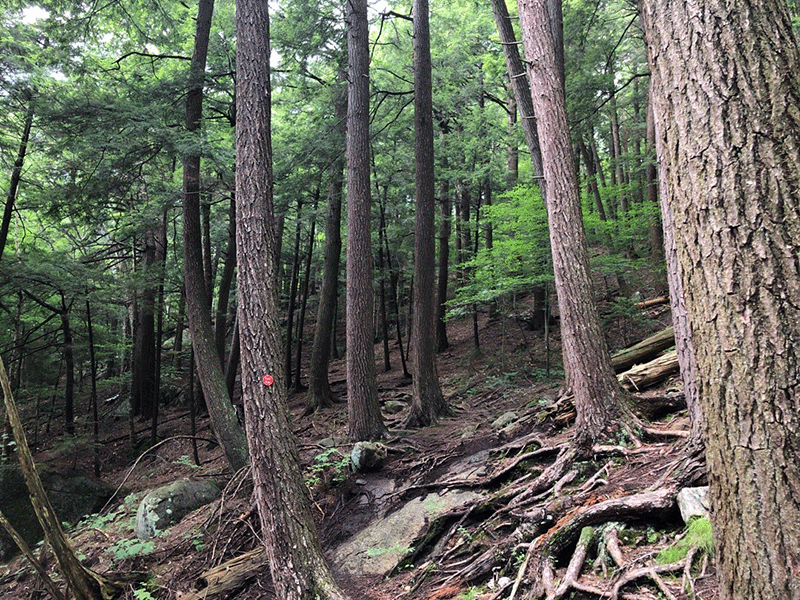
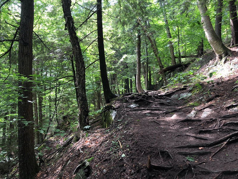
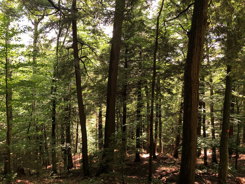
The route leads up into the woods about ten yards down the road to the left and immediately ascends past the trail register. The trail follows red trail markers as it climbs steeply through a mature mixed forest with many old white pines, hemlocks, and yellow birches.
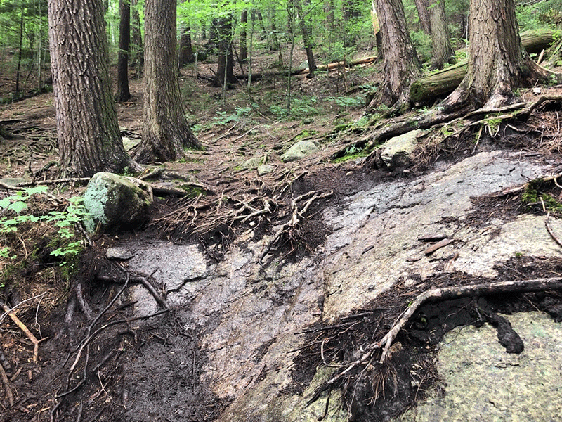
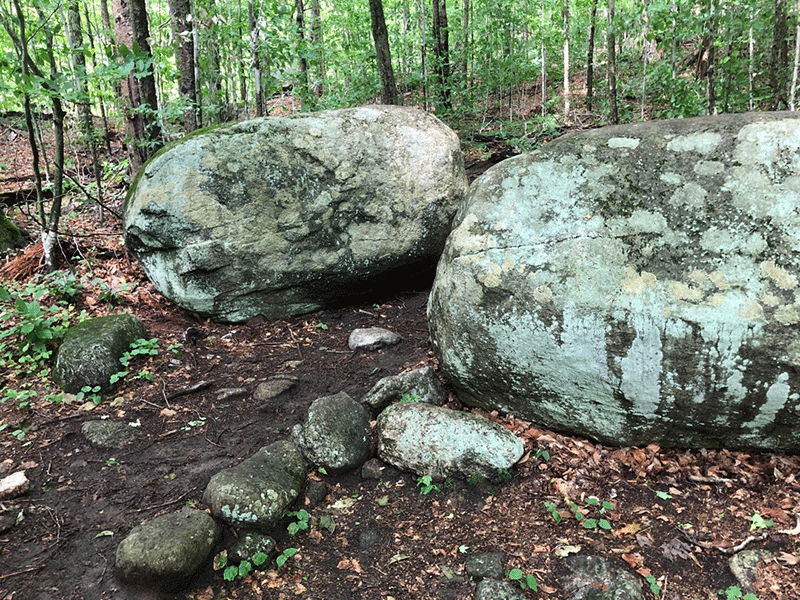
The trail passes over a number of eroded patches of exposed tree roots and bedrock that can be slippery when wet or muddy. After about 0.4 miles, the trail flattens out and curls to the right to slip between two large boulders before passing a large hollow sugar maple. The trail then leads onto a sunny stretch of bare rock lined by grass as more coniferous trees begin to appear.
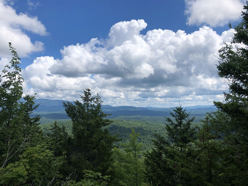
The Summit of Panther Mountain
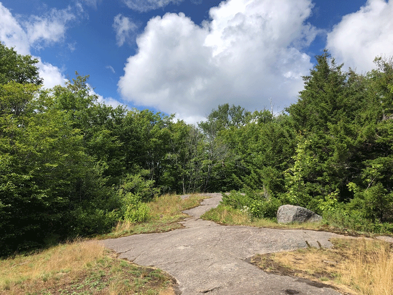
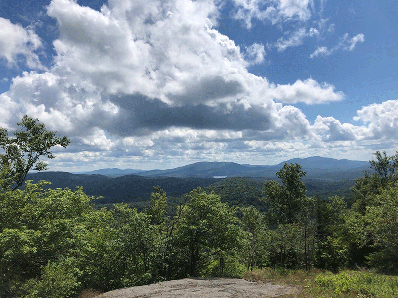
The trail returns to the shade of the forest again for a few hundred feet before rising onto the summit. The top of Panther Mountain is open and rocky, with various wildflowers growing out from the cracks in the rocks. The splendid view of the surrounding mountains and waterways stretches out just above the treetops. To the south, Panther Pond is visible just beyond Route 3. In the distance, the Seward Mountain Range stands tall and the Raquette River winds through the lowlands.
The hike out is the same as the hike in.
Click here for a map and directions to Panther Mountain.
When You Hike Make Sure to Practice “Leave No Trace” to be Prepared and to Protect the Forest Preserve
Please follow “carry in, carry out” rules for all trash and follow other Leave No Trace principles when hiking in the public Forest Preserve and other wild areas. The seven Leave No Trace principles are: 1) Plan ahead and prepare; 2) Stay on hiking trails and camp at designated areas; 3) Dispose of human waste and trash properly; 4) Leave what you find; 5) Minimize campfires; 6) Respect wildlife; 7) Respect other hikers.
Educated hikers do not damage the environment. Prepared hikers do not need search and rescue unless injured.
Winter Use: Panther Mountain is a popular trail for snowshoeing in the winter.
Click here to become a member of Protect the Adirondacks.


