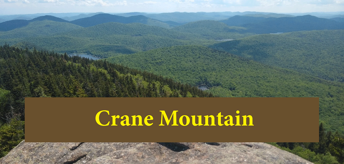
Crane Mountain and Crane Mountain Pond make a great trip that shows the rugged and varied terrain of the southern Adirondacks
Crane Mountain, Crane Mountain Pond
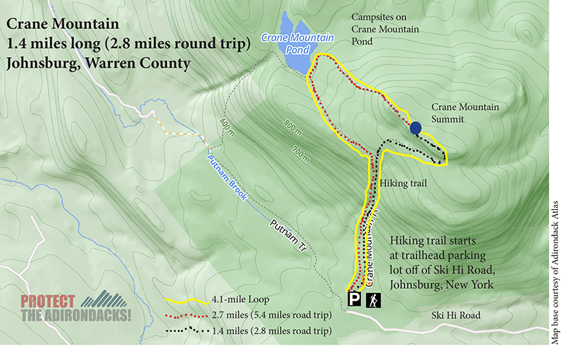
1.4 miles (2.8 miles round trip); 2.7 miles (5.4 miles round trip); 4.1-mile loop
Johnsburg, Warren County
Southern Adirondacks
Hiking, Snowshoeing, Cross-country Skiing
The Hike Up Crane Mountain and Crane Mountain Pond
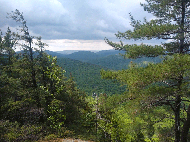
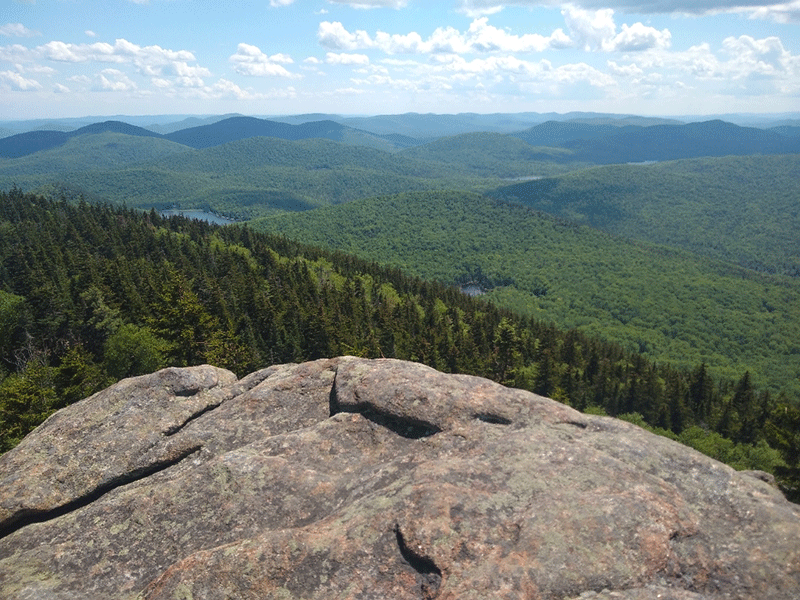
Th hike up Crane Mountain and Crane Mountain Pond is a wonderful trip. Crane Mountain is located between Warrensburg and Wevertown in Warren County. The trail is on the public Forest Preserve, part of the Wilcox Lake Wild Forest. The two hiking trails to Crane Mountain lead to a high elevation pond, a popular swimming hole during warm weather, and the rocky, gnarly summit of Crane Mountain, which has stunning views of Garnet Lake, Bullhead Mountain and many knobs and rolling hills of the southern Adirondacks.
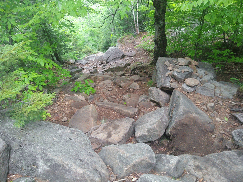
Overall, Crane Mountain is a difficult hike, especially the lower half of the trails, no matter which of the trails is followed. Crane Mountain is a challenging, but rewarding hike, which can easily be made into a a longer camping trip at the campsites on Crane Mountain Pond. If taken slowly, the trail can be done with smaller children, but be aware of very steep sections and difficult rock scrambles when considering this undertaking.
The hiking trail is accessed by following Garnet Lake Road from Route 8 in Johnsburg until it turns into a dirt road. When the road comes to a T, turn left, and very soon after take Putnam Cross Road through to a left turn onto Ski Hi Road. The trailhead is the second right, towards the end of Ski Hi Road.
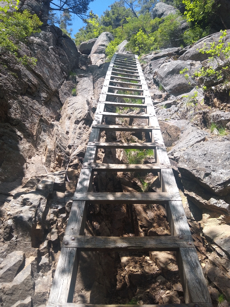
The trailhead offers two options to the summit of Crane Mountain. One way offers a direct 1.4-mile hike to the summit, which is consistently steep. The shorter route does include climbing a thick wooden ladder at one point that is more than 30 feet high. This ladder would be tough for anybody with a dog. The other option is a 3-mile trail to the summit that passes around Crane Mountain Pond, where the last 0.5 miles is a steep ascent to the summit.
The trail starts at the back of the parking lot. Make sure to sign in at the trail register. Hikers will need to make a tough choice on their route. Some hike this trail as a 4.1-mile loop. Others will choose to hike Crane Mountain as an up-and-back route of either 2.8 miles or 5.4-miles.
1.4-Mile Direct Hike to Crane Mountain
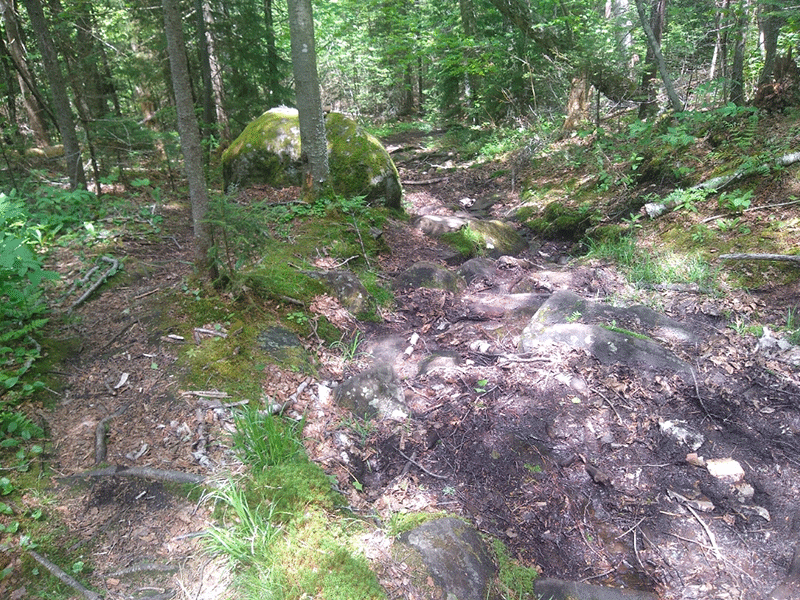
The shorter 1.4-mile route to the summit starts at the trailhead register and takes hikers up a steep and rocky trail, past large numbers of glacial erratic boulders. The trail is well-marked and easy to follow. The initial stretch passes through a deciduous forest of maple, beech, and birch. This section of trail is very steep and rocky.
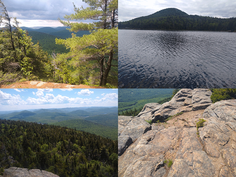
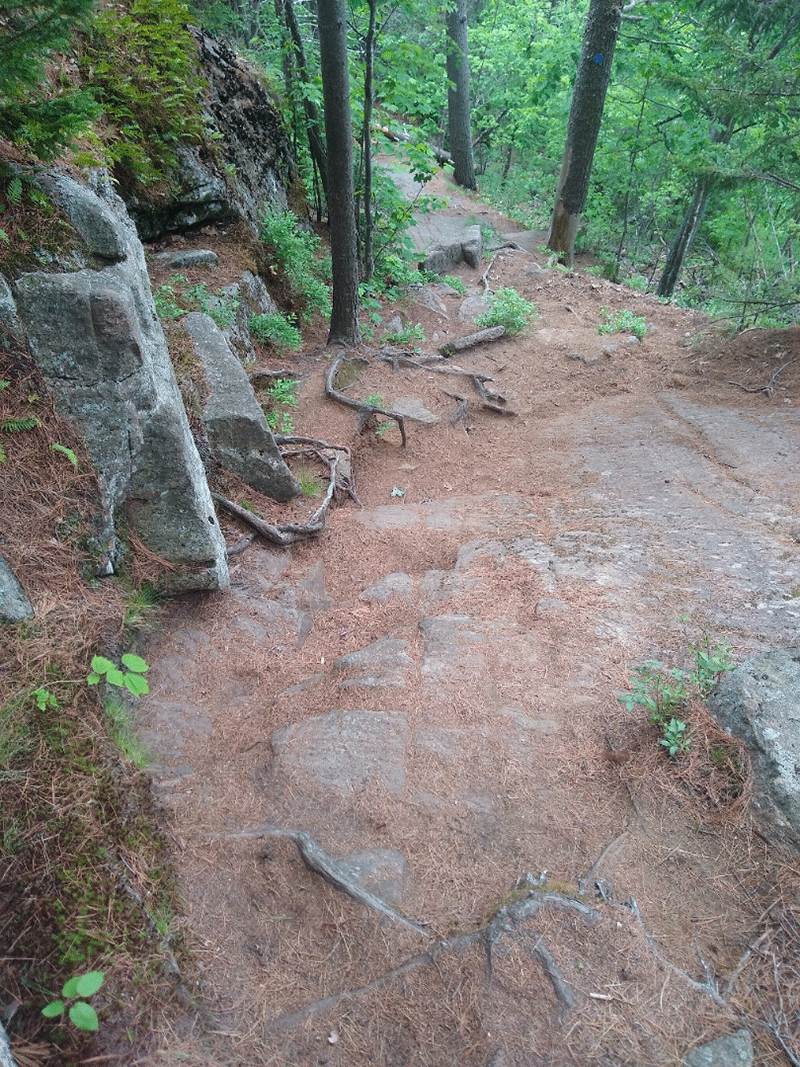
After about a third of a mile over a steep climb, there is a view to the right of a large cliff rock face that the trail will wrap around. After that, there are a couple of scenic rocky outcroppings that make for splendid resting points for tired hikers, and feature views of Mount Blue, just beyond Garnet Lake, and other smaller mountains nearby.
After two-thirds of a mile, the trail reaches a junction, where the trail turns right to reach the summit. From this point, the trail is 0.7 miles to the summit. This section is very challenging due to steep sections and tall ladders. Shortly after the trail junction, the forest changes to a coniferous, boreal forest, thick with hemlock and spruce. Hikers will have to climb two ladders in this stretch, one about ten feet tall, the second is quite a bit taller, measuring 30 – 40 feet high. This second ladder is not for the faint of heart.
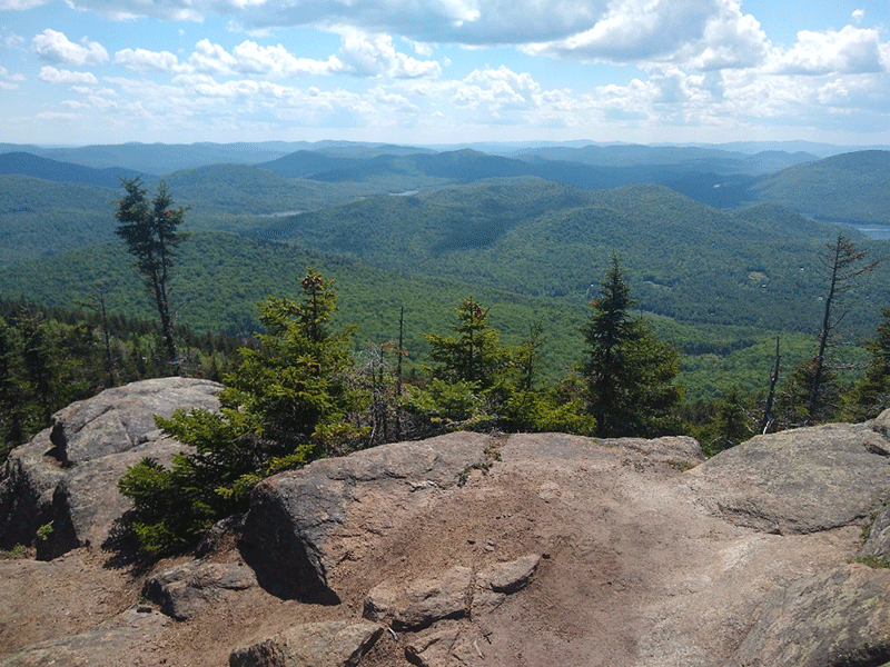
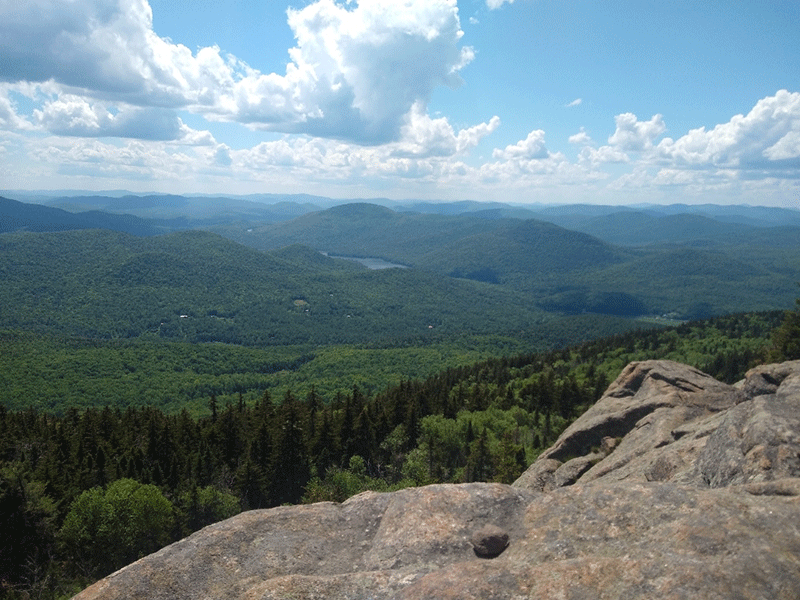
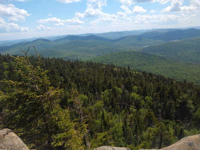
After climbing the second ladder, the trail follows along a ridge to the summit. The trail meanders for a quarter mile over the summit where there are a number of open rock areas along cliffs and outcrops that provide sweet spots from which to enjoy the mountaintop. The views stretch far to the southeast and southwest, with an especially grand view of Garnet Lake directly south, Baldhead Mountain farther off to the east, and the mountains and ridges of the Wilcox Lake Wild Forest.
Hikers can either return the same way they hiked in, which means climbing down the tall ladders, or continue towards Crane Mountain Pond to complete the 4.1-mile loop.
2.7-Mile Hike to Crane Mountain Via Crane Mountain Pond
After reaching the trail junction about two-thirds of a mile from the parking area and trailhead register, turn left towards Crane Mountain Pond. The pond is 0.4 miles from the trail junction. The trail descends downhill, and has quite a few muddy and eroded sections, but is easy enough to navigate and has far fewer tough challenging spots than the main trail to the summit.
The trail continues along the base of the mountain and emerges at Crane Mountain Pond where trail reaches a T. A left turn wraps around the south shore of the pond where there are a number of campsites and different swimming spots. The trail to the right leads to the summit.
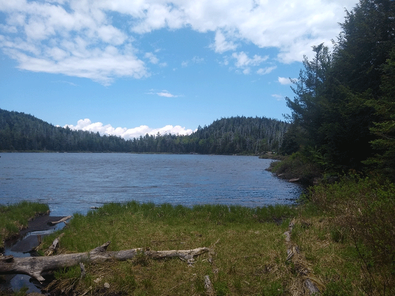
Turn right and the trail wraps around the pond for a stretch where the open waters are plainly visible. Soon the forests change from open northern upland forests to thick spruce and balsams. The trail grows steeper and rockier. The trail then continues over and around several rocky outcroppings, which look out over a wetland area and the old Putnam farm in the valley below. After this there are a number of steep sections, which are heavily eroded and wet, to reach the summit.
Once on the summit, the trail runs for a quarter mile where there are a number of open rock areas.
Hikers can either return the same way they hiked in, back down and around Crane Mountain Pond, or continue to complete the 4.1-mile loop, which means climbing down the tall ladders to the trail junction and parking area.
Click here to download a map and trail directions for Crane Mountain.
When You Hike Make Sure to Practice “Leave No Trace” to be Prepared and to Protect the Forest Preserve
Please follow “carry in, carry out” rules for all trash and follow other Leave No Trace principles when hiking in the public Forest Preserve and other wild areas. The seven Leave No Trace principles are: 1) Plan ahead and prepare; 2) Stay on hiking trails and camp at designated areas; 3) Dispose of human waste and trash properly; 4) Leave what you find; 5) Minimize campfires; 6) Respect wildlife; 7) Respect other hikers.
Educated hikers do not damage the environment. Prepared hikers do not need search and rescue unless injured.
Winter Use: Crane Mountain is used for snowshoeing and cross-country skiing in the winter.
Click here to become a member of Protect the Adirondacks.


