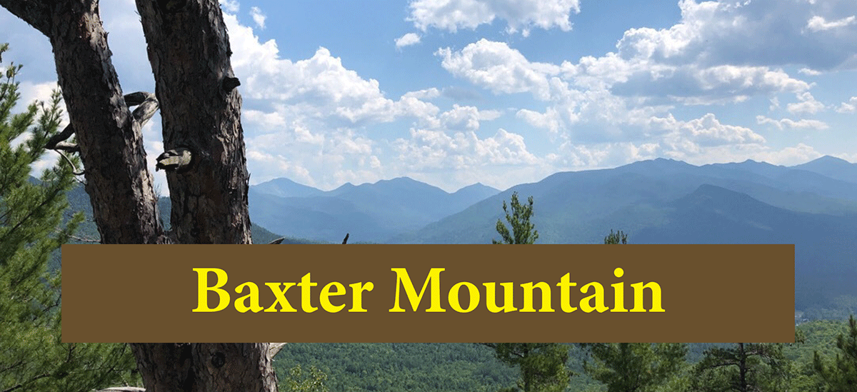
The hike up Baxter Mountain is short and easy and leads to a beautiful summit with a series of lookouts with sweeping views of the High Peaks
Baxter Mountain
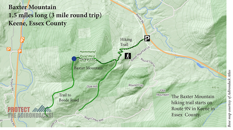
1.5 miles (3 miles round-trip)
Hammond Pond Wild Forest
Keene, Essex County
Hiking, Snowshoeing
Level of Difficulty: Moderate
Hike Baxter Mountain
Baxter Mountain is a 1.5 hike located within the Hammond Pond Wild Forest Area near the Town of Keene. The mountain is a popular destination in the area, especially among families due to its short and gradual climb. The roadside parking area is located off of Route 9N, on the east side above the intersection with Route 73, not far from Hurricane Road. Despite its short climb, Baxter Mountain’s summit provides numerous views of the High Peaks area, especially of the Great Range.
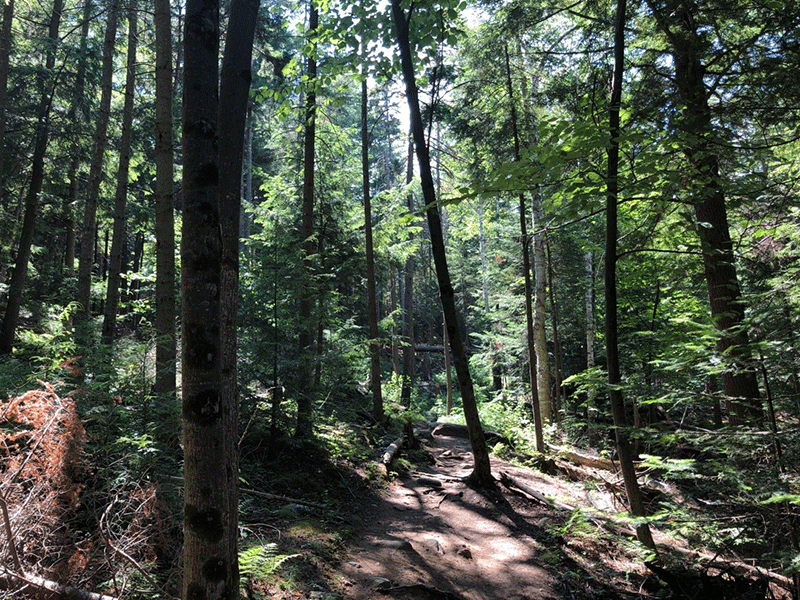
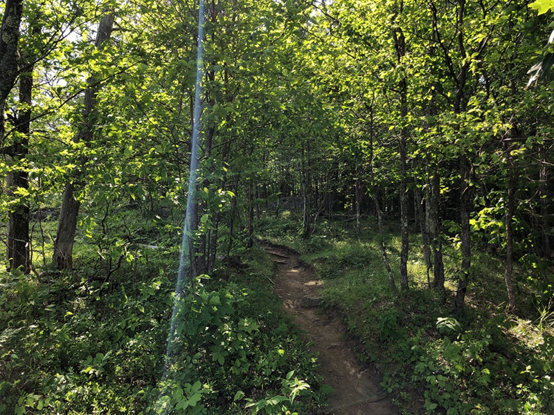
The hike follows blue trail markers from the trailhead and begins to climb steadily. After a few hundred yards, the trail cuts through a sunny clearing, traversing between telephone poles. The route is in good condition early on and is clear underfoot, apart from a few exposed tree roots.
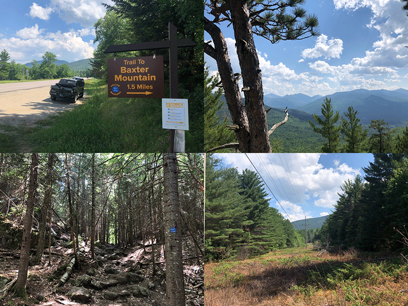
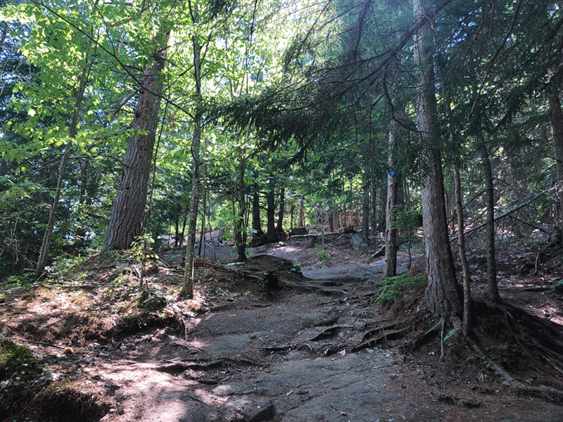
About 0.75 miles, the route begins to wind sharply up the west side of Baxter Mountain over a stretch of switchbacks. The ascent is constant from the start but never too steep because of the winding pattern. The trail continues to rise through a forest of young conifers, crossing over some wooden boards in a rocky patch.
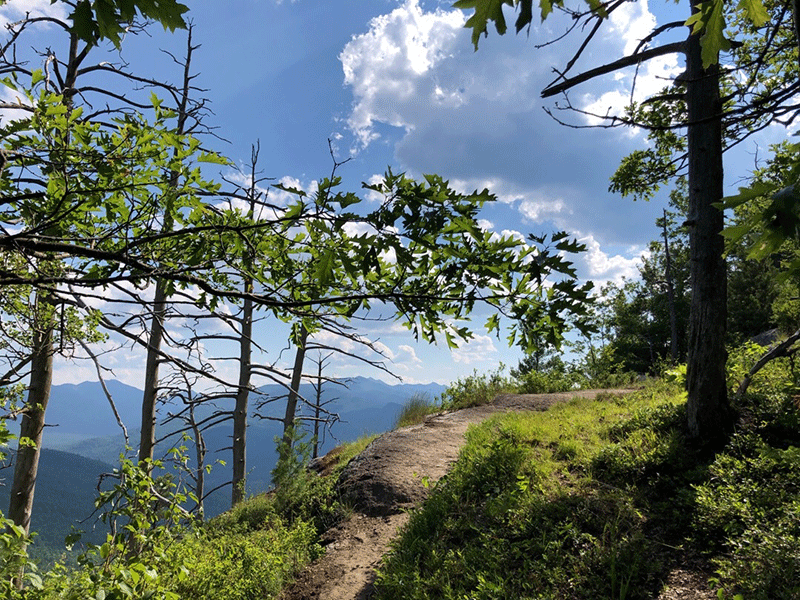
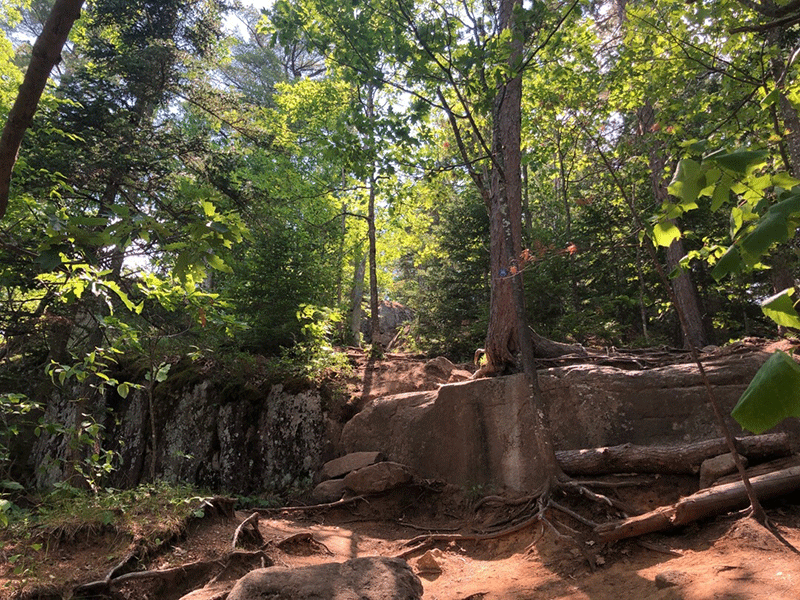
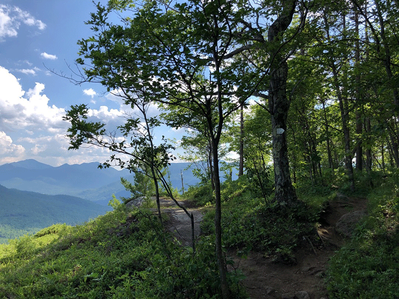
Soon the trail reaches a small junction where the trail from Beede Road comes in from the east. The trails converge, follow blue trail markers. From this point, the trail becomes rockier and steeper as it crosses over a few stretches of exposed bedrock that may be tricky, especially on the descent. After about 1 mile, views begin to open up to the east. Over the last quarter mile, the trail meanders through a series of rocky overlooks before reaching the true summit.
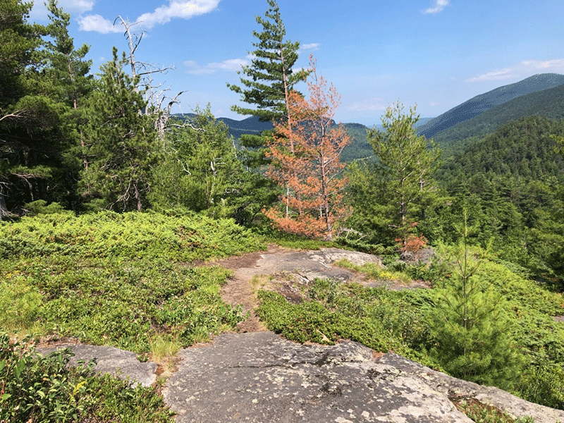
The Summit of Baxter Mountain
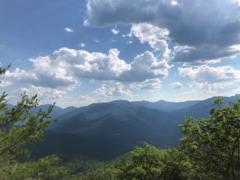
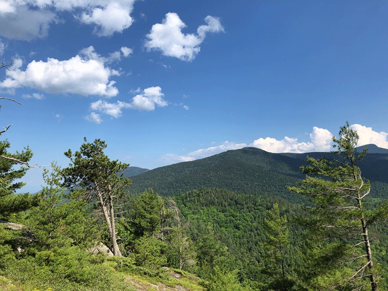
The first of several overlooks is the largest, has the most open space to rest, and provides the best views of the valleys below. Giant Mountain rises up in the foreground to the southeast, and views of other High Peaks stretch out over the horizon above the treetops. From this overlook, the trail runs through a forested section, before reaching a series of sunny, beautiful stretches of blueberry bushes and lichen-covered oak trees. The final summit has the most magnificent views of the hike of the distant mountains, including Mount Marcy and the Great Range, but is not as spacious as previous overlooks.
Return on the same route used to hike in.
Click here for a map and directions to Baxter Mountain.
When You Hike Make Sure to Practice “Leave No Trace” to be Prepared and to Protect the Forest Preserve
Please follow “carry in, carry out” rules for all trash and follow other Leave No Trace principles when hiking in the public Forest Preserve and other wild areas. The seven Leave No Trace principles are: 1) Plan ahead and prepare; 2) Stay on hiking trails and camp at designated areas; 3) Dispose of human waste and trash properly; 4) Leave what you find; 5) Minimize campfires; 6) Respect wildlife; 7) Respect other hikers.
Educated hikers do not damage the environment.
Prepared hikers do not need search and rescue unless injured.
Winter Use: Baxter Mountain is popular for snowshoeing in the winter.


