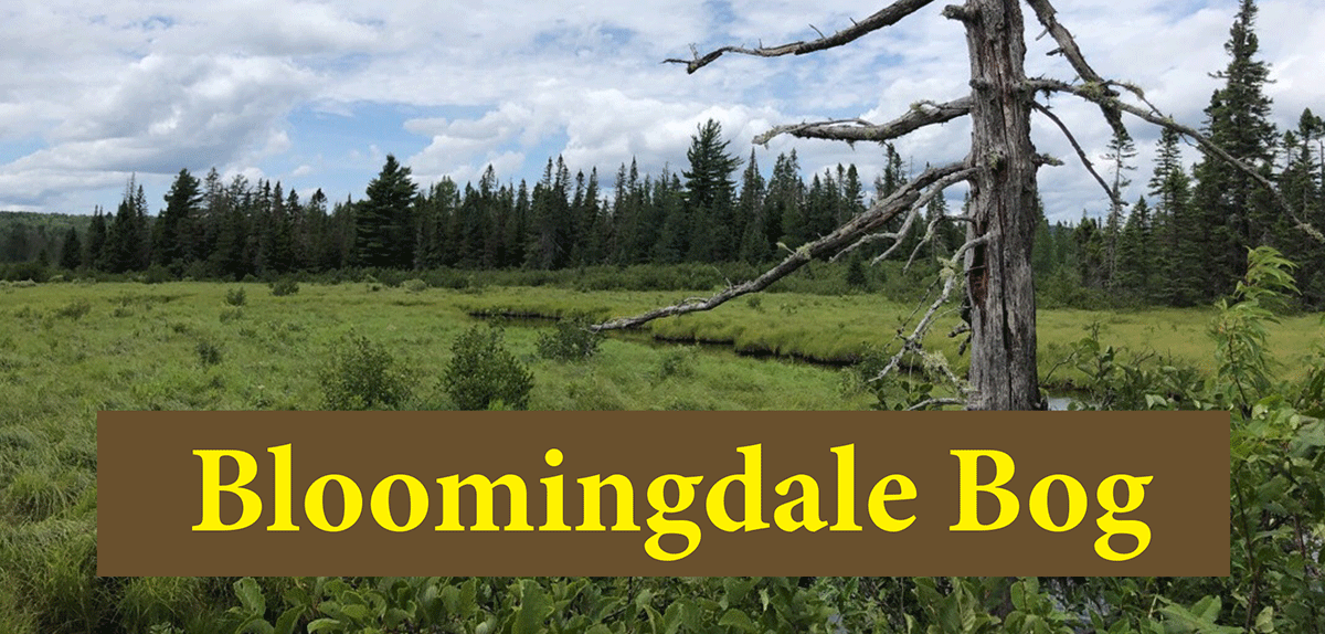
Bloomingdale Bog is an easy and flat trail that runs atop of an abandoned railroad bed through a vast wetland and bog complex with terrific and intricate views.
Bloomingdale Bog
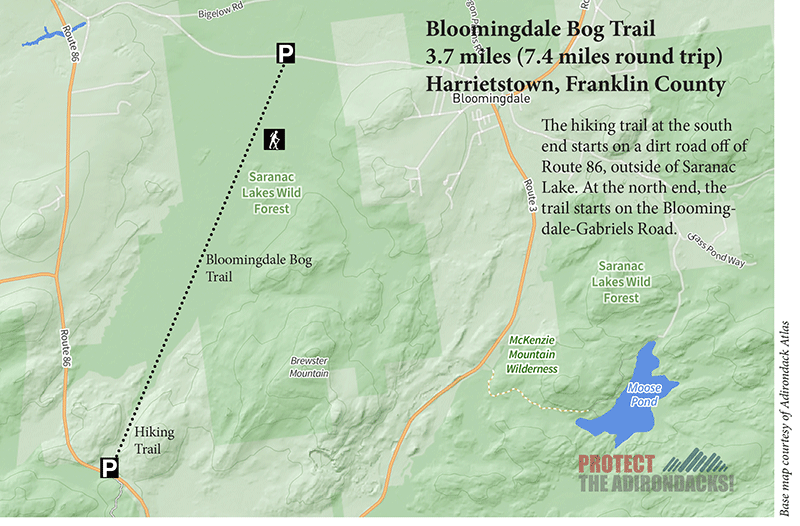
3.7 miles (7.4 miles round-trip)
Harrietstown, Franklin County
Saranac Lake Wild Forest
Hiking, Snowshoeing, Cross-country skiing
Level of Difficulty: Easy
Hike Bloomingdale Bog
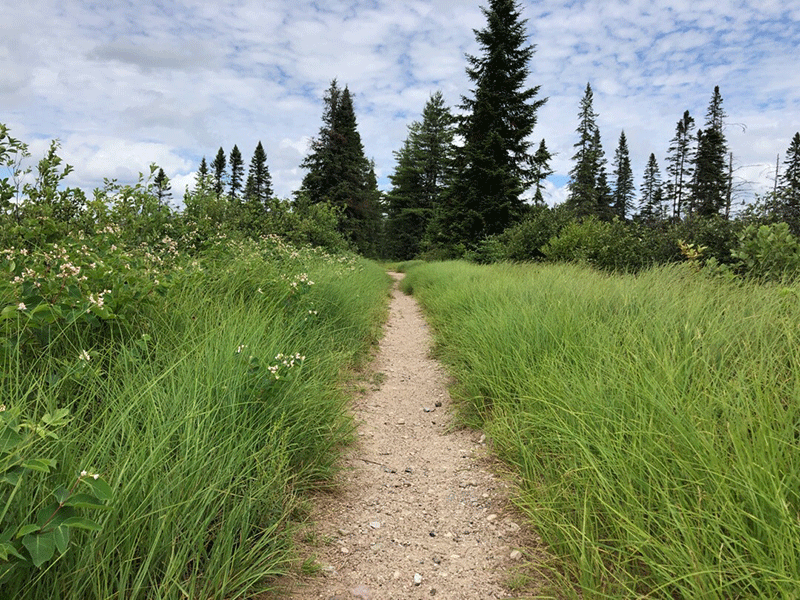
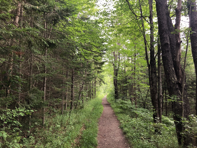
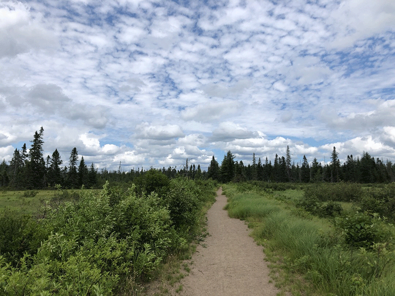
The Bloomingdale Bog Trail runs 3.7 miles atop of the abandoned railway of the Delaware and Hudson Railroad that once connected Saranac Lake to Bloomingdale. The old railroad line is flat and straight, accessible to people of all abilities, and cuts through an extraordinary bog with many beautiful views. The Bloomingdale Bog hike is easy. This trail is also open for bike riding.
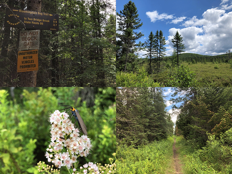
The Bloomingdale Bog Trail can be accessed at either end. The trailhead at the south end is located on Route 86, about 2.5 miles west of Saranac Lake. The north end is accessed on Bloomingdale-Gabriels Road about 1.5 miles from the 4 Corners in Bloomingdale. The trail is on public Forest Preserve in the Saranac Lake Wild Forest area.
The Bloomingdale Bog Trail
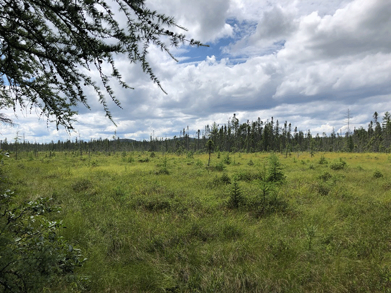
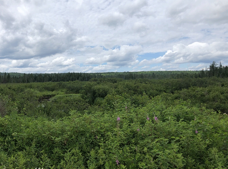
The Bloomingdale Bog Trail leads into the heart of one of the largest bogs in northern New York. It provides the opportunity to appreciate a wide variety of wetlands, boreal forests, and open bog mats. The railroad bed offers an elevated vantage point of the surrounding bog and distant mountains visible for most of the hike.
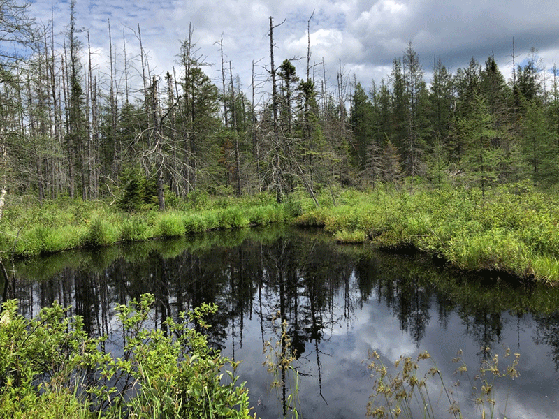
The trail begins along a lively yet serene marsh. Red elderberries, fireweed, raspberries, and other wild plants line the side of the well-maintained pathway. The trail soon leads into a mixed forest, where it runs beside a small creek for about a third of a mile before opening up again. At this point, the stream widens into a dark wetland waterway that the trail runs alongside for most of the rest of the way. Along this stretch, beaver dams and flooded trees tell the story of the adjacent forest’s ongoing transformation.
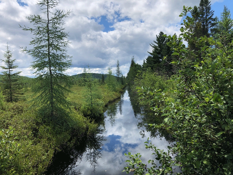
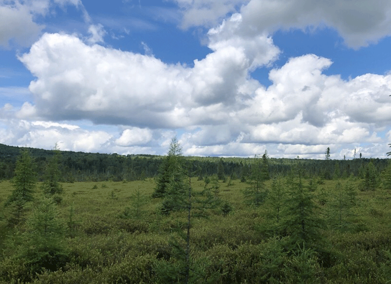
After the first mile, the view to the northeast becomes even clearer as the vast bog comes into view across the water. The southwest side soon opens up behind the tamaracks and spruce trees that line the trail. This stretch of the path is one of a kind, with views stretching across the flat bog of Whiteface Mountain and the McKenzie Range, which stand in the distance.
Broad Views of Bog Meadows and Intricate Views of Dozens of Plants and Wildflowers
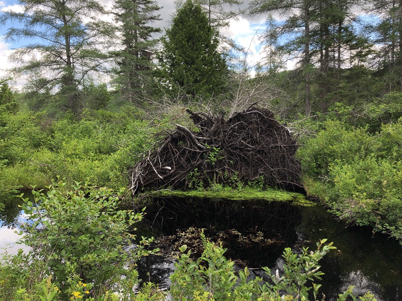
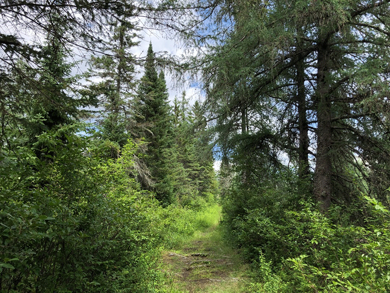
The middle portion of the trail sees less use, and trail is mildly overgrown in places. A huge upturned root system on the right creates a small cove for aquatic plants in the water just past the halfway mark. The trail continues to follow the railroad straight as the forest closes in on the trail.
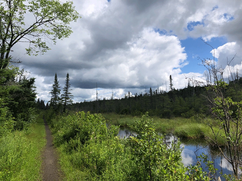
2.8 miles in (from the south end), the trail emerges into a beautiful and vast wetland, the largest open area along the route. A bridge allows hikers to pass over Two Bridge Brook, one of the many sunny waterways that cross the trail. The trail then re-enters the forest for the final stretch. Over the last mile before reaching Bloomingdale-Gabriels Road, the best view of the bog is to the southwest. A number of short side trails and a wide junction with a snowmobile trail provide scenic overlooks of the vast wetlands.
This trail can be hiked as an out-and-back or as a thru-hike with a car dropped at one end.
Click here to download a map and trail directions for Bloomingdale Bog.
When You Hike Make Sure to Practice “Leave No Trace” to be Prepared and to Protect the Forest Preserve
Please follow “carry in, carry out” rules for all trash and follow other Leave No Trace principles when hiking in the public Forest Preserve and other wild areas. The seven Leave No Trace principles are: 1) Plan ahead and prepare; 2) Stay on hiking trails and camp at designated areas; 3) Dispose of human waste and trash properly; 4) Leave what you find; 5) Minimize campfires; 6) Respect wildlife; 7) Respect other hikers.
Educated hikers do not damage the environment.
Prepared hikers do not need search and rescue unless injured.
Winter Use: Bloomingdale Bog is a popular mountain for cross-country skiing in the winter.