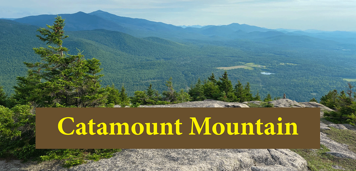
Catamount Mountain is a very steep and challenging 1.9-mile hike to a large, wide open summit with 360-degree views.
Catamount Mountain
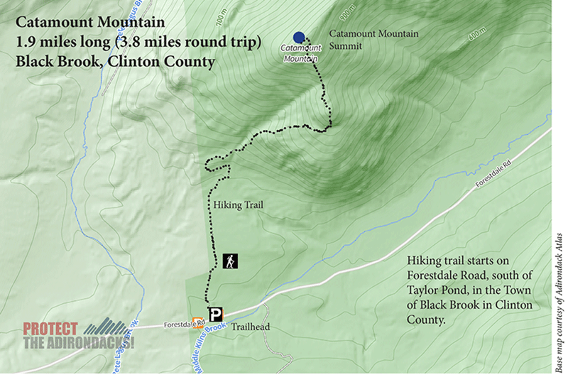
1.9 miles (3.8 round-trip)
Black Brook, Clinton County
Taylor Pond Wild Forest
Hiking, Snowshoeing
Level of Difficulty: Challenging
The Hike Up Catamount Mountain
Catamount Mountain is a 1.9-mile hike, south of Taylor Pond in the Town of Black Brook in Clinton County. The trail is on public Forest Preserve in the Taylor Pond Wild Forest area. With steep scrambles and beautiful views from numerous scenic overlooks, Catamount Mountain is an Adirondack gem that stands tall and alone in the Taylor Pond Wild Forest. This is a challenging and steep hike with great payoffs from many scenic vistas.
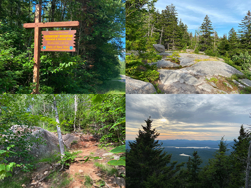
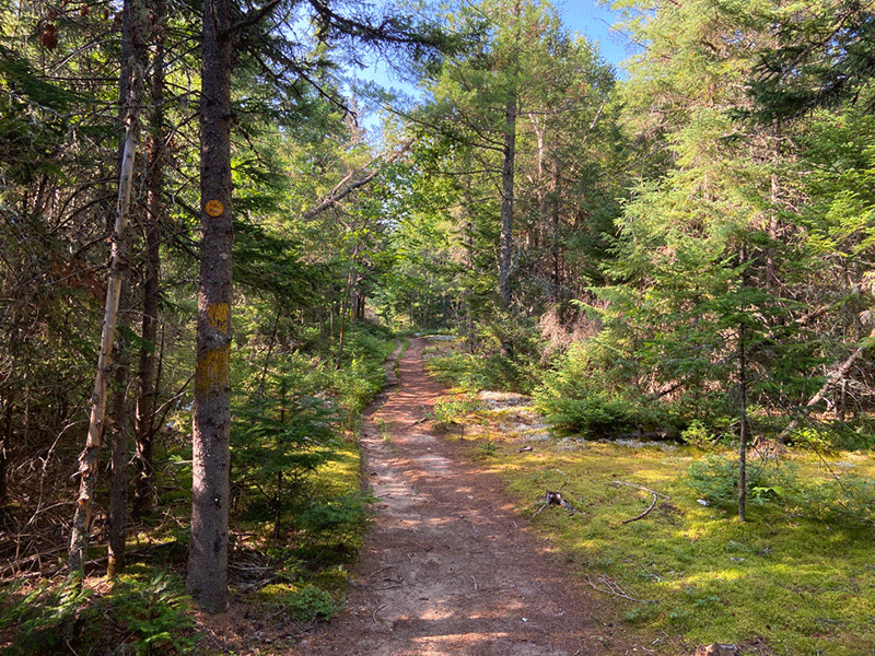
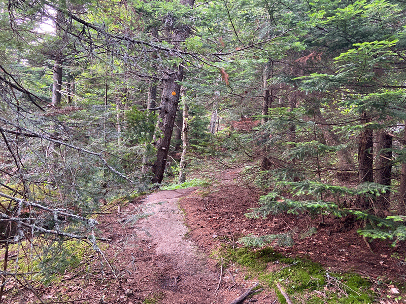
The parking area is located on Forestdale Road. On busy days, vehicles will be parked on the roadside. From the parking area, the trail passes a yellow gate and follows a relatively flat dirt road for 0.6 miles. Spruce, balsam, and hemlocks dominate the surrounding forest.
The Catamount Mountain Hiking Trail
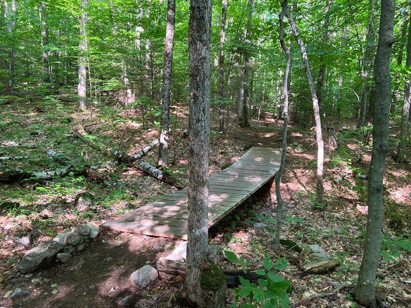
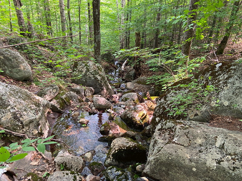
The trail then crosses a small bridge followed by a series of stream crossings. The trail narrows onto a snake-like path and the forest transitions to a northern hardwood forest, with many birch, beech, and maples.
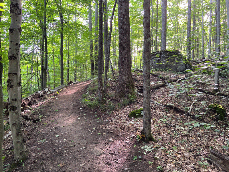
This is roughly the half-way point of the trail and it’s at this point that the ascent begins. The trail is well-worn, highly eroded in places, and is littered with small rocks, large boulders, and clusters of tree roots. At just over 1 mile, the trail emerges onto a bedrock ridgeline that leads to the trail’s first scenic overlook.
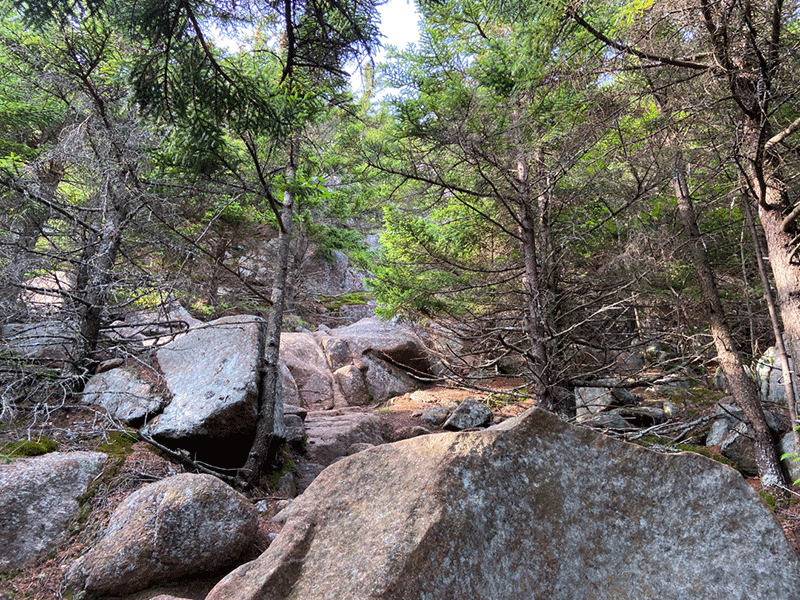
After the overlook, the trail passes back into the forest and immediately runs through a series of steep sections, some of which are difficult. Sharp rocky inclines lead to increasingly steep ascents, many of which entail full-body scrambles over boulders and rock faces. In particular, two of them require that hikers wedge themselves between rocks and then propel themselves upwards. Neither are easy tasks.
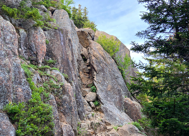
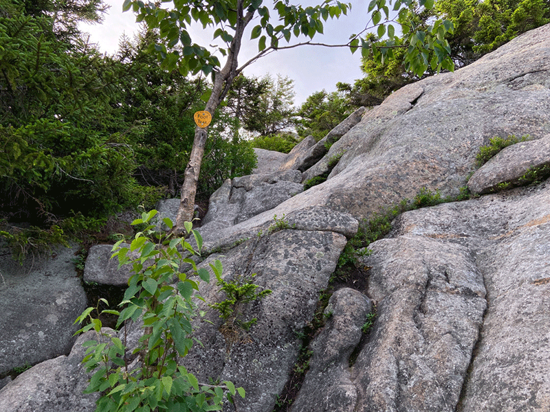
The trail is poorly marked at this point, so hikers should be careful. The trail runs through deep forested sections and other areas of open bedrock. The main summit of Catamount Mountain can be seen in the distance. At one point the trail traverses an open cliff, where the trail is wedged into a narrow crevice. The surrounding forest at this point starts to change to heavy spruce.
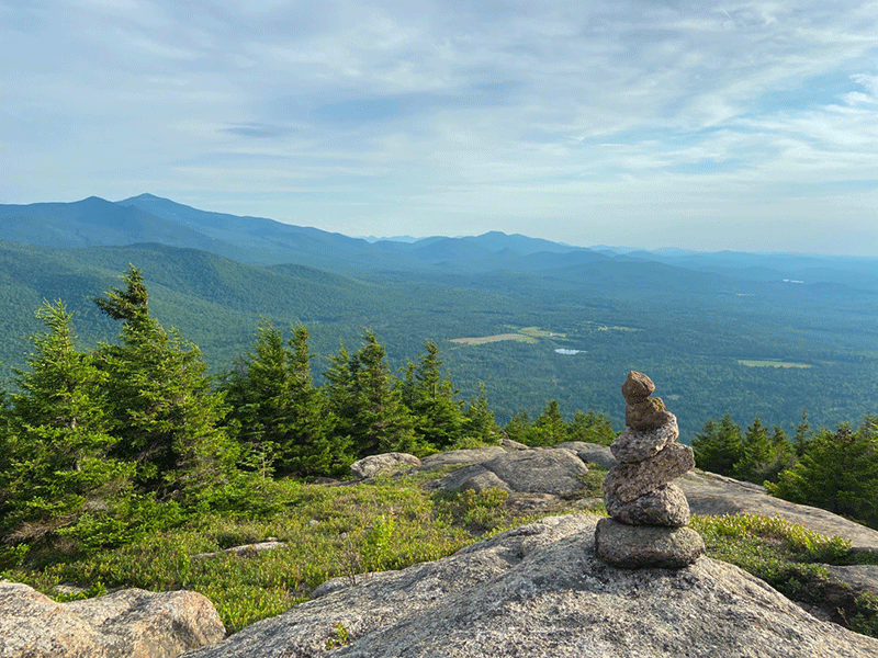
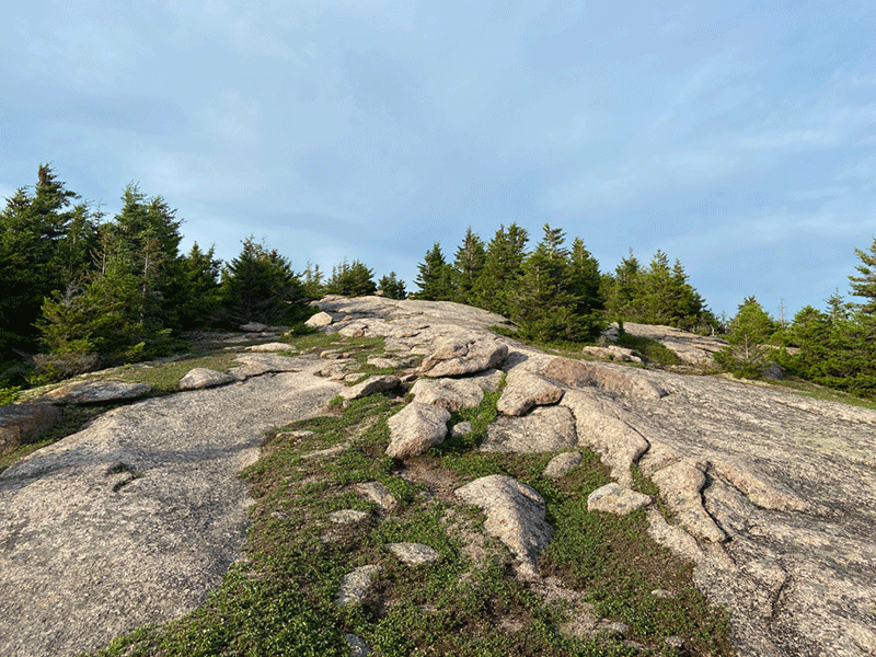
The Catamount Mountain Summit
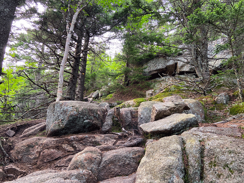
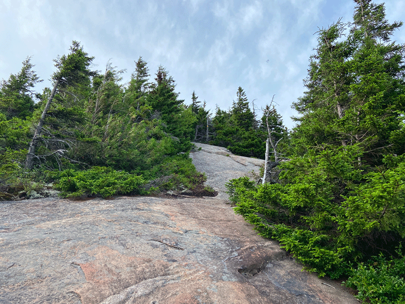
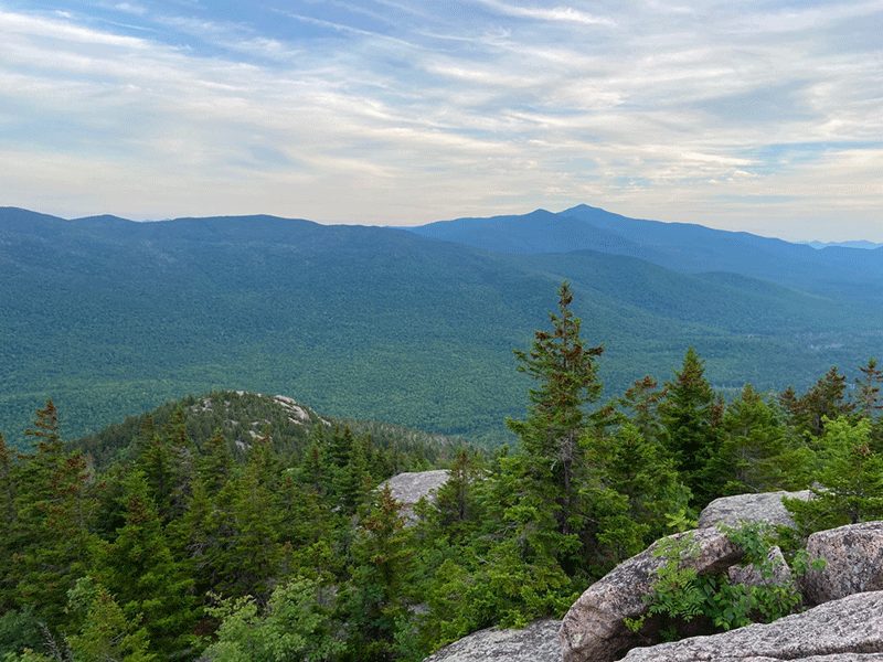
The trail then emerges onto open bedrock areas, which ascend steeply and unrelentingly. There are several sections where the trail scales boulders and large open rock faces. The trail, which is often on rock, is marked with rock cairns, orange flagging, and intermittent yellow trail markers nailed to trees en route to the summit. There are many places to enjoy the view along this stretch.
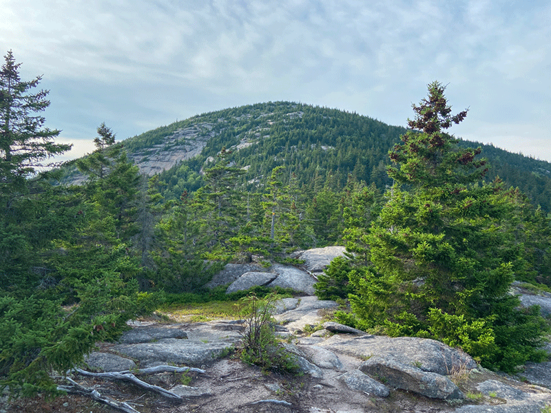
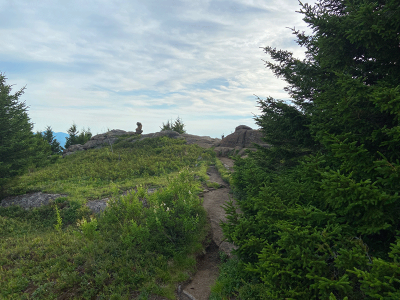
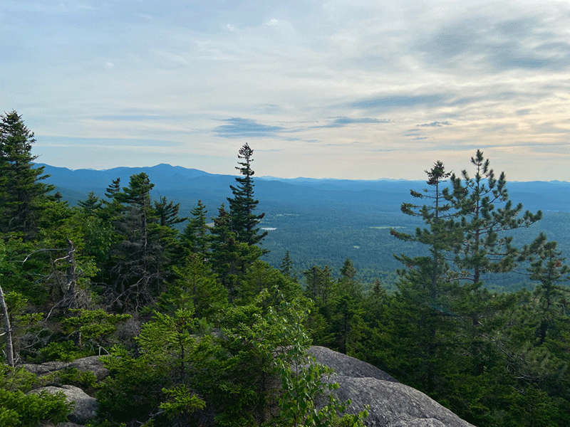
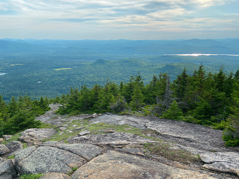
The summit is spectacular. The summit is immense and wide open with many rocky areas to sit and enjoy the view. From the top of Catamount Mountain, a nearly 360-degree view offers glimpses of Union Falls Reservoir to the west, Whiteface Mountain to the south, and Vermont to the east. Taylor Pond is visible below.
From here, the trail descends using the same path taken to the top.
Click here to download a map and trail directions for Catamount Mountain.
When You Hike Make Sure to Practice “Leave No Trace” to be Prepared and to Protect the Forest Preserve
Please follow “carry in, carry out” rules for all trash and follow other Leave No Trace principles when hiking in the public Forest Preserve and other wild areas. The seven Leave No Trace principles are: 1) Plan ahead and prepare; 2) Stay on hiking trails and camp at designated areas; 3) Dispose of human waste and trash properly; 4) Leave what you find; 5) Minimize campfires; 6) Respect wildlife; 7) Respect other hikers.
Educated hikers do not damage the environment.
Prepared hikers do not need search and rescue unless injured.
Winter Use: Catamount Mountain is a popular mountain for snowshoeing in the winter.


