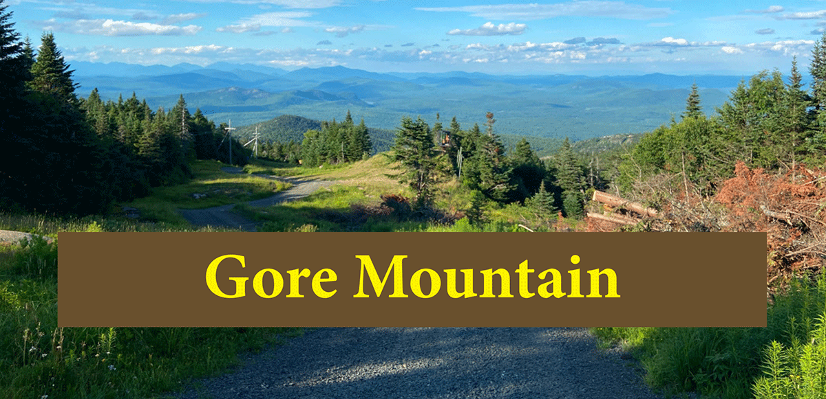
The Schaefer Trail to the summit of Gore Mountain is a long hike through beautiful forests and a downhill ski area to a mountaintop with grand views
Gore Mountain (The Schaefer Trail)
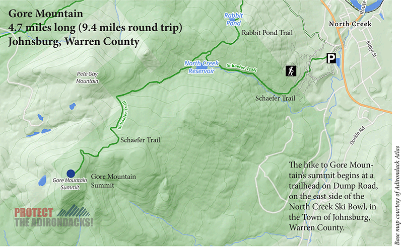
4.7 miles (9.4 miles round trip)
Town of Johnsburg Park Lands/Vanderwhacker Mountain Wild Forest/Gore Mountain Intensive Use Area
Johnsburg, Warren County
Hiking, snowshoeing, cross-country skiing
Level of Difficulty: Moderate
The Schaefer Trail up Gore Mountain
The Schaefer Trail on Gore Mountain is a wonderful 4.7-mile hike that starts at the town park outside of the hamlet of North Creek in the Town of Johnsburg in Warren County. The trail begins on town land in the North Creek Ski Bowl but mostly traverses Forest Preserve lands in the Vanderwhacker Mountain Wild Forest Area and Gore Mountain Intensive Use Area. This hike may seem challenging because of its length, but this hike is accessible to all ages and hiking levels.
The hike to Gore Mountain’s summit begins at a trailhead on Dump Road, on the east side of the North Creek Ski Bowl. The trail to the summit is known as “The Schaefer Trail.” The trail starts off easily just behind the fenced-in parking area and continues a short distance until reaching a blue trail sign that reads “Schaefer Trail.”
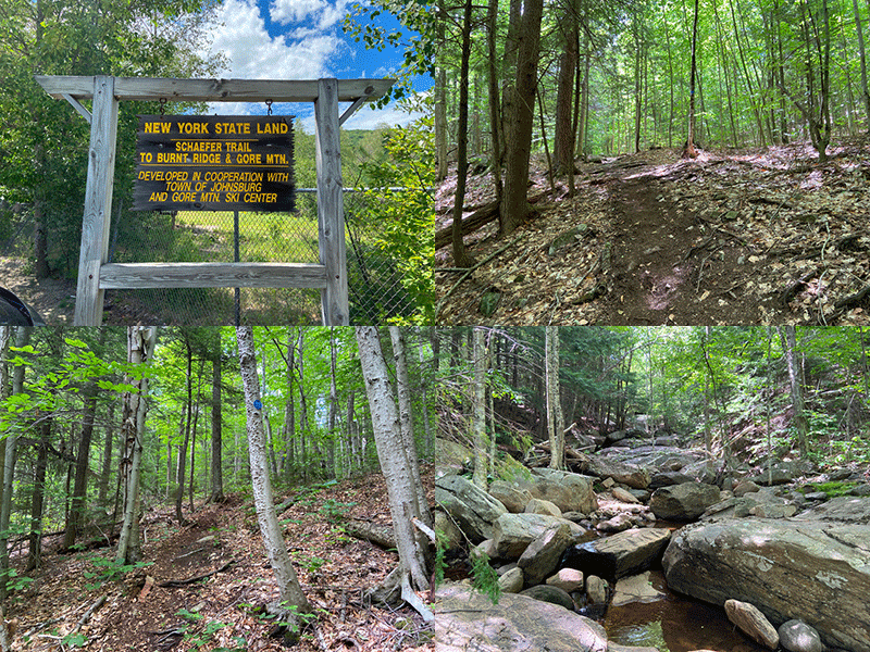
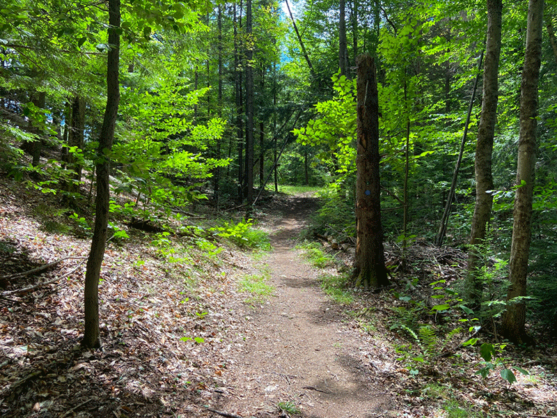
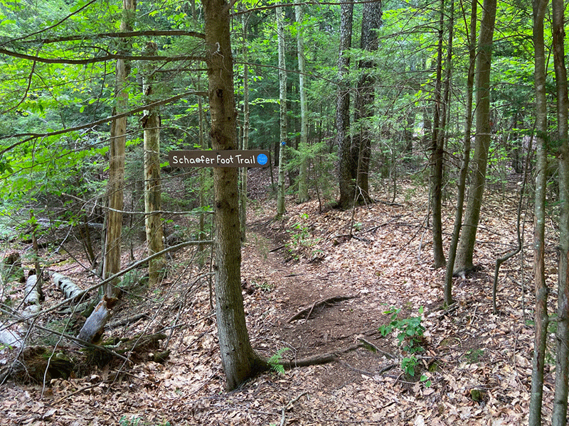
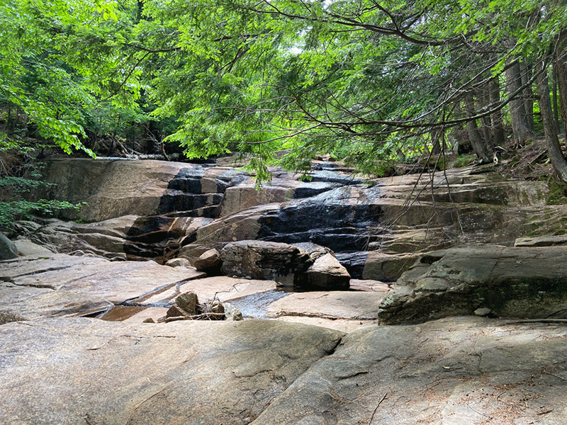
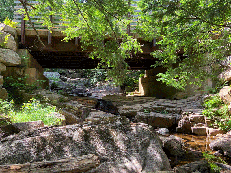
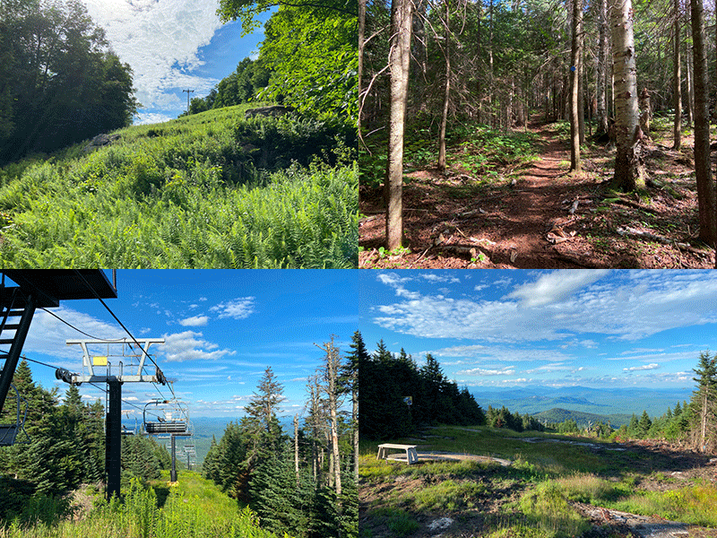
The Schaefer Trail is well worn, easy to follow, and marked with blue trail markers. The trail leads to the summit. It intersects with mountainbike trails, roads, and downhill ski trails. The first trail junction is 0.4 miles where the Schaefer Trail crosses a mountainbike trail marked with red trail markers. The trail continues and crosses Roaring Brook at 0.9 miles.
For the next mile, the trail follows Roaring Brook and passes open cliffs. At times, the trail veers away from the stream and onto vehicle access roads or bridges, but keep following the blue trail markers as the trail consistently finds its way back to the water and runs near or directly alongside the stream.
At the trail’s 2.0-mile mark, the trail once again temporarily leaves the brook and this time reaches an overlook of the Gore Mountain reservoir, which provides water for snowmaking. The path wraps around the reservoir and at the 2.1-mile mark, it reaches a trail sign that points ahead to the Gore Mountain summit. It’s 2.6 miles away.
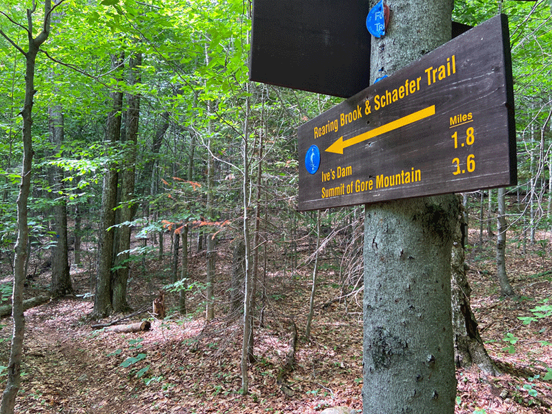
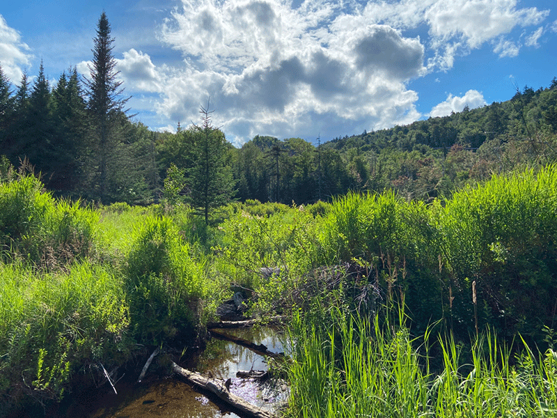
From this directional sign, the path follows a relatively smooth stretch of trail for another 1.0 mile before reaching a wetland, once known as the Ives Dam, with a view of the summit to the southwest. Streams, clearings, and beautiful ferns characterize this stretch.
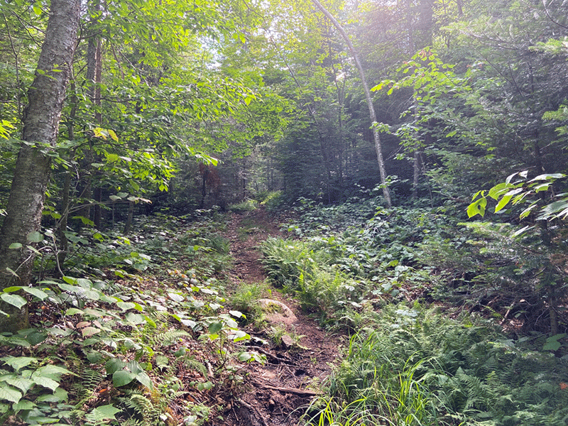
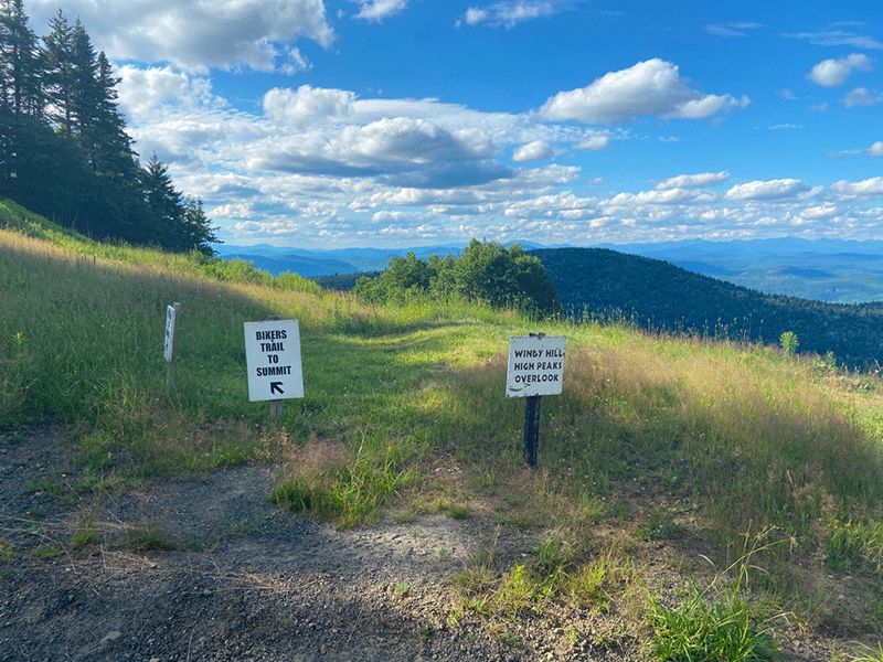
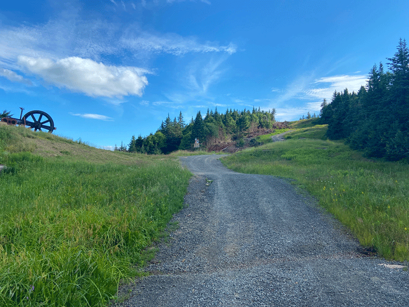
The trail leaves the open wetland meadow and enters a thick spruce and balsam forest. The trail is steep in this stretch and quickly gains elevation with the help of erratics and staircases of roots and rocks. At the 4.0-mile mark, the trail leaves the forest and follows a ski area road.
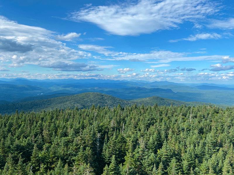
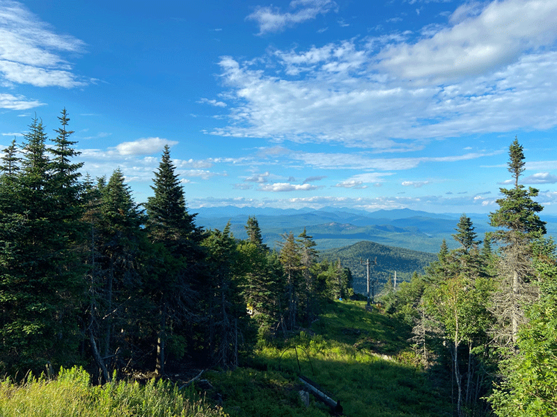
The Summit of Gore Mountain
Marked with signs that point to the summit and laid with gravel, these access roads push upwards and views open up with each step. The summit is an active Alpine ski area with chairlifts and buildings and roads, but it also provides sweeping views.
The hike down is the same as the hike up.
Click here for a map and directions to Gore Mountain.
When You Hike Make Sure to Practice “Leave No Trace” to be Prepared and to Protect the Forest Preserve
Please follow “carry in, carry out” rules for all trash and follow other Leave No Trace principles when hiking in the public Forest Preserve and other wild areas. The seven Leave No Trace principles are: 1) Plan ahead and prepare; 2) Stay on hiking trails and camp at designated areas; 3) Dispose of human waste and trash properly; 4) Leave what you find; 5) Minimize campfires; 6) Respect wildlife; 7) Respect other hikers.
Educated hikers do not damage the environment. Prepared hikers do not need search and rescue unless injured.
Winter Use: Gore Mountain is an active alpine ski area during the winter.
Click here to become a member of Protect the Adirondacks.


