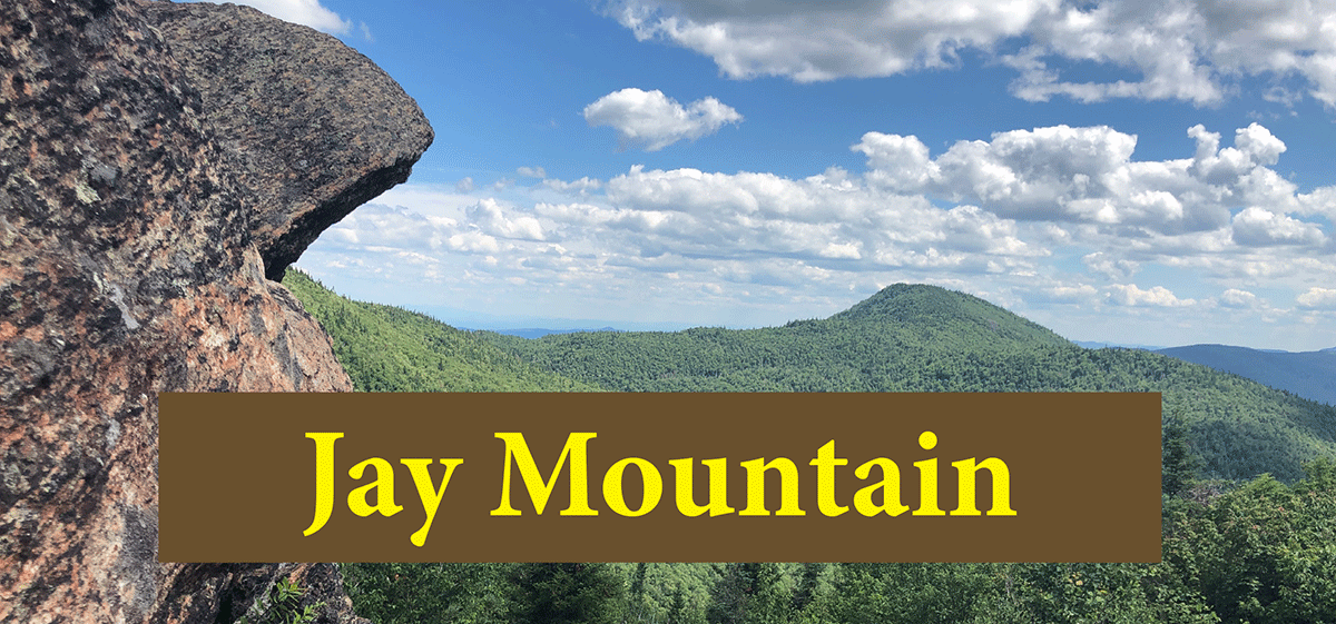
Jay Mountain is a 7-mile hike (round trip) through stunning forests to an open ridegline trail that provides dozens of great scenic vistas on the way to a rocky summit with sweeping views.
Jay Mountain
3.5 miles (7 miles round-trip)
Jay, Essex County
Northern Adirondacks
Hiking, Snowshoeing
Level of Difficulty: Challenging
The Hike Up Jay Mountain
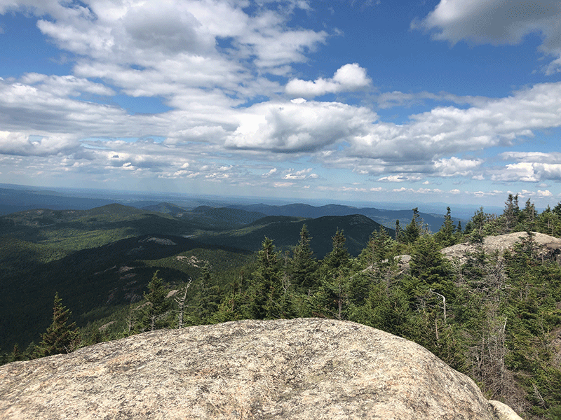
Jay Mountain is a 3.5-mile hike in the mountains between Keene and Jay in Essex County. The trail is on public Forest Preserve in the Jay Mountain Wilderness Area. At approximately seven miles round trip, Jay Mountain is a challenging hike that offers spectacular and continuous scenic vistas from numerous points along the trail that runs along the mountain ridge’s open and rocky spine as it approaches the summit. This trail provides stunning views of the surrounding mountains and Champlain Valley at multiple locations.
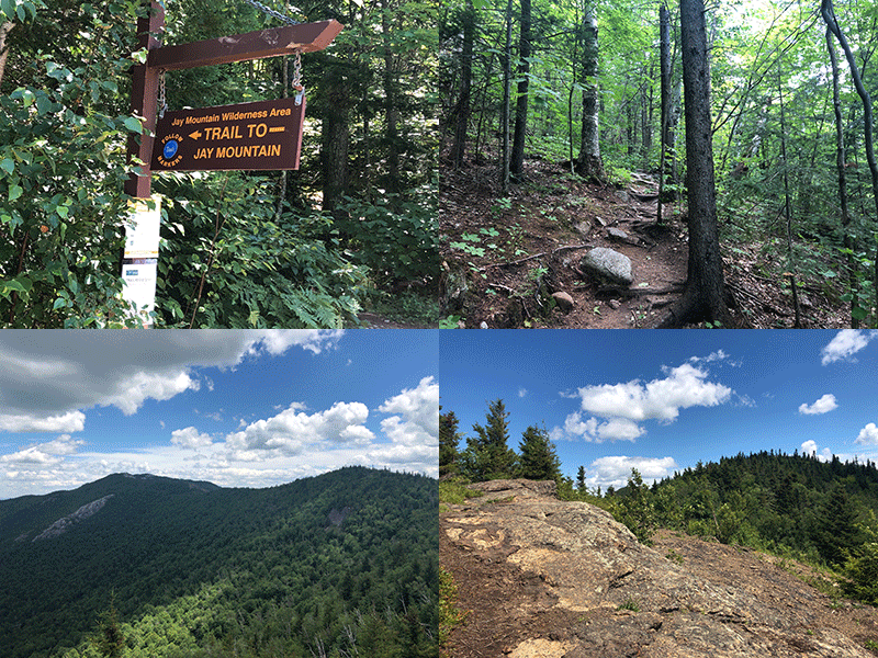

The trailhead and parking area are on the Jay Mountain Road from Styles Brook Road, accessed from Route 9, just north of Keene. The trail is well worn, well-marked, and sufficiently switch-backed to take the edge off of the couple-thousand-foot ascent.

The Jay Mountain Hiking Trail
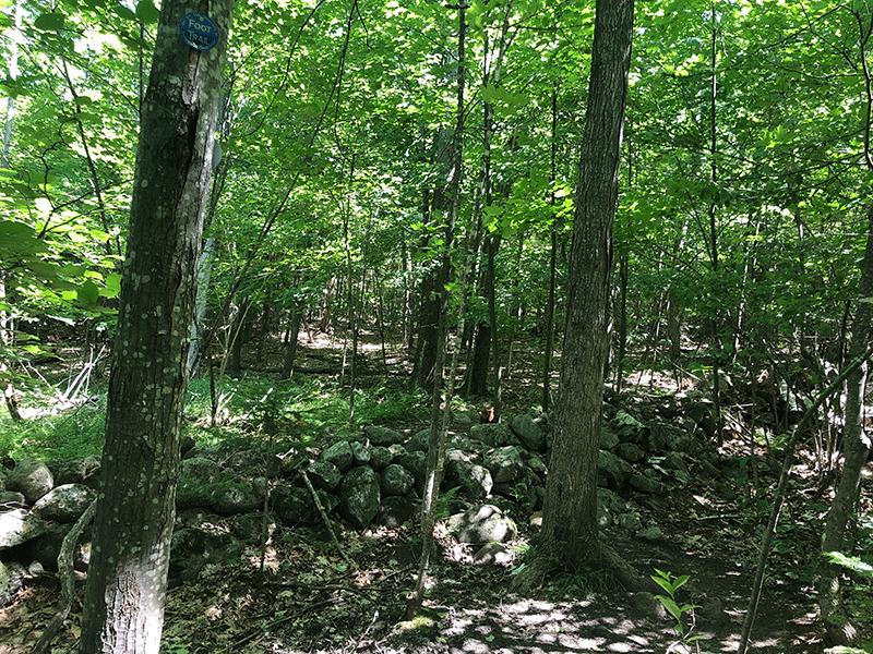
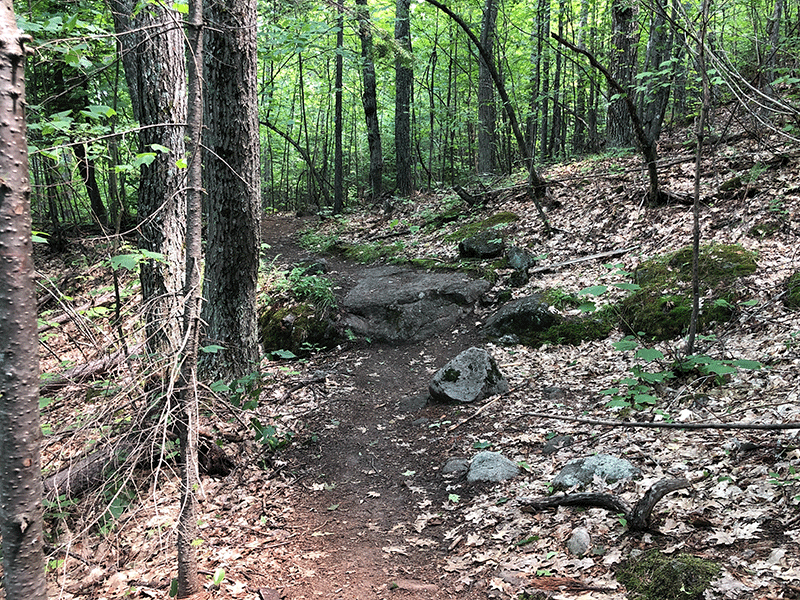
The trail starts with a climb up a low ridge, then levels off before beginning the ascent of the slope of Jay Mountain. Note the old stone wall that runs through the forest from a long-ago farm. Forests shroud the trail at this stage. Large oak trees are abundant. Throughout this hike, the surrounding forests are mixed with conifers never wholly absent from the hardwoods and vice versa. The white pines, hemlocks, and spruce take over somewhat as elevation increases, but never monopolize the forest like higher Adirondack mountain peaks.
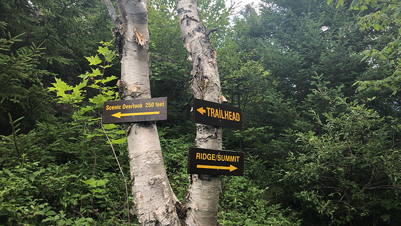
At about the halfway point, the trail’s completely forested leg ends at a junction with a side trail to a scenic lookout to the left and the main ridge of the mountain to the right. This scenic lookout is well worth a hundred yards or so that it adds to the journey, and offers a view of the remaining leg of the hike, Jay Mountain’s famous ridgeline, and views of the High Peaks to the southeast.
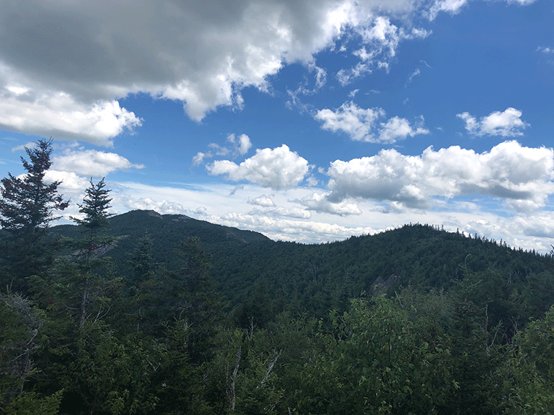
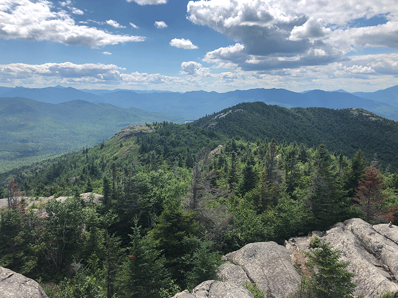
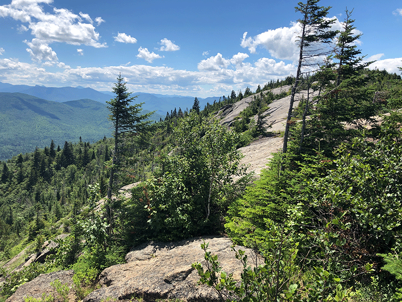
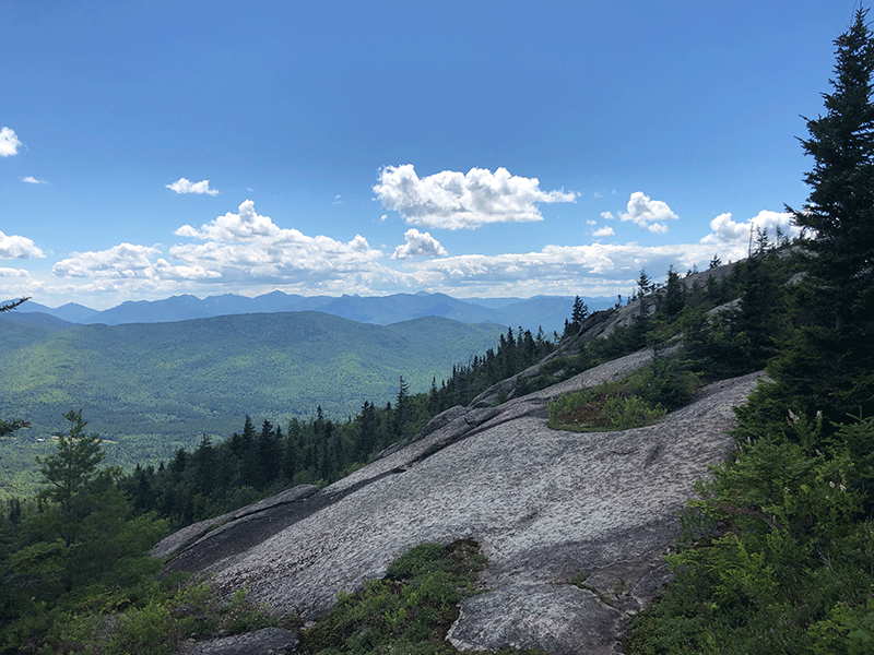
After the first scenic vista, the forest grows thick with a dense understory that will reappear in the various small valleys along the ridgeline that approaches the summit. Soon, the trail emerges from the forest and runs along the ridgetop, offering dozens of knobs and rock cliffs for viewing the surrounding landscape. The views are stunning.


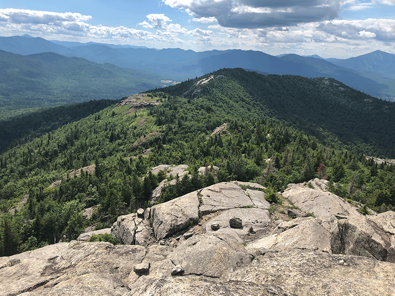
The ridgeline itself is rocky and open, though the variety of rock changes as the trail progresses. Be aware of cliffs and loose stone, especially on the second to last ridgeline section, just under the summit. The trail here is not marked except by cairns (rock piles) created to guide hikers.
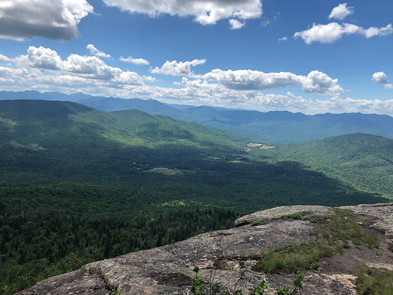
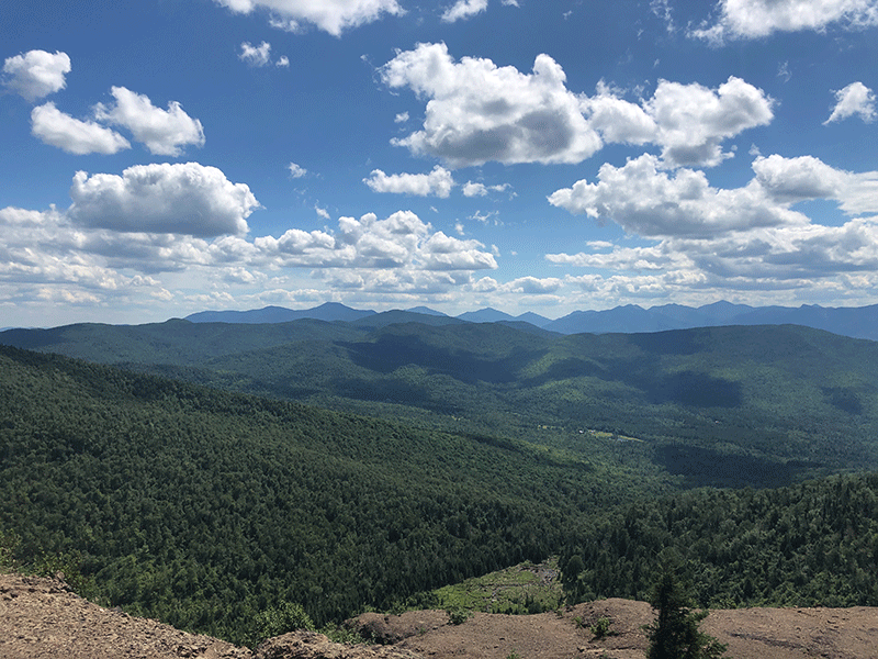
The Jay Mountain Summit
The summit is clearly visible from a number of points along the ridgeline, making arriving there easy despite the lack of trail markers. Among the many other peaks visible from Jay’s summit are Giant, Marcy and the Great Range in general, Hurricane Mountain and the Soda Range or Nundagao loop. The Whiteface Mountain Ski Are is clear as are grand views of the Champlain Valley.


The hike out follows the same route as this hike in.
Click here to download a map and trail directions for Jay Mountain.
When You Hike Make Sure to Practice “Leave No Trace” to be Prepared and to Protect the Forest Preserve
Please follow “carry in, carry out” rules for all trash and follow other Leave No Trace principles when hiking in the public Forest Preserve and other wild areas. The seven Leave No Trace principles are: 1) Plan ahead and prepare; 2) Stay on hiking trails and camp at designated areas; 3) Dispose of human waste and trash properly; 4) Leave what you find; 5) Minimize campfires; 6) Respect wildlife; 7) Respect other hikers.
Educated hikers do not damage the environment.
Prepared hikers do not need search and rescue unless injured.
Winter Use: Jay Mountain is a popular mountain for snowshoeing in the winter.