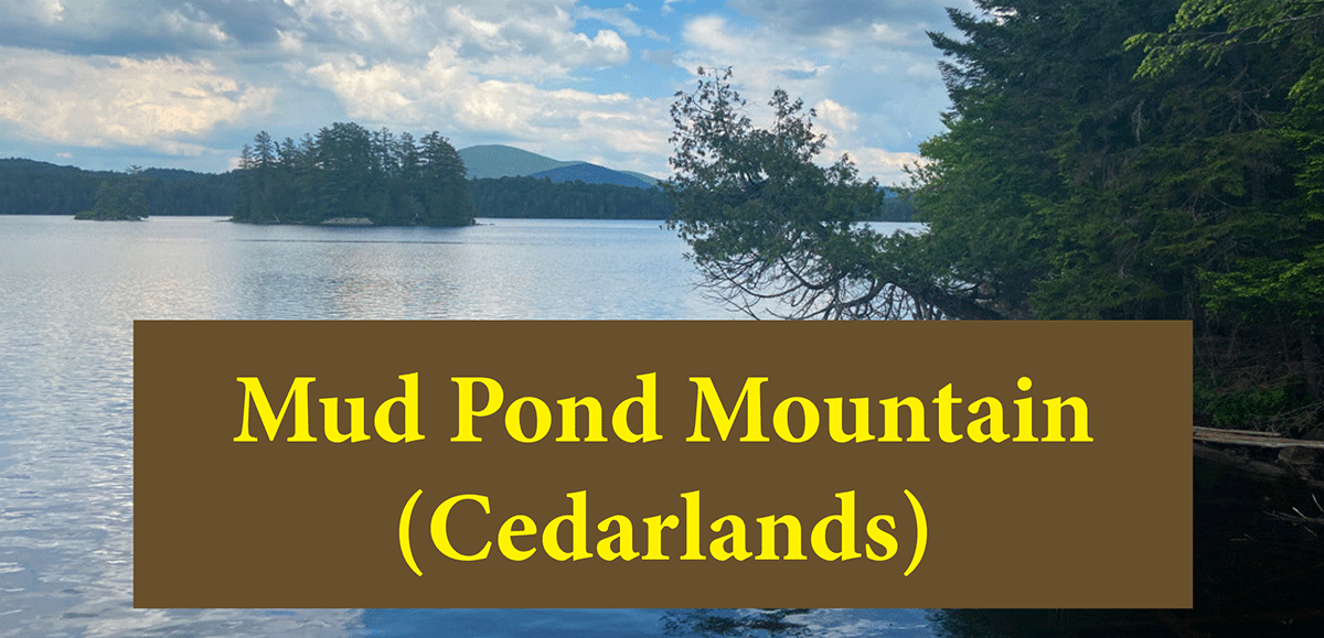
Mud Pond Mountain is a moderate 2.1-mile hike along dirt roads and trails to a small mountain with terrific views of the central Adirondacks in the Cedarlands Conservation Easement tract.
Mud Pond Mountain
2.1 miles long (4.2 miles round-trip)
Long Lake, Hamilton County
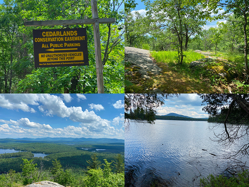
Cedarlands Conservation Easement
Hiking, Snowshoeing
Level of Difficulty: Moderate
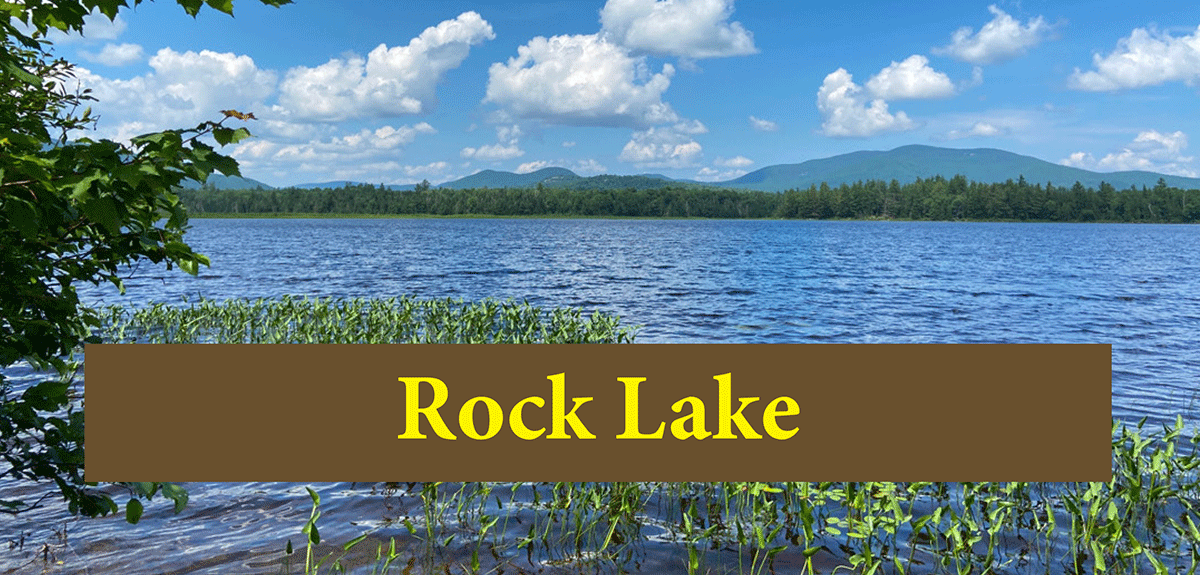
Hike Up Mud Pond Mountain
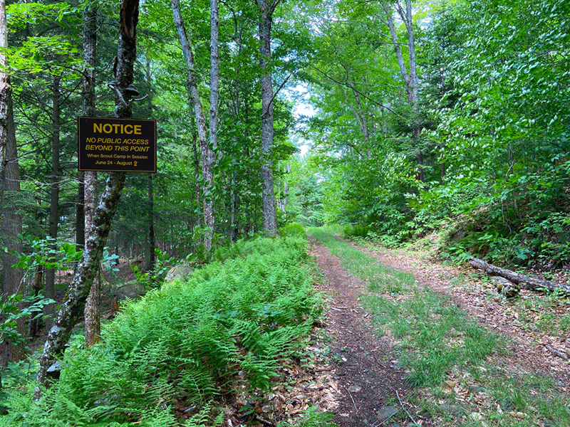
Mud Pond Mountain is a 2.1-mile hike just outside of Long Lake in Hamilton County. This trail includes a small parcel of Forest Preserve, but most of the trail is on the Cedarlands Conservation Easement. Public use on the easement lands is restricted and there is no public use from June 24th – August 24th each year. The trail to Mud Pond is open year-round, but the trail to Mud Pond Mountain and McRorie Lake is only open 10 months of the year. The hike to Mud Pond Mountain is a beautiful early or late season hike.
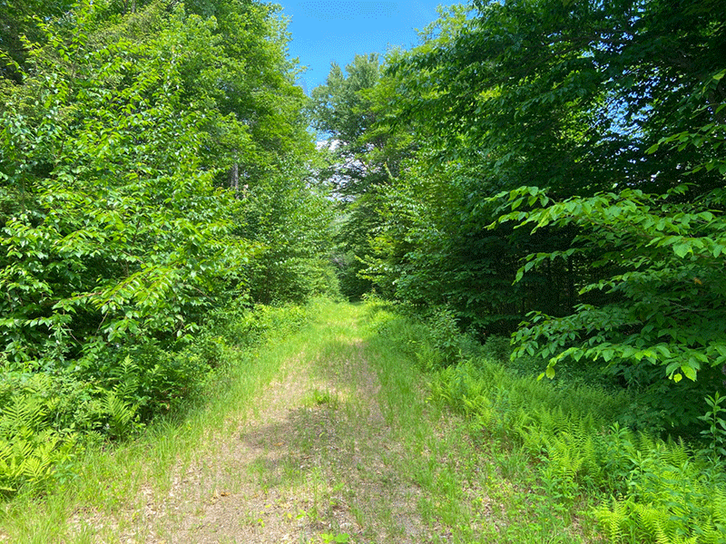
The hike to Mud Pond Mountain follows dirt roads on the easement lands and a foot trail to the summit. There is a small parking area at the end of Kickerville Lane, just north of Long Lake on Route 30. The last stretch is a short, approximately 0.75 miles along a gravel road. The public parking area is on the left.
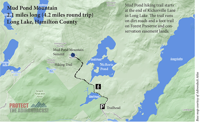
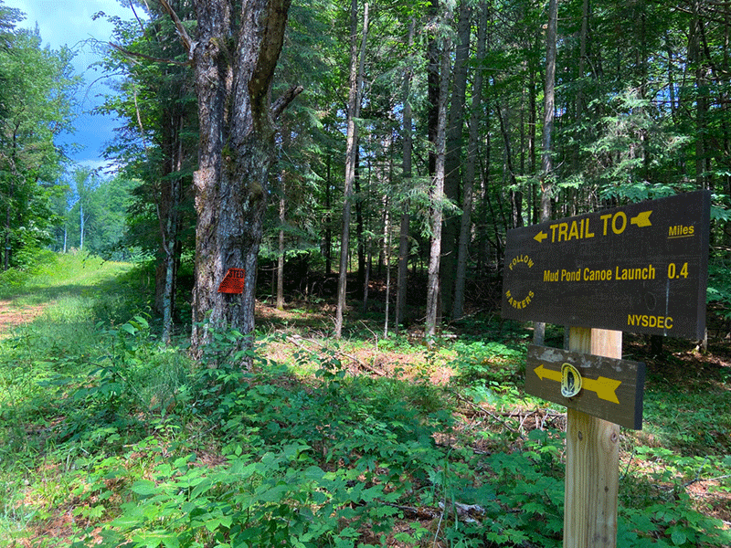
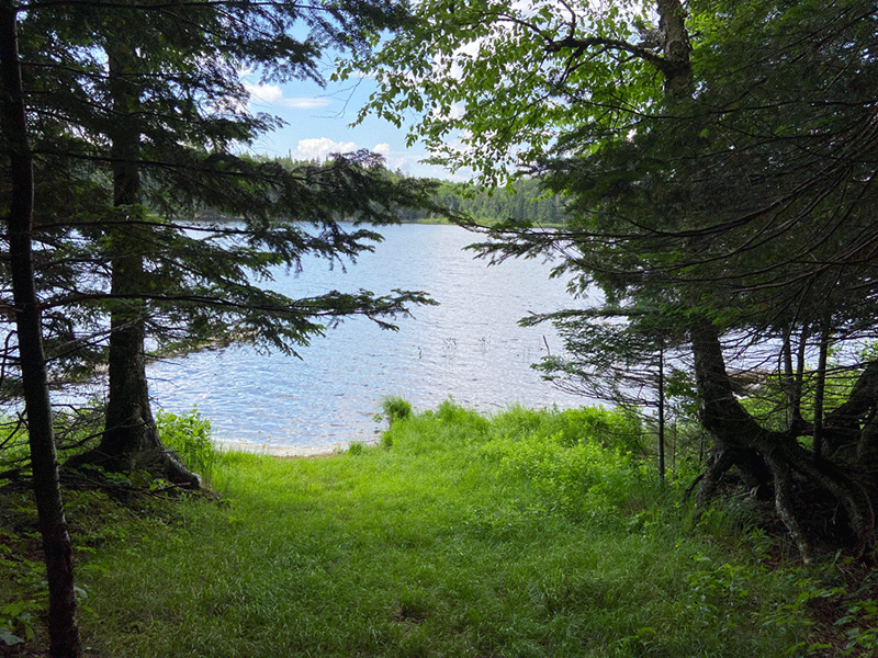
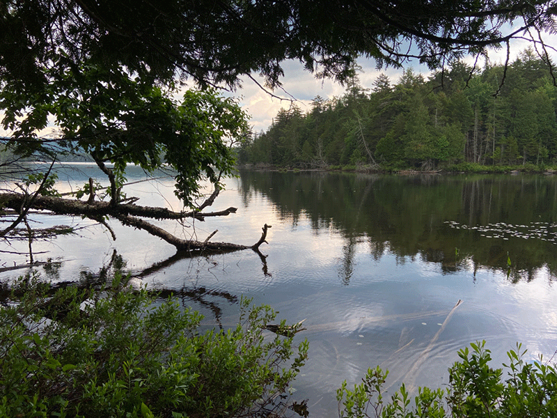
The trail to the Cedarlands Conservation Easement area starts on a dirt road through a northern hardwood forest. At 0.4 miles, there’s a 3-way junction, keep left for Mud Pond, Mud Pond Mountain, and McRorie Lake. Soon after there is an open clearing of tall grasses. This section of the trail is called the “Fish Camp Trail.” Mud Pond is seen through the trees to the west and at 0.8 miles the trail reaches the Mud Pond canoe launch. This section of trail is open year-round.
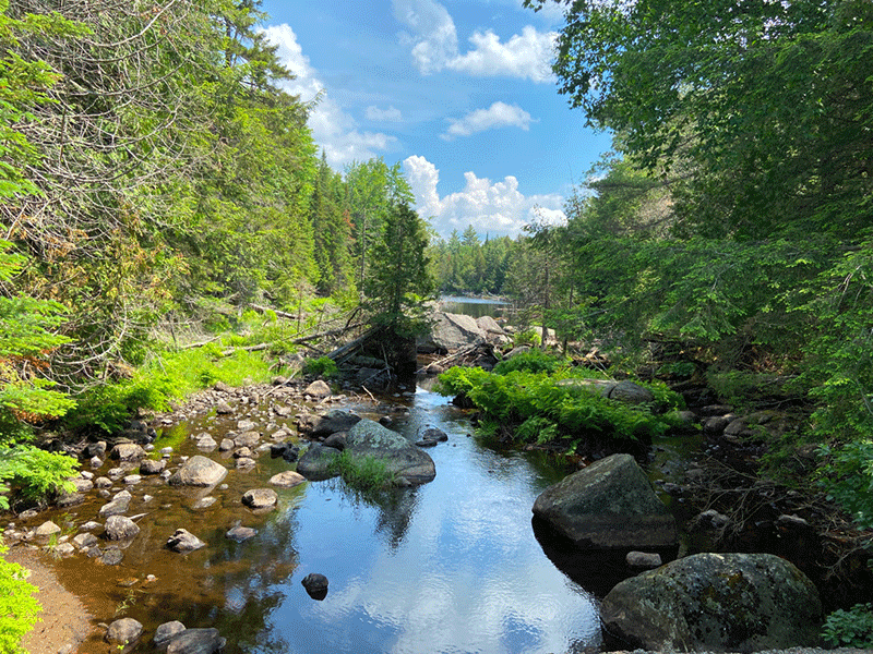
The trail after Mud Pond continues on a smooth, flat dirt road that leads in a quarter of a mile to a bridge that crosses the outlet McRorie Lake. The dirt road continues for a half mile, where it intersects with the trail (left) to Mud Pond Mountain and McRorie Lake (right). The hike to McRorie Lake is short and well worth it, but is marked with flagging and hard to follow in places. The dirt road continues northeast, leading to campsites on the north shore of McRorie Lake, but the trail Rock Pond Mountain is overgrown and difficult to follow.
The Summit of Mud Pond Mountain
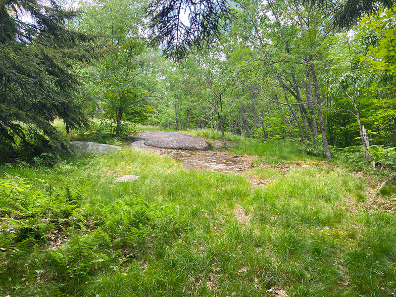
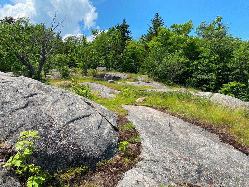
Turn left to the trail to the top of Mud Pond Mountain. The 0.75-mile ascent the mountain’s scenic overlook is steep and passes a bedrock clearing before arriving at a false-summit, from which no view appears. The trail rises and falls with the ridge line, passing over and around bedrock slabs, before emerging at the top of the mountain.
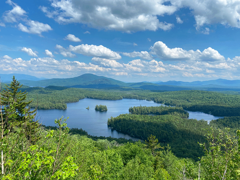
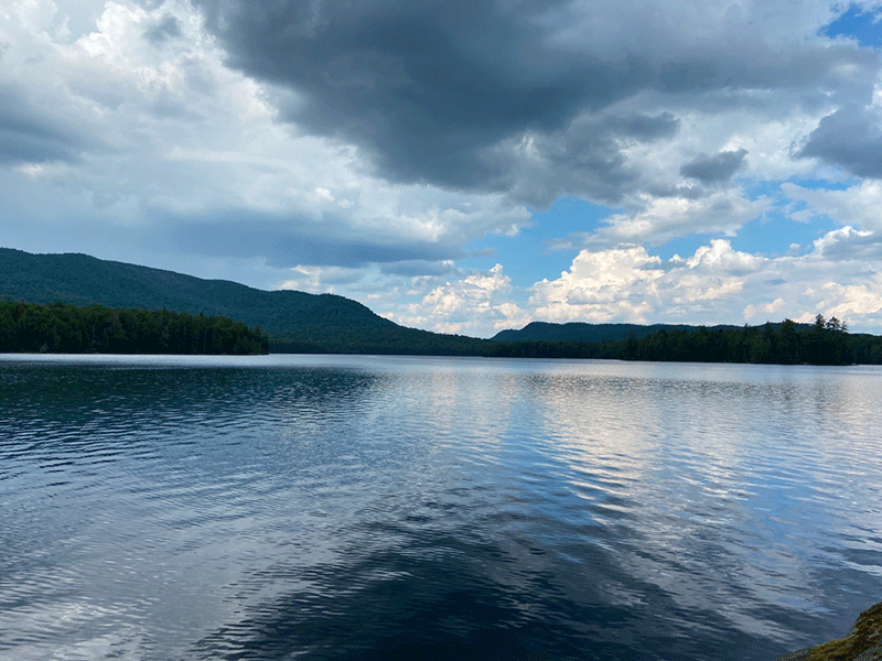
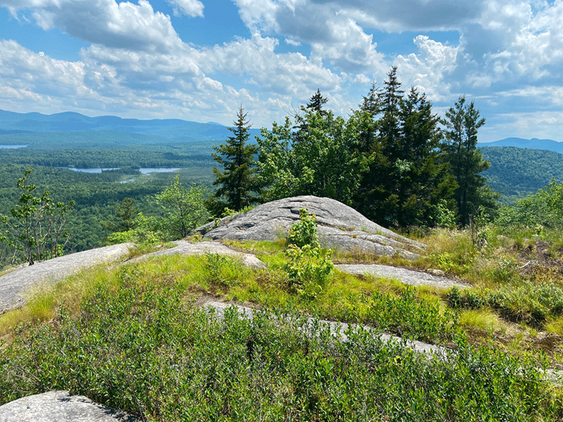
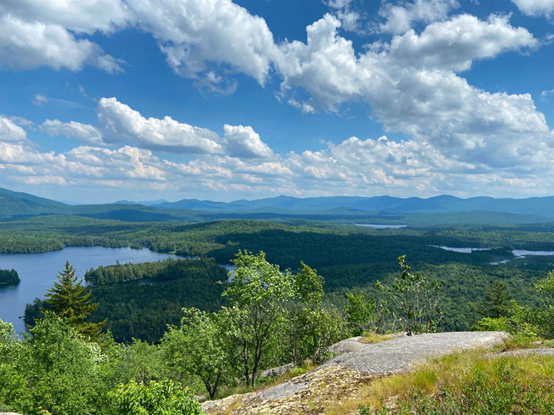
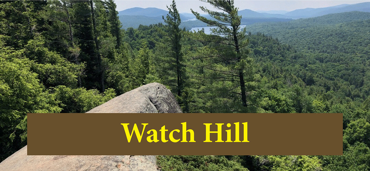
The summit of Mud Pond Mountain is a large open, rocky clearing that provides fantastic views of Mud Pond to the southeast, McRorie Lake to the east, and the High Peaks in the distance. It’s possible to walk past the summit, as the trail continues to the north, but the path is rapidly overgrown.
Follow the same route out as was used for the hike in.
Click here to download a map and trail directions for Mud Pond Mountain.
When You Hike Make Sure to Practice “Leave No Trace” to be Prepared and to Protect the Forest Preserve
Please follow “carry in, carry out” rules for all trash and follow other Leave No Trace principles when hiking in the public Forest Preserve and other wild areas. The seven Leave No Trace principles are: 1) Plan ahead and prepare; 2) Stay on hiking trails and camp at designated areas; 3) Dispose of human waste and trash properly; 4) Leave what you find; 5) Minimize campfires; 6) Respect wildlife; 7) Respect other hikers.
Educated hikers do not damage the environment. Prepared hikers do not need search and rescue unless injured.
Winter Use: Mud Pond Mountain is a popular mountain for snowshoeing and cross country skiing in the winter.
Click here to become a member of Protect the Adirondacks.