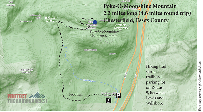
The 2.3-mile hike up Poke-O-Moonshine Mountain in northern Essex County in the Champlain Valley includes beautiful forests and a spectacular panoramic view from a historic firetower
Poke-O-Moonshine Mountain
2.3 miles (4.6 miles round-trip)
Chesterfield, Essex County
Northern Adirondacks
Hiking, Snowshoeing
Level of Difficulty: Moderate
Start Your Hike up Poke-O-Moonshine Mountain
Poke-O-Moonshine Mountain is a 2.3-mile hike in the northern parts of the Champlain Valley, west of Willsboro and north of Lewis. The trail is on public Forest Preserve in the Taylor Pond Wild Forest. The trailhead parking lot is accessed off of Route 9, just south of Northway Exit 33, Auger Lake, and Butternut Pond. Poke-O-Moonshine Mountain is a popular and historic hike. A firetower on the mountaintop provides striking views of Lake Champlain and the Adirondacks.
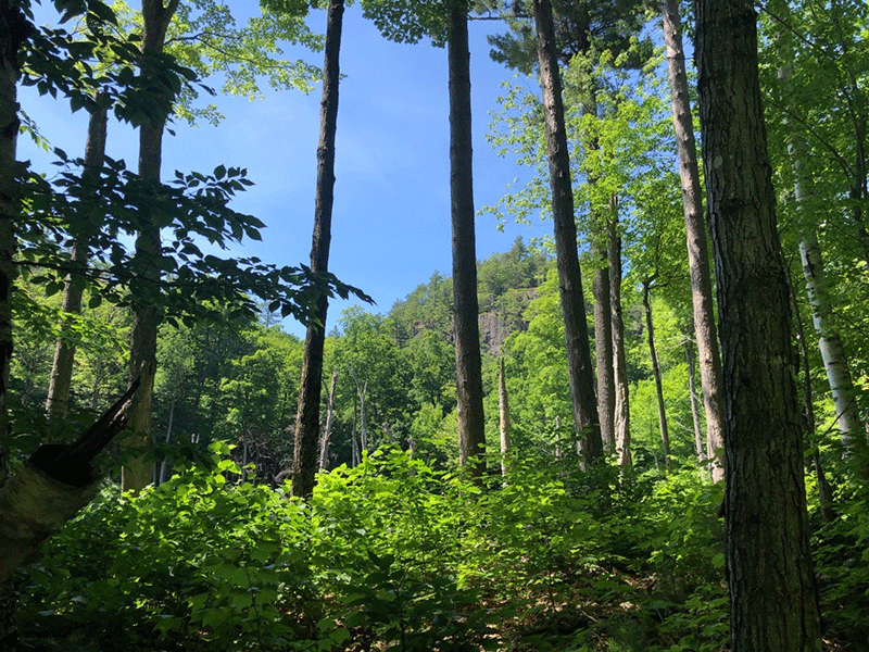
Two hiking trails lead to the summit of Poke-O-Moonshine Mountain. The newer, and recommended trail, is the Observer’s Trail that totals 4.6 miles round trip. This trail is a more gradual route that leads hikers past a number of serene beaver ponds, through beautiful red pine forests, and is in much better condition. The parking area for the Observer’s Trail is located off of State Route 9, five miles south of Exit 33, and one mile south of the Ranger’s trailhead in the Poke-O-Moonshine Campground.
The Observer’s Trail up Poke-O-Moonshine Mountain
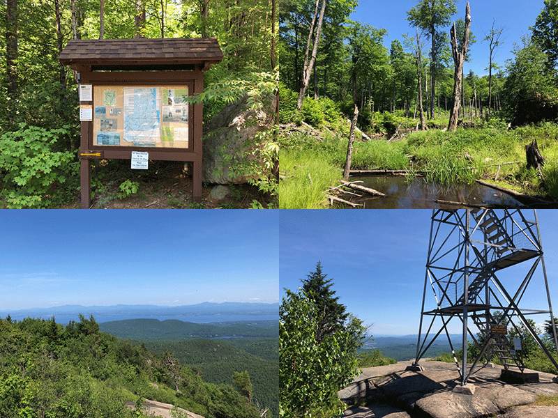
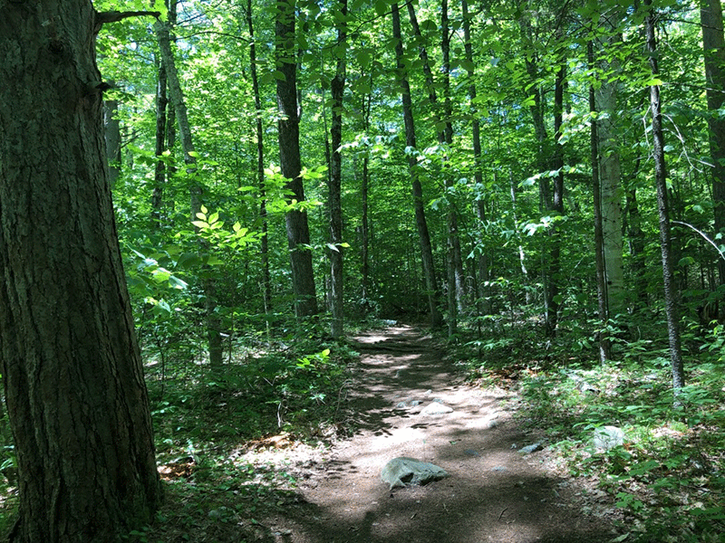
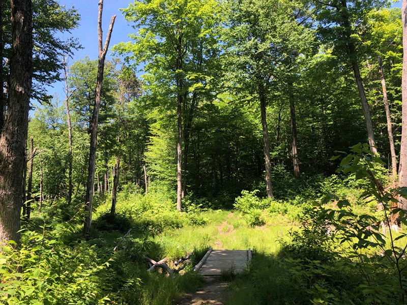
The trail starts on the west side of the parking lot, descends over a small stream, passes the trail register, and winds through a beautiful open forest. The trail is well-maintained, with many rocky water bars to prevent erosion, and follows blue trail markers. After about 0.75 miles, the trail flattens out as it reaches a junction and turns right. The trail then crosses over a small bridge, before ascending steeply up a straight length that flattens out over some bedrock.
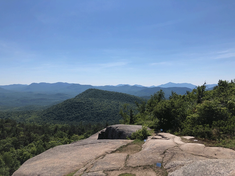
Soon the trail drops down through the first of two sunny wetland areas. From the bridge that spans the wetland’s stream, the rocky summit of Poke-O-Moonshine is visible below the open sky. After a short distance, another clear view of one of the ponds opens up as the trail begins to climb again. At about 1.5 miles, the trail rises over its most challenging length, which includes some loose rocks and open, wet, and slippery slabs of bedrock.
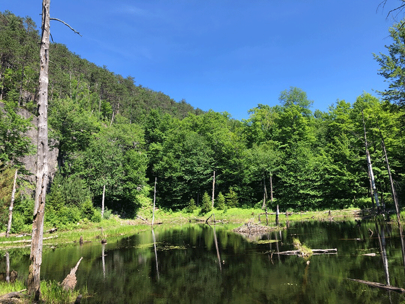
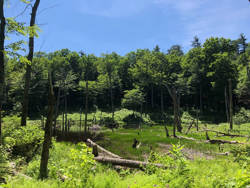
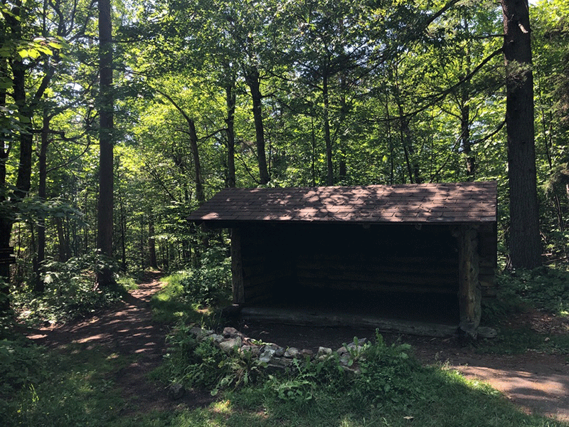
The mud and rocks give way to crunchy pine needles as the trail leads into a coniferous forest. To the left, a peaceful beaver pond is nestled at the base of Poke-O’s rocky cliff, home to countless croaking green frogs and dragonflies who dart across the water’s surface. This pond is the headwaters of Cold Brook. The trail then continues through the red pines and reaches a wide trail junction at the 2.1-mile mark where it joins up with the Ranger’s Trail. An outhouse, firepit, and lean-to make the junction a perfect camping spot or a fine place for a rest before the final ascent.
Historic Sites on Poke-O-Moonshine Mountain
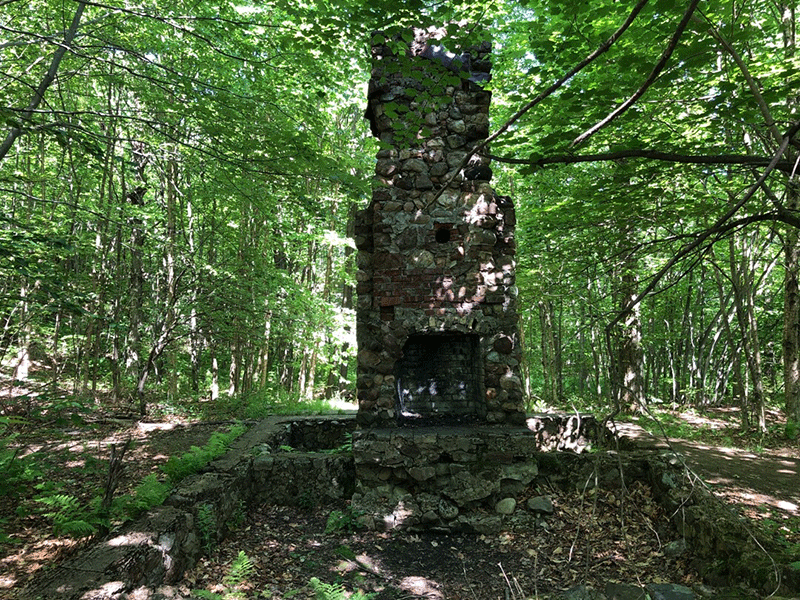
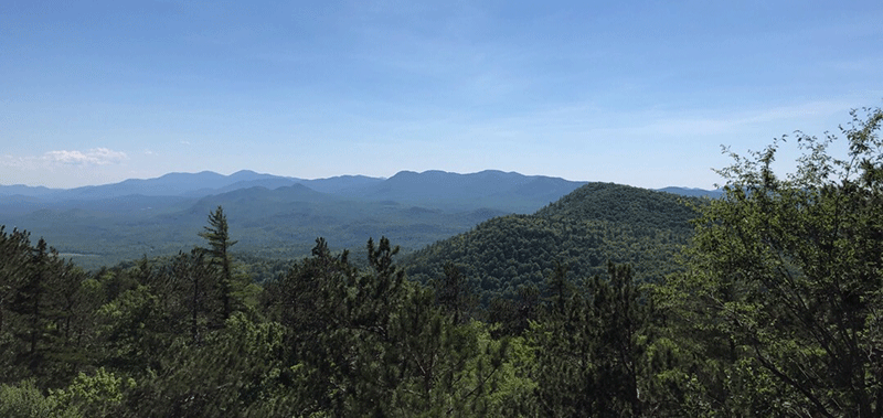
After the junction, a side trail soon leads to a large stone chimney, the last relic of a cabin that housed the mountain’s Fire Observer from 1936 through 1988. The trail then runs up a pair of stone and wooden staircases before leading onto a long, rocky outcrop that provides a vast view of the south.
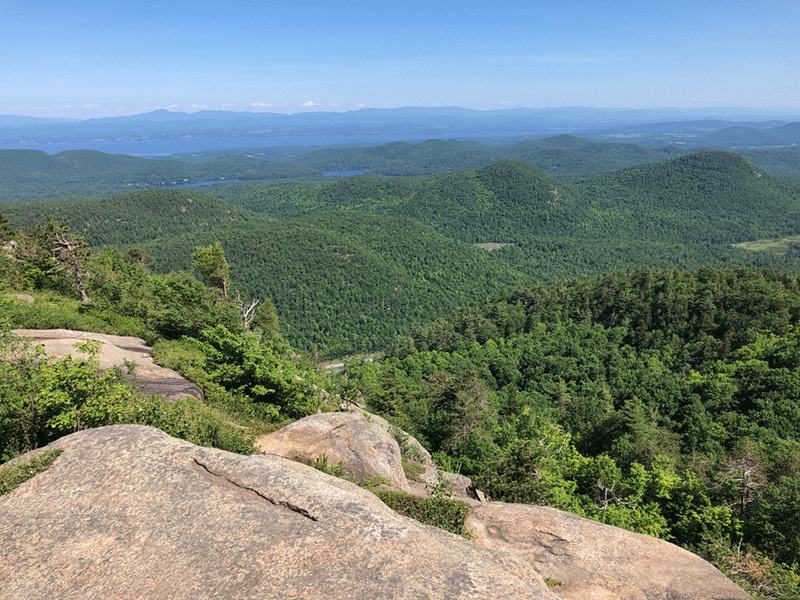
The View from the Top of Poke-O-Moonshine Mountain
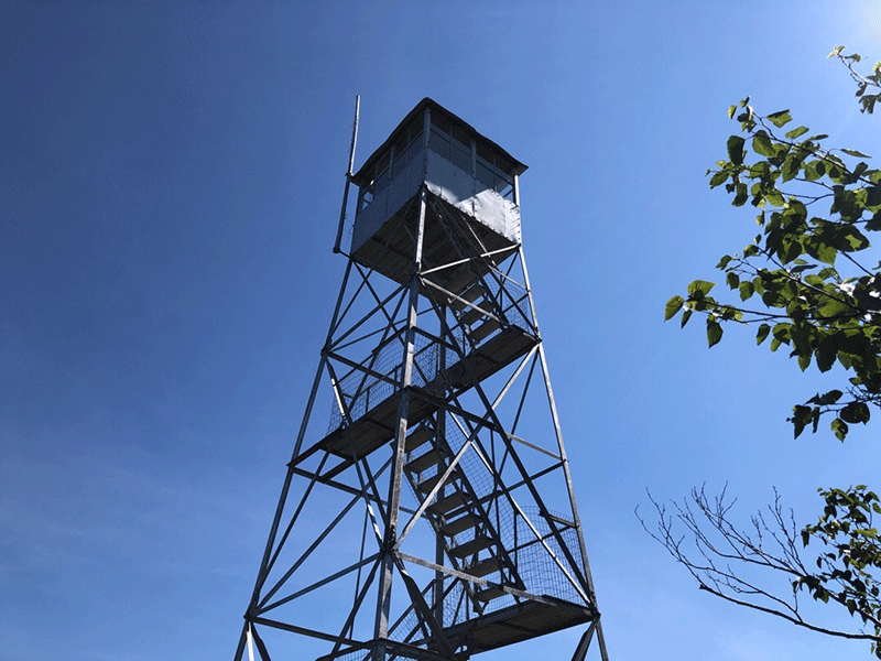
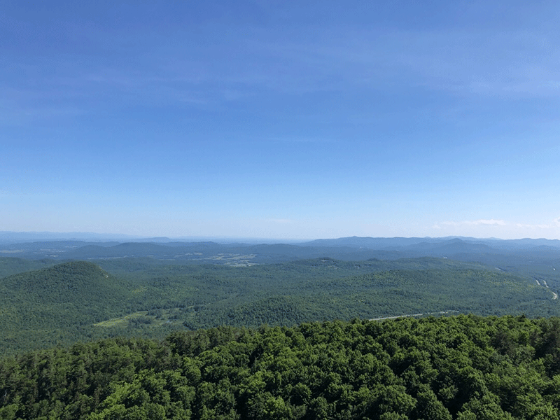
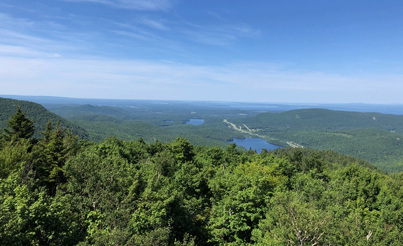
The trail after the outcrop is mostly flat for a short way. The trail wraps around and reaches the summit from the west. The open summit of Poke-O-Moonshine has a dozen large rock and cliff areas that face east. Built in 1917, the steel Poke-O-Moonshine firetower stands tall on the summit and offers brilliant views of Lake Champlain, Burlington, Vermont, and the hills of Vermont off to the east. High Peaks stand to the south and the Northway is plainly visible in the valley below.
The well-maintained summit and trail are evidence of the hard work by the Friends of Poke-O-Moonshine. This group offers historical context and advice for healthy engagement through educational postings along the trail.
The return trip is that same route as the hike up.
Click here to download a map and trail directions for Poke-O-Moonshine Mountain.
When You Hike Make Sure to Practice “Leave No Trace” to be Prepared and to Protect the Forest Preserve
Please follow “carry in, carry out” rules for all trash and follow all other Leave No Trace principles when hiking in the public Forest Preserve and other wild areas. The seven Leave No Trace principles are: 1) Plan ahead and prepare ; 2) Stay on hiking trails and camp at designated areas; 3) Dispose of human waste and trash properly; 4) Leave what you find; 5) Minimize campfires; 6) Respect wildlife; 7) Respect other hikers.
Educated hikers do not damage the environment.
Prepared hikers do not need search and rescue unless injured.
Winter Use: Poke-O-Moonshine Mountain is used for snowshoeing in the winter.


