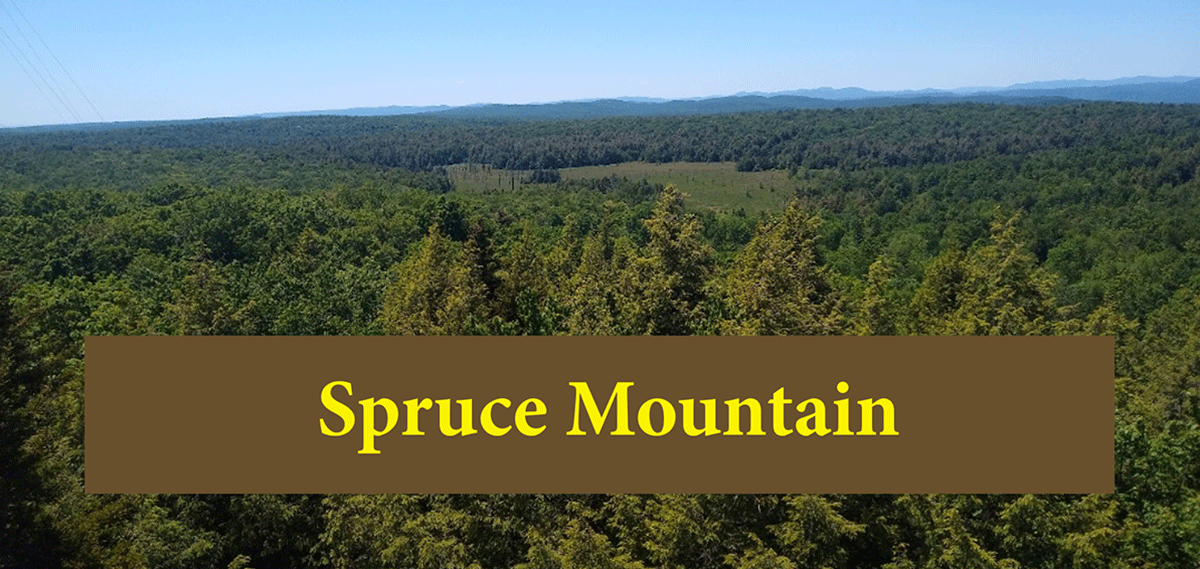
Spruce Mountain is a short hike in Saratoga County that provides great views of the rolling foothills in the southern Adirondacks from a restored firetower
Spruce Mountain
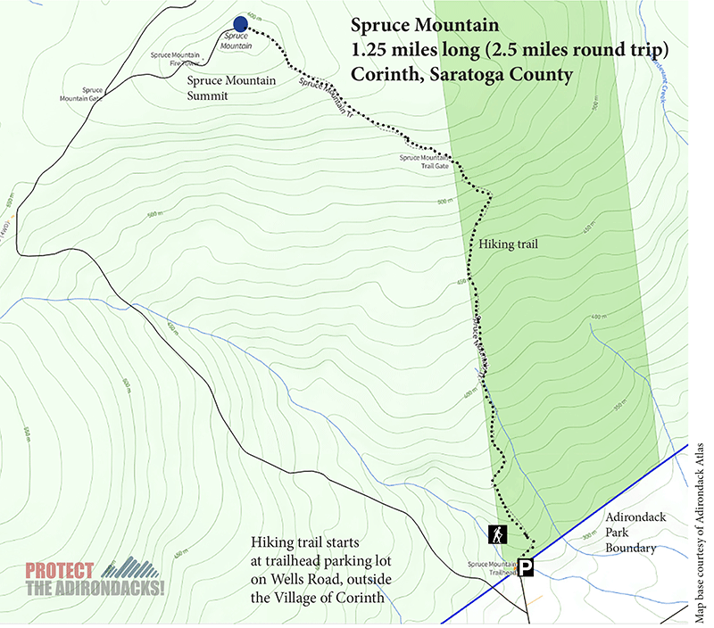
1.3 miles (2.6 miles round trip)
Corinth, Saratoga County
Southern Adirondacks
Hiking, Snowshoeing, Cross-country Skiing
Hike Up Spruce Mountain
NOTE: In accordance with the conservation easement agreement the trail is closed to public use during the big game hunting season from mid-October through early December each year.
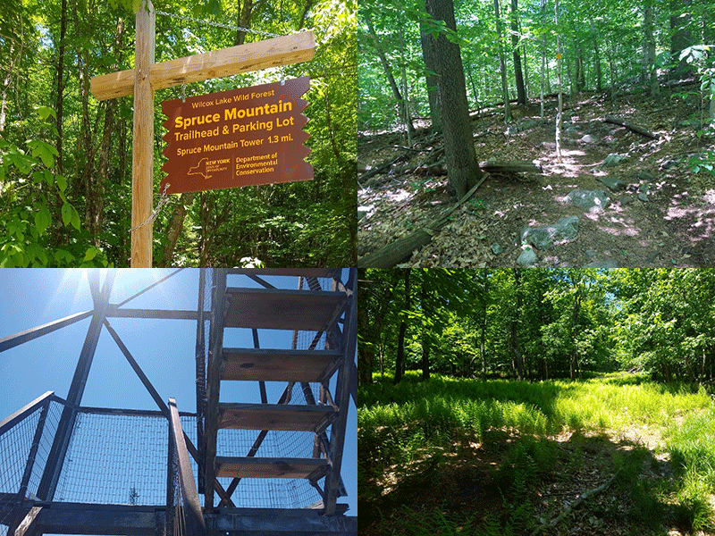
Spruce Mountain is located on private property outside of the Village of Corinth in Saratoga County. The Spruce Mountain Trail was created through a partnership between the New York State Department of Environmental Conservation, Saratoga County, and Saratoga PLAN. The trail is just under 1.3 miles to the summit.
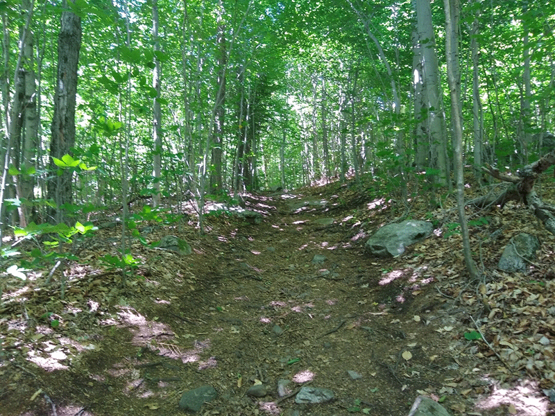
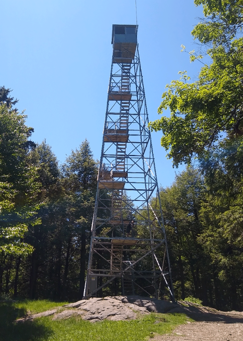
The trail is very well maintained and easy to follow. The only view from the top is from the upper reaches of the firetower, so those unwilling to climb the stairs will not get the view from the top. Those willing to climb the tower are rewarded with a beautiful panoramic view, that stretches out for over 100 miles on a clear day.
The Hiking Trail on Spruce Mountain Winds through Beautiful Forests
The Spruce Mountain Trail can be accessed by a turn onto Wells Road of off Route 9N a few miles south of Corinth. At the end of Wells Road turn right onto Spruce Mountain Road. The trailhead and parking area are at the very end of the road, which is a dead-end.
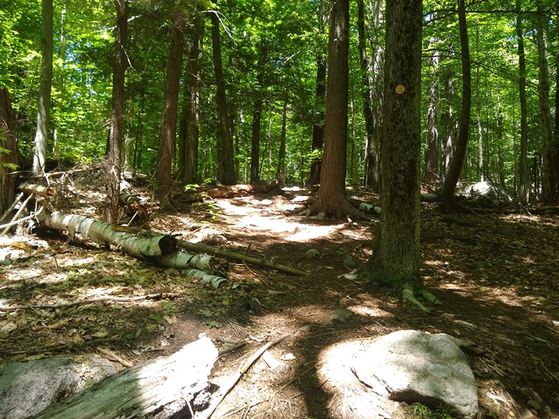
The trail begins from the back of the parking area. The trail immediately crosses a concrete bridge over a small stream. Just after the bridge, the trail turns to the right sharply and begins a steep climb, which soon levels out to a moderate incline in a short time. The trail register is located near the top of this initial incline. Make sure to sign the trailhead register.
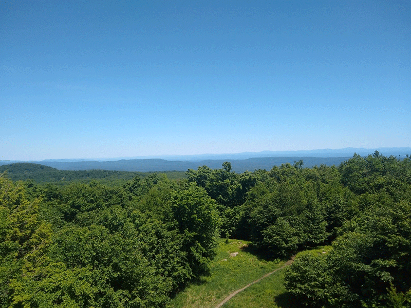
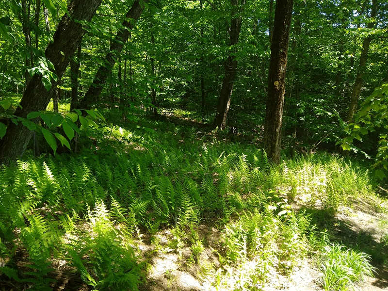
The trail continues at a consistent, very moderate slope that gradually gains elevation until a left turn leads into a more open area. A long stretch of the trail is on top of Spruce Mountain, where the trail twists and turns through a series of beautiful fern-covered clearings before reaching the final cleared area at the top of the mountain.

The Spruce Mountain Mountaintops
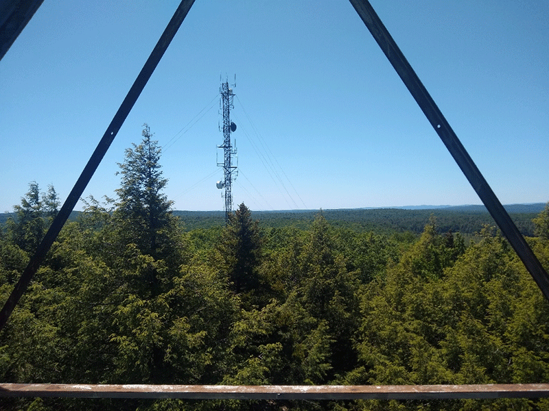
At the summit, there is a large open area with both grassy and rocky spaces. The area under the fire tower provides a number of places to sit as well. The firetower is well maintained and stable and protrudes above the trees and towers over the forest canopy for those brave enough to go all the way to the top. The views from the firetower get better the higher one climbs. The top tiers of the firetower provide a panoramic view of mountains and rolling foothills in all directions – the only exception being the minor disruption of nearby mono-pole celltower directly to the west.
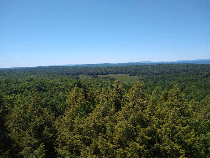
The proximity of this trail to Saratoga Springs, combined with its short distance and great views means that hikers will generally always be sharing the trail and summit with other people. The trip back to the parking lot is similarly short and simple, and the trip overall takes very little time, and provides a very good view. This trail is appropriate for people of all ages and ability levels, with no technically difficult or particularly steep sections and a short overall distance.
Click here to download a map and trail directions for Spruce Mountain.
When You Hike Make Sure to Practice “Leave No Trace” to be Prepared and to Protect the Forest Preserve
Please follow “carry in, carry out” rules for all trash and follow other Leave No Trace principles when hiking in the public Forest Preserve and other wild areas. The seven Leave No Trace principles are: 1) Plan ahead and prepare ; 2) Stay on hiking trails and camp at designated areas; 3) Dispose of human waste and trash properly; 4) Leave what you find; 5) Minimize campfires; 6) Respect wildlife; 7) Respect other hikers.
Educated hikers do not damage the environment. Prepared hikers do not need search and rescue unless injured.
Winter Use: Spruce Mountain is used for snowshoeing and cross-country skiing in the winter.
Click here to become a member of Protect the Adirondacks.