Tongue Mountain is a challenging hike with numerous peaks and outcrops that have wonderful views of Lake George and the southern Adirondacks
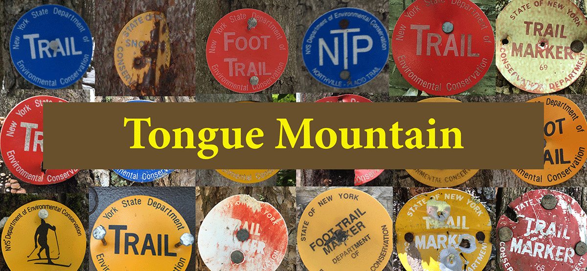
Tongue Mountain
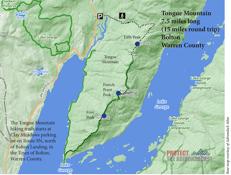
7.5 miles (15 miles round trip/loop)
Lake George Wild Forest
Bolton, Warren County
Hiking, Snowshoeing
Level of Difficulty: Challenging
Hike Tongue Mountain
The 7.5-mile Tongue Mountain Trail is located on the Tongue Mountain peninsula on Lake George in the Town of Bolton in Warren County. The trail is on the public Forest Preserve in the Lake George Wild Forest. Tongue Mountain is a mountain range with a series of peaks. This can be hiked as an up-and-back route to one of the peaks on the mountain range or as a loop with the Northwest Bay Trail. Tongue Mountain provides stunning views of the south basin of Lake George and the mountains that line the east side of the lake.
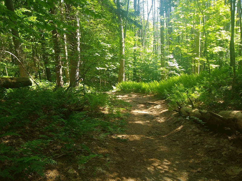
The Tongue Mountain Trail is accessed off of Route 9N, north of Bolton Landing, also known as Lake Shore Drive. The Clay Meadows parking lot in on the right. From the parking lot, walk south about fifty feet to the trailhead, which leads up to the Tongue Mountain Range (left) and the Northwest Bay Trail (right). The trail is well maintained, with only a couple of muddy spots over close to five miles. The trail is gentle the whole way and traverses a few rolling hills.
Plan Your Hike for Tongue Mountain
It’s possible to hike the entire Tongue Mountain Range, starting north in Hague with Five Mile Mountain.
The full loop of Tongue Mountain and returning on Northwest Bay Trail is a very difficult 15-mile hike and takes a full day to complete, so start early and bring plenty of water and snacks. However, the views from the multiple peaks along the spine of Tongue Mountain and lakeside at Montcalm Point are superb and make this loop one of the great hikes in the Adirondacks, absolutely worth the effort for anyone up to the challenge. Alternatively, hikers can turn back at the first or second peak on Tongue Mountain for a shorter trip.
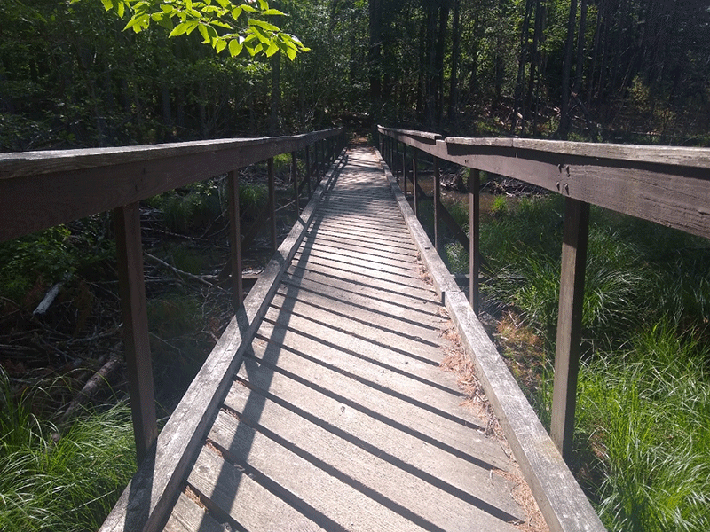
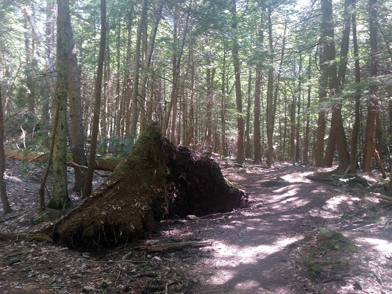
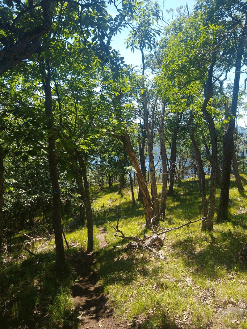
The trail begins just south of the parking areas and continues away from the highway into a forest of towering white pines and hemlocks. After about a third of a mile, the trail crosses a long bridge over a small wetland area. Soon afterward, it comes to a junction where hikers will come back from the loop at the very end of the hike. The trail continues for another mile or so, only going up a couple of small steep sections before the incline begins in earnest. The trail climbs steeply before reaching the main ridgeline trail. A third of a mile before this junction, there is another minor T-junction where hikers should bear right to get to the ridge. At the ridge, the trail to the right leads towards Fifth Peak and to Montcalm Point, while the trail to the left leads back to Five Mile Mountain and the Deer Leap Trailhead.
Fifth Peak on Tongue Mountain
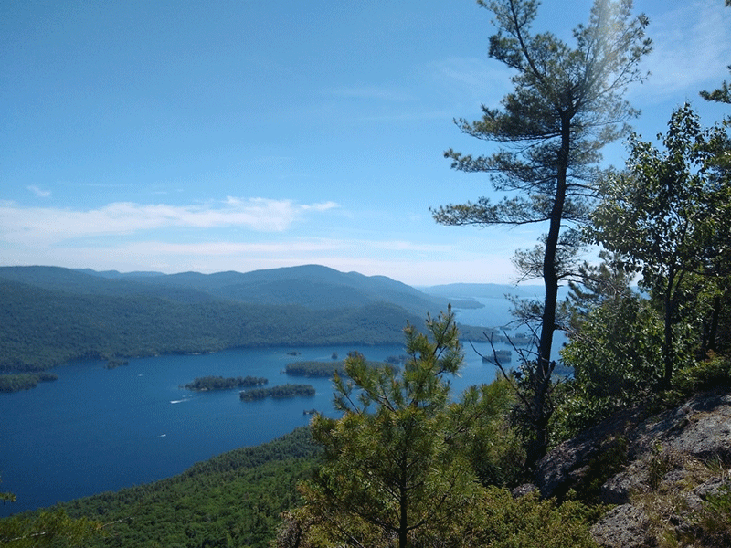
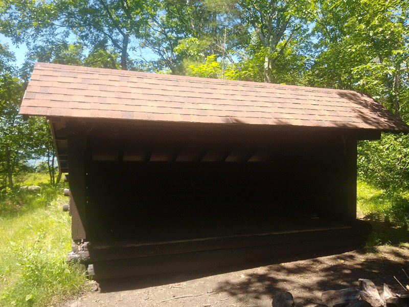
The summit of Fifth Peak and the lean-to located nearby are less than a mile from the ridgeline junction. It’s about 3.5 miles to Fifth Peak. To reach the lean-to, take a spur trail on the left soon after the initial junction, which leads up to the summit and camping area. The lean-to is in great condition, with a fire pit right next to it. Just a couple hundred feet away, there is a rocky outcropping and a view out over Lake George. From that area, hikers can reach a small privy, on a small trail a little ways back into the woods. Depending how long hikers what to go, this can be a good point to turn around, or to set up camp for the night and continue the next day. Alternatively, turning back after the next peak shortens the trip by 6 or 7 miles, but still gets hikers to one of the best views available on this half of the range.
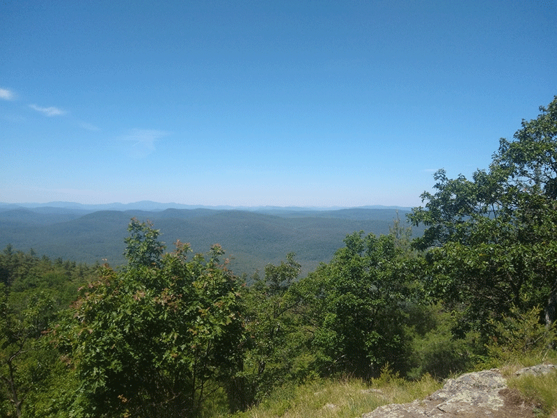
To get back to the main trail, turn back from the lean-to and return to the previous junction. Continue straight instead of taking a left turn, and the trail will continue on towards Montcalm Point. The next peak hikers will reach is French Point Mountain, another 1.5 miles or so from Fifth Peak. The trail between Fifth and French Point has a number of inclines and declines as it goes over the smaller peaks on the range, and then ascends to the summit of French Point. On the smaller peaks between, there are some small rocky outcroppings with moderate views.
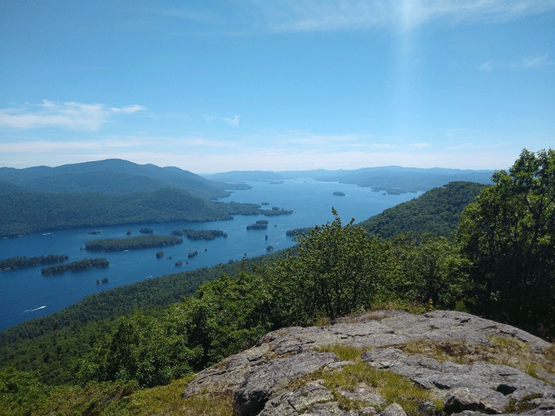
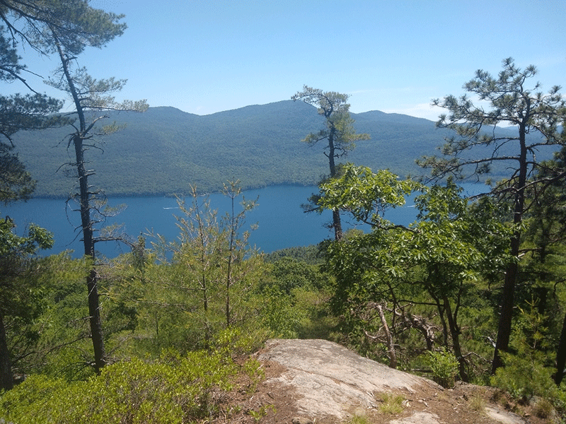
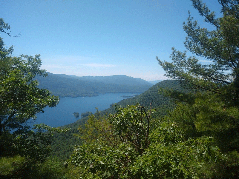
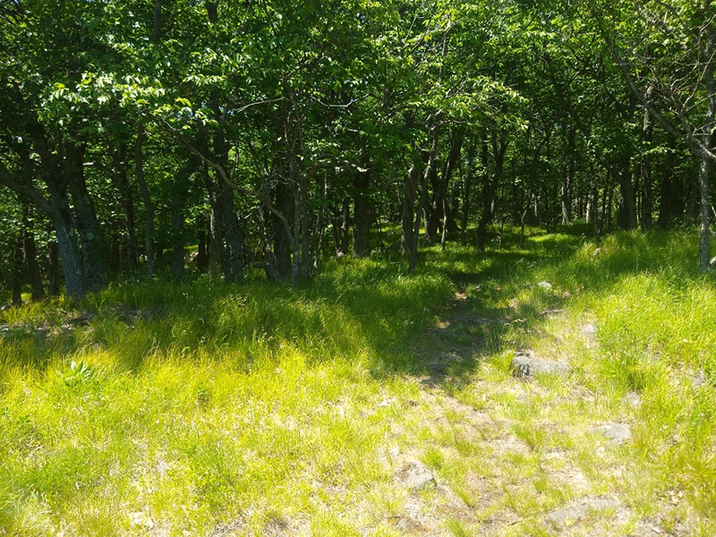
The view from French Point Mountain is absolutely stunning. After reaching a flat area, characterized by a grassy understory and sparse oak trees that let in dappled light, the trail reaches a rocky overlook. There is ample seating area, a campfire pit, and a sweeping view of Lake George and the surrounding mountains that reaches far to the southeast.
After French Point Mountain, if hikers choose to continue onwards, there is one more significant peak about 0.5 miles further, called First Peak, before the descent begins in earnest to Montcalm Point, which is lakeside on Lake George.
Click here to read about the Northwest Bay Trail.
The Tongue Mountain Range is a long, difficult trail recommended for experienced hikers.
When You Hike Make Sure to Practice “Leave No Trace” to be Prepared and to Protect the Forest Preserve
Please follow “carry in, carry out” rules for all trash and follow other Leave No Trace principles when hiking in the public Forest Preserve and other wild areas. The seven Leave No Trace principles are: 1) Plan ahead and prepare; 2) Stay on hiking trails and camp at designated areas; 3) Dispose of human waste and trash properly; 4) Leave what you find; 5) Minimize campfires; 6) Respect wildlife; 7) Respect other hikers.
Educated hikers do not damage the environment. Prepared hikers do not need search and rescue unless injured.
Winter Use: Tongue Mountain Trail is used for snowshoeing in the winter.
Click here to become a member of Protect the Adirondacks.