The 3-mile hike up Vanderwhacker Mountain in southern Essex County winds through beautiful forests and wetlands and leads to a spectacular panoramic view from a historic firetower
Vanderwhacker Mountain
3 miles (6 miles round-trip; 10 miles round trip if park at Route 28N)
Minerva, Essex County
Central Adirondacks
Hiking, Snowshoeing
Hike Vanderwhacker Mountain
The hike up Vanderwhacker Mountain is 3-miles-long and leads to a firetower with a panoramic view of the central Adirondacks. The trail is on public Forest Preserve in the Vanderwhacker Mountain Wild Forest area. The trailhead and parking lot are accessed from Route 28N where the highway crosses over the Boreas River between Minerva and Newcomb. This hike winds through beautiful forests and around backwoods ponds to reach a rocky summit and firetower.
The hike up Vanderwhacker Mountain is about 6 miles round trip. It starts on a rocky road off of Route 28N. This road may not be accessible to every vehicle, but fine for any high-clearance vehicle or those who are experienced picking their way around rocks and ruts. If one decides to walk the road instead of drive it, the total length of the hike will increase by four miles round trip since the distance on this dirt road from the Route 28N to the marked trailhead is two miles.
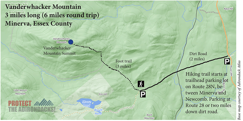
The Vanderwhacker Mountain Hiking Trail
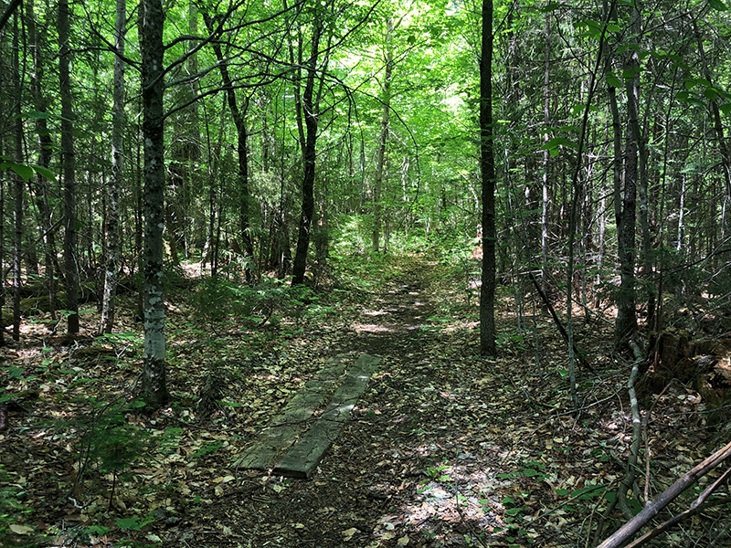
Like many trails, this hike approaches the mountain through lowland forest before beginning the climb. The trail is well marked and easy to follow. This approach makes up the first half of the trail. There are several wetlands that the trail passes by early in the hike that are quite beautiful. Approach these quietly for a chance to see beaver, deer, or even moose. The beaver activity in the area is significant.
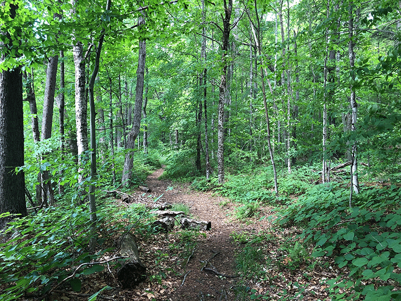
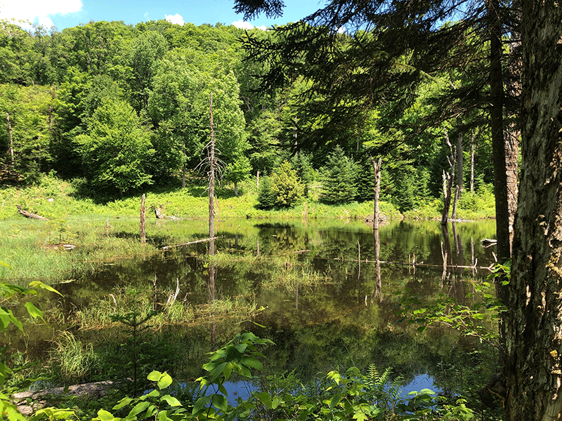
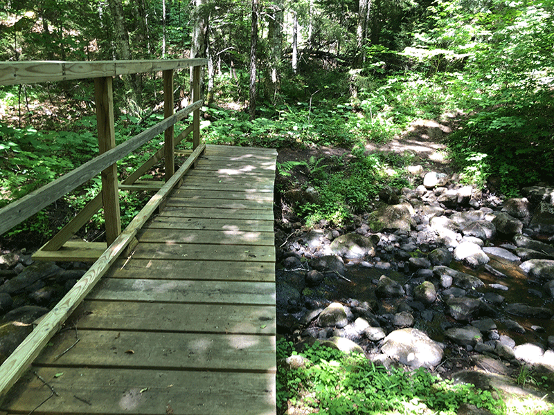
The approximate halfway point of the hike is an old cabin and outhouse that you cannot walk the trail without seeing. The forests surrounding the trail are mostly hardwood except for near water bodies, where larch, cedar, and balsams prevail. The trail along this first half includes bridges, boardwalks, and stepping stones to assist hikers navigating the water moving between the wetlands.
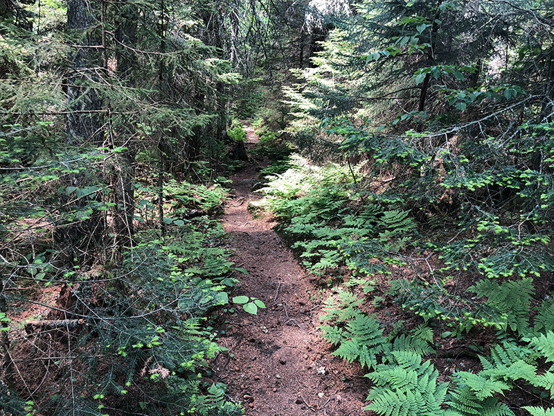
The climb to the summit of Vanderwhacker Mountain utilizes some trail switchbacks, the corners of which have been cut by hikers making the trail confusing at times, so pay attention to the trail markers. As the trail approaches the summit, it runs the spine of a distinct ridgeline, with views of the neighboring mountains appearing through the canopy on either side of the trail.
The Summit of Vanderwhacker Mountain
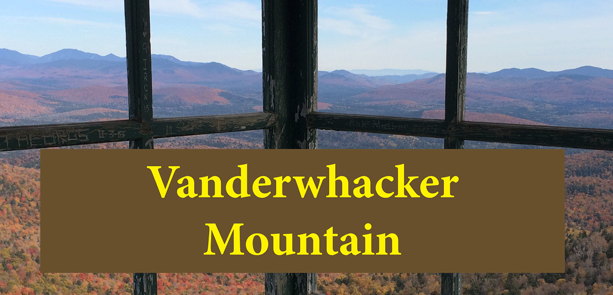
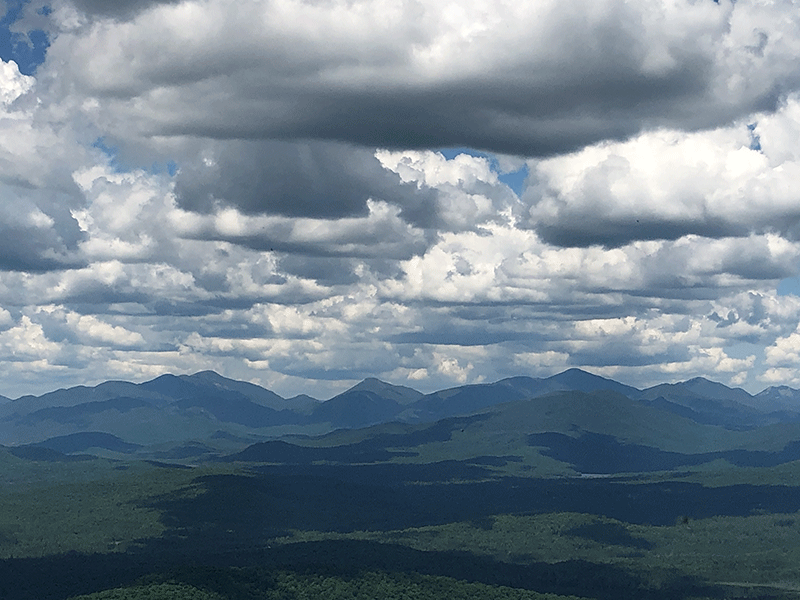
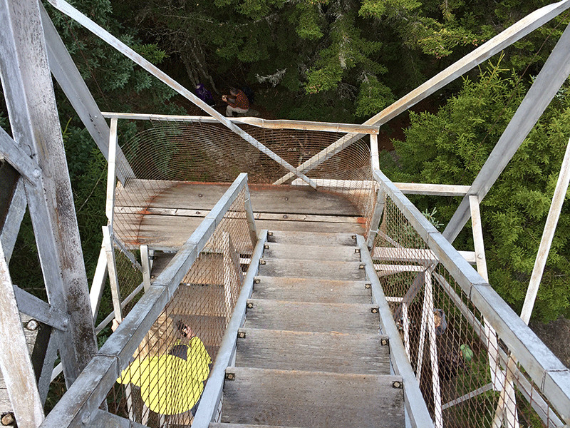
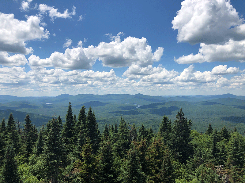
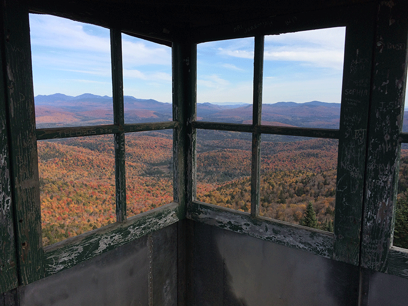
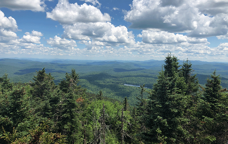
Near the summit, the understory becomes thick with ferns, and the trees are nearly all conifers heavily spruce. The summit is forested but a tall fire tower stands on a large outcrop. The firetower provides an excellent view of the High Peaks to the north, the ridges and mountains of central Adirondacks, Blue Mountain to the west, and Gore and Crane mountains to the southeast. The lowlands spread wide of rolling hills and ridges. Overall this a moderately challenging hike on a well-maintained trail to a mountaintop that offers an excellent view.
The return trip is that same route as the hike up.
Click here to download a map and trail directions for Vanderwhacker Mountain.
When You Hike Make Sure to Practice “Leave No Trace” to be Prepared and to Protect the Forest Preserve
Please follow “carry in, carry out” rules for all trash and follow all other Leave No Trace principles when hiking in the public Forest Preserve and other wild areas. The seven Leave No Trace principles are: 1) Plan ahead and prepare ; 2) Stay on hiking trails and camp at designated areas; 3) Dispose of human waste and trash properly; 4) Leave what you find; 5) Minimize campfires; 6) Respect wildlife; 7) Respect other hikers.
Educated hikers do not damage the environment. Prepared hikers do not need search and rescue unless injured.
Winter Use: Vanderwhacker Mountain is used for snowshoeing in the winter.
Click here to become a member of Protect the Adirondacks.
