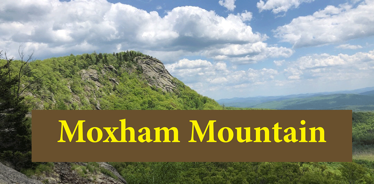
Moxham Mountain is one of the outstanding hikes in the central Adirondacks
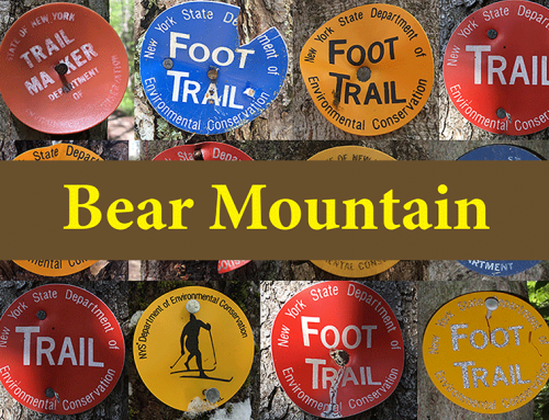
Moxham Mountain
2.5 miles (5 miles round trip)
Minerva, Essex County
Central Adirondacks, on the outskirts of the hamlet of Minerva
Hiking, Snowshoeing Trail
Level of Difficulty: Moderate
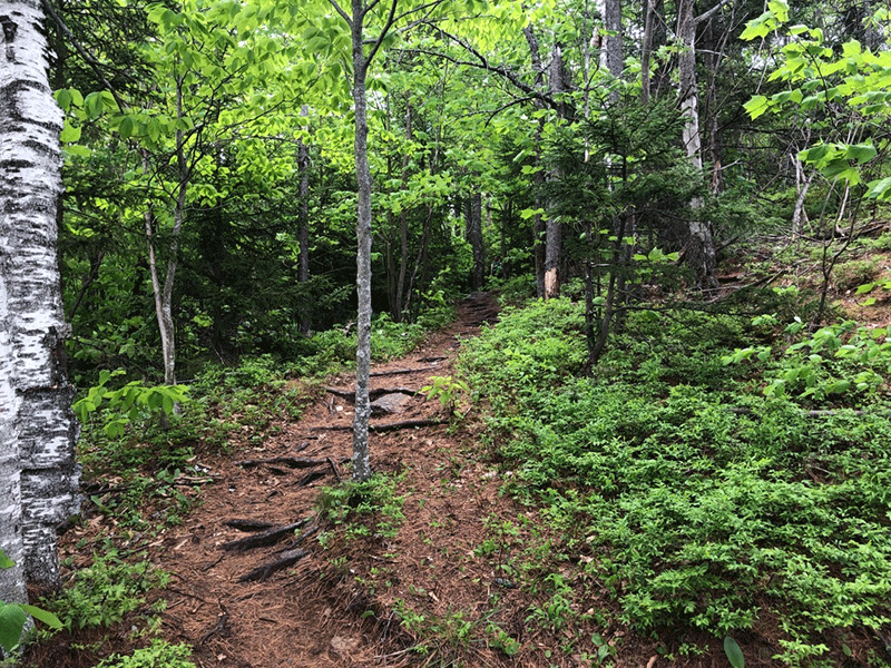
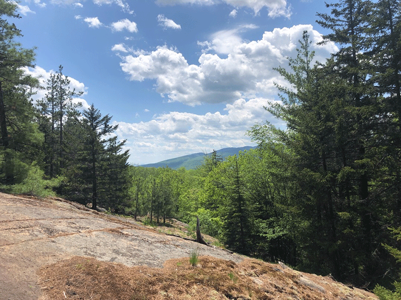
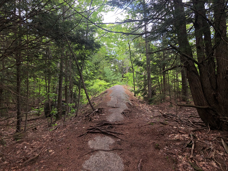
Moxham Mountain starts at a trailhead near the end of the paved section of Fourteenth Road in the Town of Minerva in Essex County. The trail is entirely located on public Forest Preserve, which is part of the Vanderwhacker Mountain Wild Forest. The trail is clearly defined and well-marked. Hikers should be prepared for a 2.5-mile hike to the summit with a gradual elevation gain of about 1,000 feet. The trail is well designed and brings hikers through different forest types and near a large wetland. The trail winds over 11 rocky outcrops on its way to the summit that provide numerous scenic overlooks, allowing hikers views of neighboring mountains and forested valleys that grow bigger as the trail gains elevation.
NOTE: The trailhead sign says 2.0 miles, but GPS tracking calculates that the trail is 2.5 to 2.65 miles to the summit, a hike of more than 5 miles roundtrip.
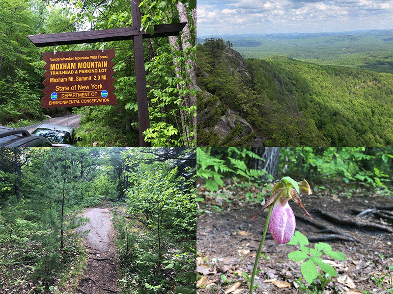
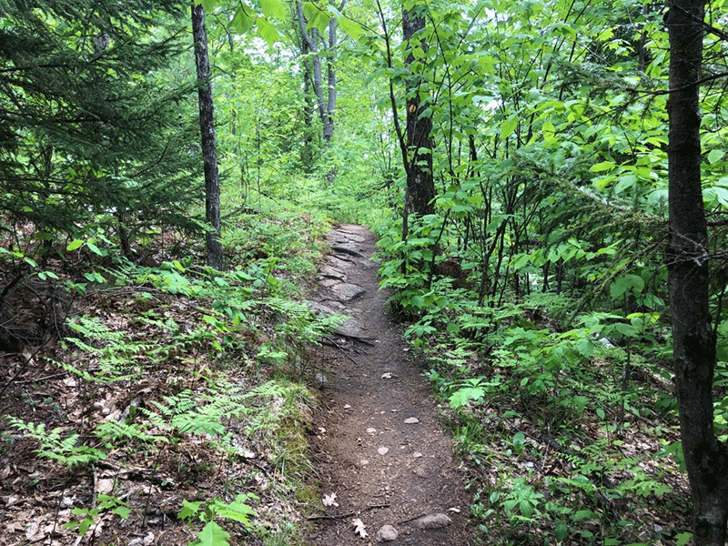
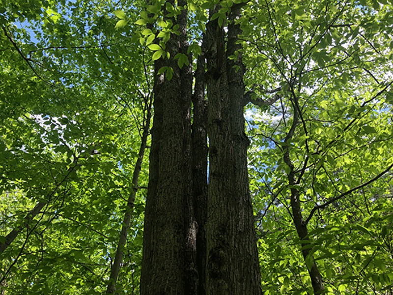
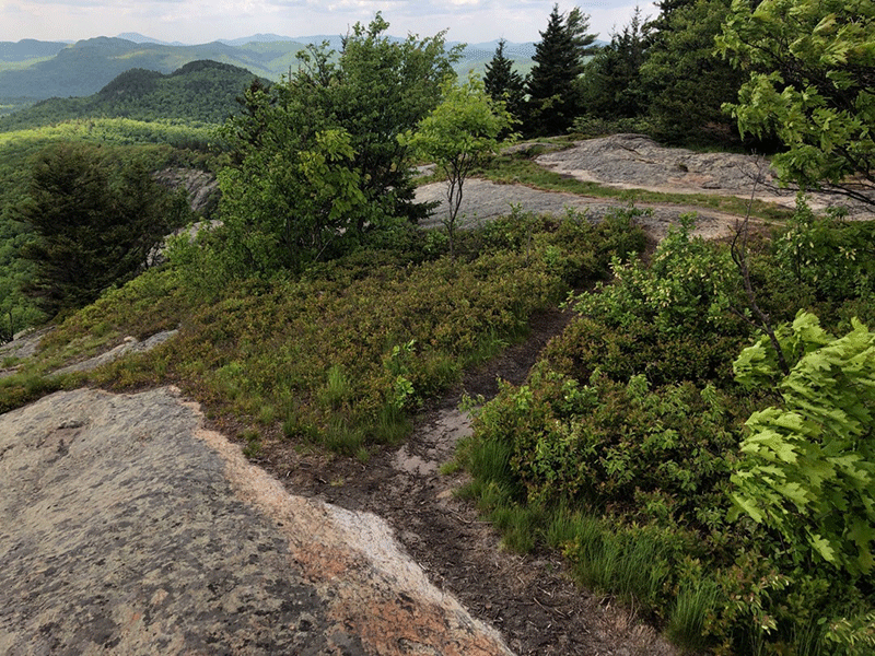
The trail begins with a gradual ascent through a beautiful young hardwood forest dominated by beech and white birch. The trail begins to get rockier as the trail grows steeper. Pine needles cover the trail as the forest changes abruptly to hemlock, spruce, and white pine, as the trail reaches the first two of 11 scenic overlooks. The first two overlooks are close together on a small ridge with open rock thickly covered with moss, ferns, and blueberry plants.
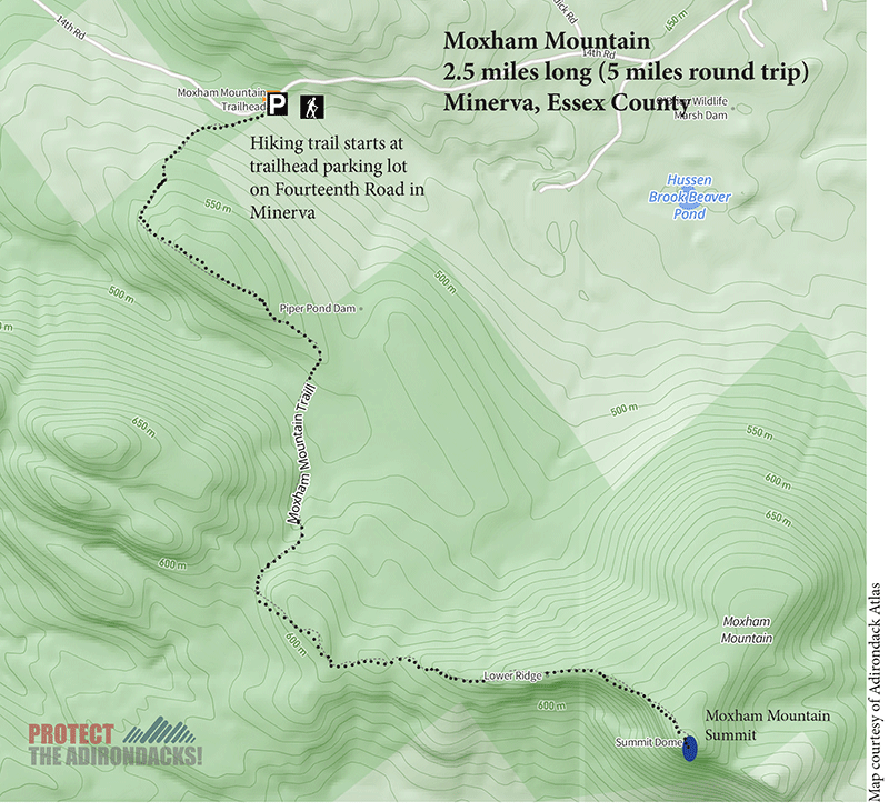
The trail returns to worn ground after the second overlook and descends gradually through a mature Northern hardwood forest toward a stream-crossing that borders a nearby wetland. This stretch of the trail passes through a mature forest with many large yellow birch and white pines, a number over 40 inches in diameter.
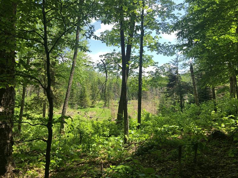
The vibrant wetland provides an interesting change of scenery before the trail begins another ascent. The next stretch of the trail is lined with erratics and fallen trees as numerous older yellow birch are common. This trail in this section is also in the poorest condition, with erosion, trail widening, and wet and muddy areas. Hikers won’t be able to miss the eight-pronged yellow birch that towers on the trailside. The trail then winds through boulders at the base of a cliff towards another set of scenic rocky outcrops.
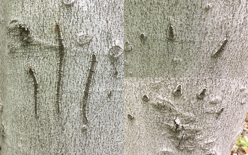
As the ascent becomes steeper, overlooks become more frequent, each of which is blanketed with moss and lichen. These rock ledges make perfect stops along the way. After the fourth outlook, the trail passes over the spine of a narrow bare-rock ridge. The forest beyond is heavy with beech trees. Hikers will want to keep an eye out for the claw-marks of a bear scraped on a trailside beech tree, evidence of a hungry giant searching for beechnuts.
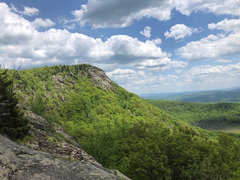
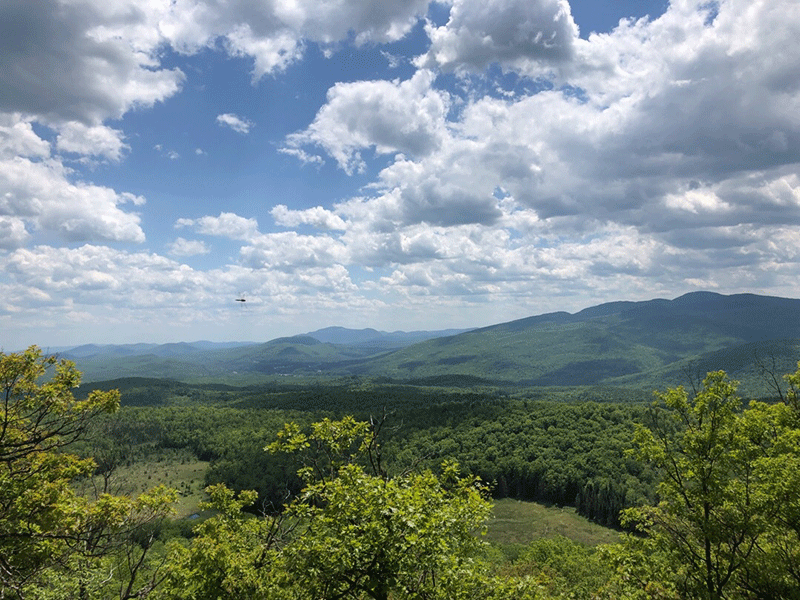
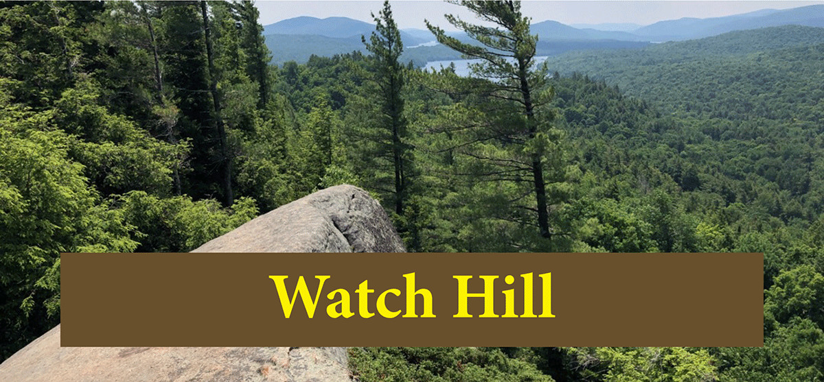
After dropping again into a small ravine, the trail curls up toward the final long ascent. Here the view starts to expand dramatically to first reveal the wetlands and ponds in the valley below, the bare face of the Barton Mines on Ruby Mountain to the southwest, Gore Mountain and Crane Mountain to the south, and finally the rocky cliffs of small peaks to the east.
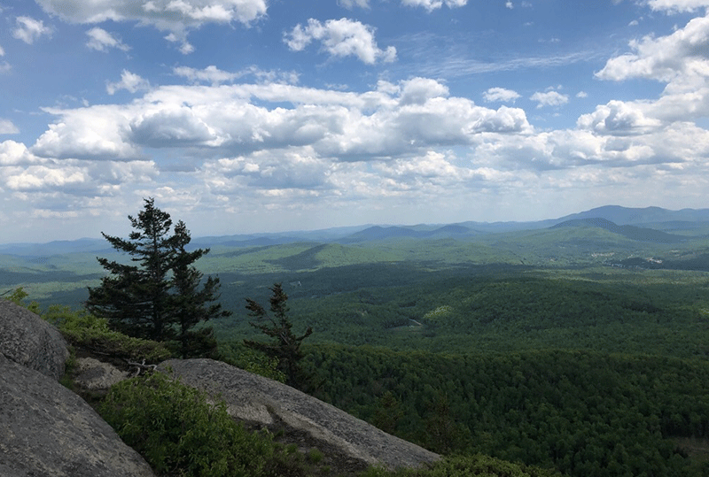
Despite having solid scenic overlooks along the way, the view from the summit is undeniably special. The wetlands and ponds in the valley below are stunning to look down upon. Part of the North Creek hamlet is visible as is a stretch of the Hudson River. In addition to the beautiful view, curious hikers will notice the misspelling of the Mountain’s namesake as “Maxam” Mountain on one of the geological survey markers embedded in the summit. There are also rings used by the Colvin surveys in the late 19th century still affixed in the summit.
The trail down follows the same gradual path. Overall, a beautiful hike, accessible for anyone who is comfortable with some steep sections and, of course, able to walk the full 5 miles.
Click here to download a map and trail directions for Moxham Mountain.
Help Protect the Forest Preserve and Be Prepared When You Hike: Please follow “carry in, carry out” rules for all trash and follow Leave No Trace principles when hiking in the public Forest Preserve and other wild areas. The 7 Leave No Trace principles are: 1) Plan ahead and prepare ; 2) Stay on hiking trails and camp at designated areas; 3) Dispose of human waste and trash properly; 4) Leave what you find; 5) Minimize campfires; 6) Respect wildlife; 7) Respect other hikers.
Educated hikers do not damage the environment.
Prepared hikers do not need search and rescue unless injured.
Winter Use: Moxham Mountain is a popular mountain for snowshoeing in the winter. It is not practical for cross-country skiing.